MyTopo
Flying H NE New Mexico US Topo Map
Couldn't load pickup availability
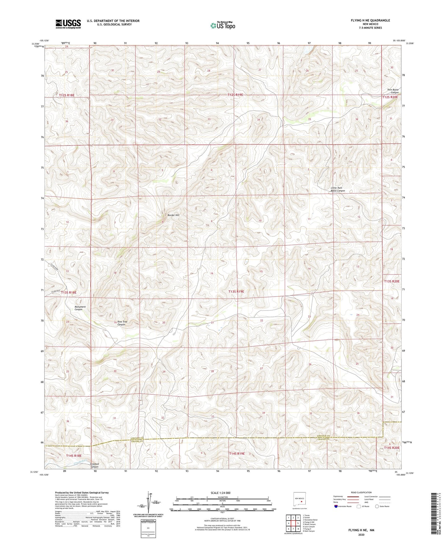
2023 topographic map quadrangle Flying H NE in the state of New Mexico. Scale: 1:24000. Based on the newly updated USGS 7.5' US Topo map series, this map is in the following counties: Lincoln, Chaves. The map contains contour data, water features, and other items you are used to seeing on USGS maps, but also has updated roads and other features. This is the next generation of topographic maps. Printed on high-quality waterproof paper with UV fade-resistant inks.
Quads adjacent to this one:
West: Flying H NW
Northwest: Tinnie
North: Sunset
Northeast: Horseshoe Bend
East: Skunk Canyon
Southeast: Dark Canyon
South: Flying H
Southwest: Loco Canyon
This map covers the same area as the classic USGS quad with code o33105b1.
Contains the following named places: Goodrum Ranch, High Lonesome Well, Pine Tree Canyon, Treat Ranch, Twin Butte Well, Watson Ranch, ZIP Code: 88343