MyTopo
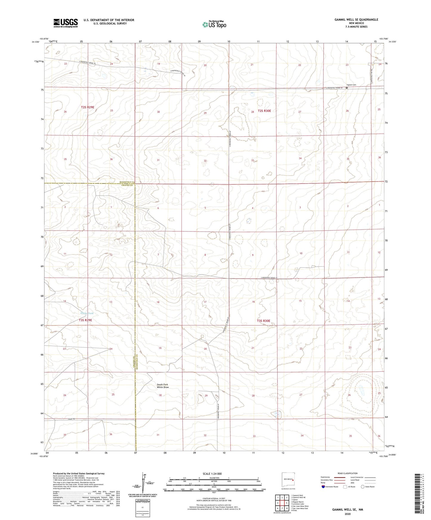
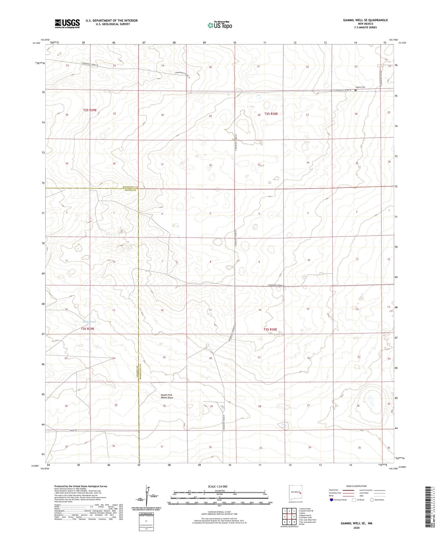
Gammil Well SE New Mexico US Topo Map
Couldn't load pickup availability
2020 topographic map quadrangle Gammil Well SE in the state of New Mexico. Scale: 1:24000. Based on the newly updated USGS 7.5' US Topo map series, this map is in the following counties: Roosevelt, Chaves. The map contains contour data, water features, and other items you are used to seeing on USGS maps, but also has updated roads and other features. This is the next generation of topographic maps. Printed on high-quality waterproof paper with UV fade-resistant inks.
Quads adjacent to this one:
West: Rippee Ranch
Northwest: Gammil Well
North: Gammil Well NE
Northeast: Upton
East: Lewiston Lake
Southeast: Elida
South: San Juan Mesa East
Southwest: San Juan Mesa West
Contains the following named places: Double Windmills, Elkins Tank, Foust-Hilburn Ranch, Ingram, Ingram Cemetery, Ingram Post Office, Johnson Windmill, Jones Well, Lake Well, Miller Well, Morrow Well, South Jett Windmill, Tolar Well, Walkins Beam Wells