MyTopo
Elida New Mexico US Topo Map
Couldn't load pickup availability
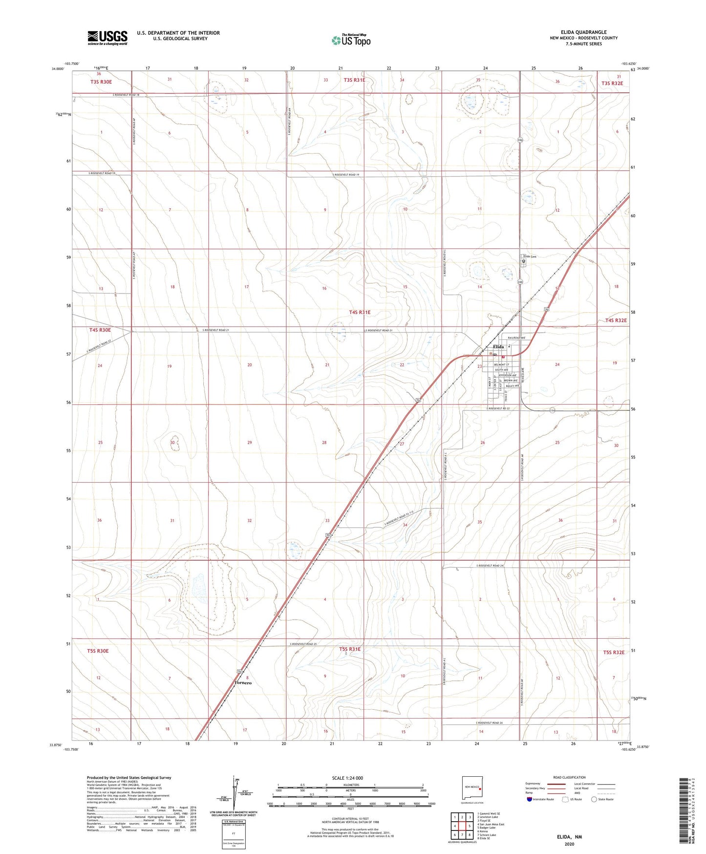
2023 topographic map quadrangle Elida in the state of New Mexico. Scale: 1:24000. Based on the newly updated USGS 7.5' US Topo map series, this map is in the following counties: Roosevelt. The map contains contour data, water features, and other items you are used to seeing on USGS maps, but also has updated roads and other features. This is the next generation of topographic maps. Printed on high-quality waterproof paper with UV fade-resistant inks.
Quads adjacent to this one:
West: San Juan Mesa East
Northwest: Gammil Well SE
North: Lewiston Lake
Northeast: Floyd SE
East: Badger Lake
Southeast: Elida SE
South: Schram Lake
Southwest: Kenna
This map covers the same area as the classic USGS quad with code o33103h6.
Contains the following named places: 06042 Water Well, 06043 Water Well, 06048 Water Well, 06049 Water Well, 06055 Water Well, 06056 Water Well, 06057 Water Well, 06058 Water Well, 06059 Water Well, 06060 Water Well, 06061 Water Well, 06062 Water Well, 06063 Water Well, 06064 Water Well, 06065 Water Well, 06066 Water Well, 06067 Water Well, 06068 Water Well, 06069 Water Well, 06070 Water Well, 06071 Water Well, 06072 Water Well, 06073 Water Well, 06100 Water Well, 06102 Water Well, 06103 Water Well, 06104 Water Well, 06105 Water Well, 06106 Water Well, 06107 Water Well, 06108 Water Well, Bonham Tank, Castano de Sosas Route Historical Marker, Danbom Dairy, Elida, Elida Cemetery, Elida Church of Christ, Elida Fire Department, Elida Post Office, Elida United Methodist Church, Elida Weather Station, First Baptist Church, Methodist Episcopal Church, Pecos Valley Historical Marker, Ruth McCowen Public Library, Tornero, Town of Elida