MyTopo
Garfield New Mexico US Topo Map
Couldn't load pickup availability
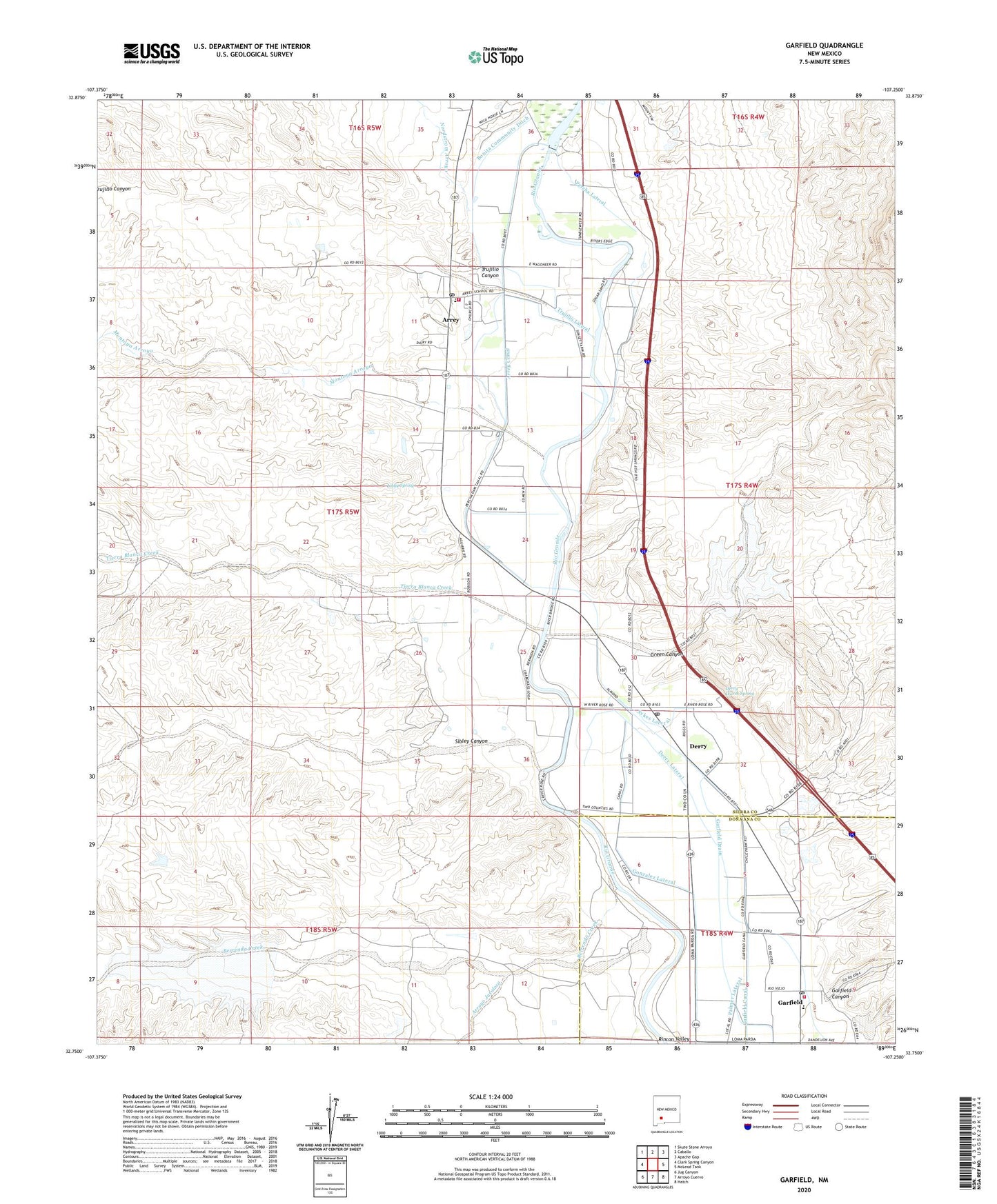
2023 topographic map quadrangle Garfield in the state of New Mexico. Scale: 1:24000. Based on the newly updated USGS 7.5' US Topo map series, this map is in the following counties: Sierra, Doña Ana. The map contains contour data, water features, and other items you are used to seeing on USGS maps, but also has updated roads and other features. This is the next generation of topographic maps. Printed on high-quality waterproof paper with UV fade-resistant inks.
Quads adjacent to this one:
West: Clark Spring Canyon
Northwest: Skute Stone Arroyo
North: Caballo
Northeast: Apache Gap
East: McLeod Tank
Southeast: Hatch
South: Arroyo Cuervo
Southwest: Jug Canyon
This map covers the same area as the classic USGS quad with code o32107g3.
Contains the following named places: 10010 Water Well, 10059 Water Well, 87933, 87936, Alvarez, Alvarez Claims, Arrey, Arrey Canal, Arrey Catholic Cemetery, Arrey Cemetery, Arrey Census Designated Place, Arrey Community Church, Arrey Community Church Cemetery, Arrey Derry Fire Department Station 2, Arrey Elementary School, Arrey Post Office, Arroyo Jaralosa, Berrenda Creek, Bonita Community Ditch, Caballo Arroyos Site Number One Dam, Caballo Arroyos Site Number Two Dam, Caballo Dairy, Church of God, County Line Detention Dam, Davis Ranch, Derry, Derry Lateral, Derry Post Office, Derry Warm Spring, Esperanza, Esperanza Prospect, Fera Drain, Garfield, Garfield Canyon, Garfield Cemetery New, Garfield Cemetery Old, Garfield Census Designated Place, Garfield Elementary School, Garfield Flume, Garfield Post Office, Garfield Salem Volunteer Fire Department, Gonzalez Lateral, Green Canyon, Hill Top Mine, John Gordon Windmill, Jones-Reiland Mine, Kight Flood Control Retarding Dam, LA 1082, LA 50743, LA 50749, LA 50751, LA 517, Libby Spring, Loma Parda Dairy, Manganese Hill, Manganese Hill Group, Montoya Arroyo, Nordstrom Arroyo, Palmer Lateral, PB-5 Water Well, Percha Dam, Percha Diversion Dam, Percha Lateral, Red Star, San Isidro Parish, San Isidro School, San Jose Church, Sibley Canyon, Southern Caballo Mountains Section Sixteen, Sykes Lateral, Tierra Blanca Creek, Trujillo Canyon, Trujillo Lateral, United States Bureau of Reclamation 1 Water Well, Vega Lateral