MyTopo
Apache Gap New Mexico US Topo Map
Couldn't load pickup availability
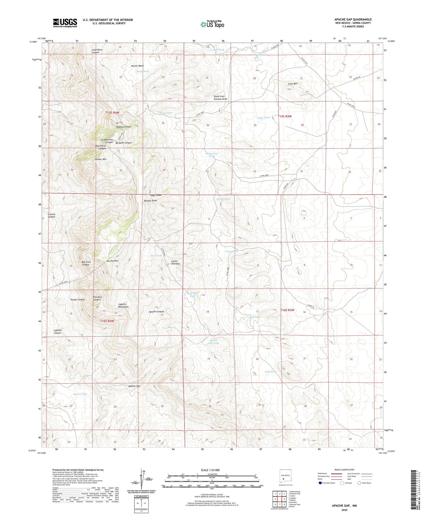
2023 topographic map quadrangle Apache Gap in the state of New Mexico. Scale: 1:24000. Based on the newly updated USGS 7.5' US Topo map series, this map is in the following counties: Sierra. The map contains contour data, water features, and other items you are used to seeing on USGS maps, but also has updated roads and other features. This is the next generation of topographic maps. Printed on high-quality waterproof paper with UV fade-resistant inks.
Quads adjacent to this one:
West: Caballo
Northwest: Williamsburg
North: Palomas Gap
Northeast: Cutter
East: Upham
Southeast: Alivio
South: McLeod Tank
Southwest: Garfield
This map covers the same area as the classic USGS quad with code o32107h2.
Contains the following named places: Apache Chief, Apache Chief Group, Apache Gap, Apache Gap Tank, Bar B Tank, Barbee Tank, Basin Tank, Bobs Tank, Brushy Mountain, Caballo Mountains, Cedar Tank, Flouride, Flouride Prospect, Gaume Windmill, Ghost Tank, Gold Eagle, Grass Tank, Hillside-Sierra Group, Hillside-Sierra Mine, Homestead Tank, Hurt Tank, Jack Tank, Johnson Windmill, KSNM-FM (Truth Or Consequences), L 7 Red Tank, Lone Mountain, Lorraine Group, Lyons Homestead, Lyons Red Tank, Mary Jane Claims, Mary Jane Prospect, Mikes Camp Mine, Parker, Red Cloud Group, Red Tank, Rincon Basin, Rincon Tank, Rock Spill Tank, Saddle Tank, Sandy Tank, Sierrite Mine, Slater Ranch, Slater Red Tanks, Southern Caballo Mts Sec 23 Mine, Sunset, Timber Mountain