MyTopo
Clark Spring Canyon New Mexico US Topo Map
Couldn't load pickup availability
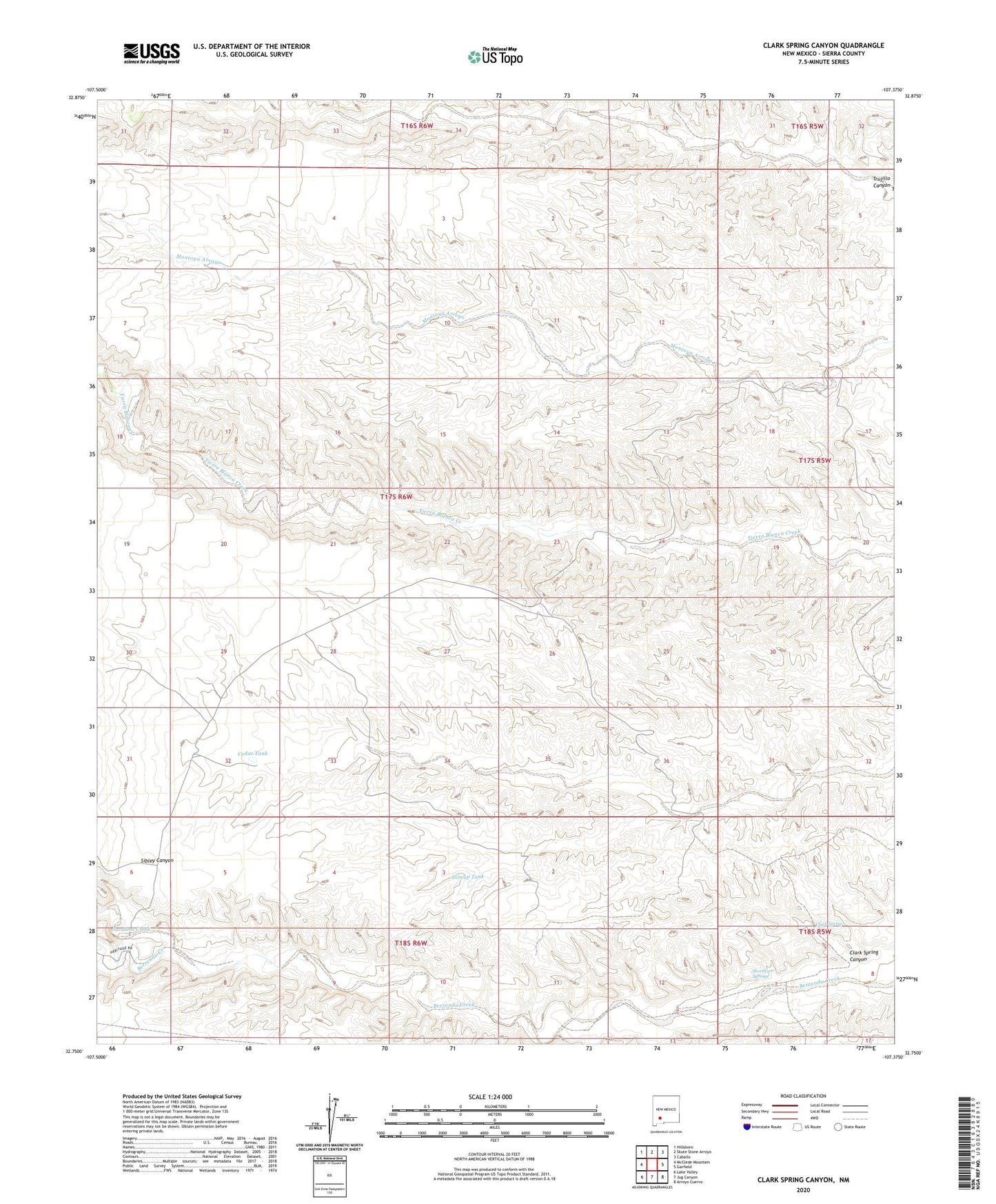
2023 topographic map quadrangle Clark Spring Canyon in the state of New Mexico. Scale: 1:24000. Based on the newly updated USGS 7.5' US Topo map series, this map is in the following counties: Sierra. The map contains contour data, water features, and other items you are used to seeing on USGS maps, but also has updated roads and other features. This is the next generation of topographic maps. Printed on high-quality waterproof paper with UV fade-resistant inks.
Quads adjacent to this one:
West: McClede Mountain
Northwest: Hillsboro
North: Skute Stone Arroyo
Northeast: Caballo
East: Garfield
Southeast: Arroyo Cuervo
South: Jug Canyon
Southwest: Lake Valley
This map covers the same area as the classic USGS quad with code o32107g4.
Contains the following named places: Apodaca Windmill, Berrenda Well, Cedar Tank, Clark Spring, Clark Spring Canyon, Cooper Windmill, Cordell Well, Jaralosa Creek, Lacy Well, Midway Well, North Sibley Well, North Well, Shorthorn Springs, Sibley Well, South Sibley Well, Teacup Tank, Wilson Well, ZIP Code: 87930