MyTopo
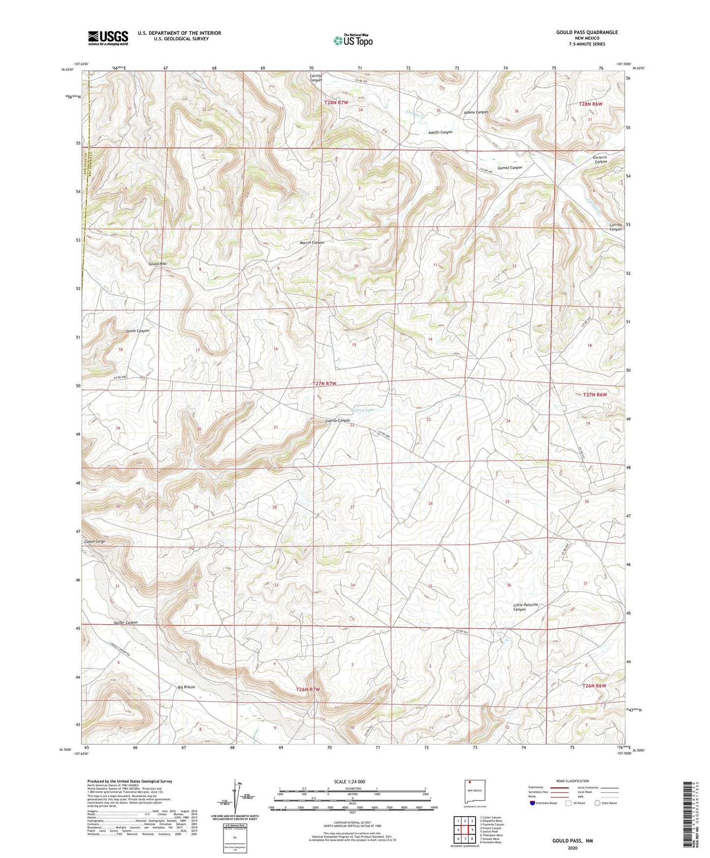
Gould Pass New Mexico US Topo Map
Couldn't load pickup availability
2023 topographic map quadrangle Gould Pass in the state of New Mexico. Scale: 1:24000. Based on the newly updated USGS 7.5' US Topo map series, this map is in the following counties: Rio Arriba, San Juan. The map contains contour data, water features, and other items you are used to seeing on USGS maps, but also has updated roads and other features. This is the next generation of topographic maps. Printed on high-quality waterproof paper with UV fade-resistant inks.
Quads adjacent to this one:
West: Fresno Canyon
Northwest: Cutter Canyon
North: Delgadita Mesa
Northeast: Fourmile Canyon
East: Santos Peak
Southeast: Gonzales Mesa
South: Smouse Mesa
Southwest: Thompson Mesa
This map covers the same area as the classic USGS quad with code o36107e5.
Contains the following named places: Adams Canyon, Adams Canyon Historic Site, Adolfo Canyon, Adolfo Canyon Historic Site, Big Rincon, Casa Mesa Diablo Historic Site, Cuervo Lake, Encierro Canyon, Gomez Canyon, Gould Pass, Gould Pass 1 Water Well, Heifer Canyon, Kaime Ranch, San Juan Basin Gas Field