MyTopo
Gonzales Mesa New Mexico US Topo Map
Couldn't load pickup availability
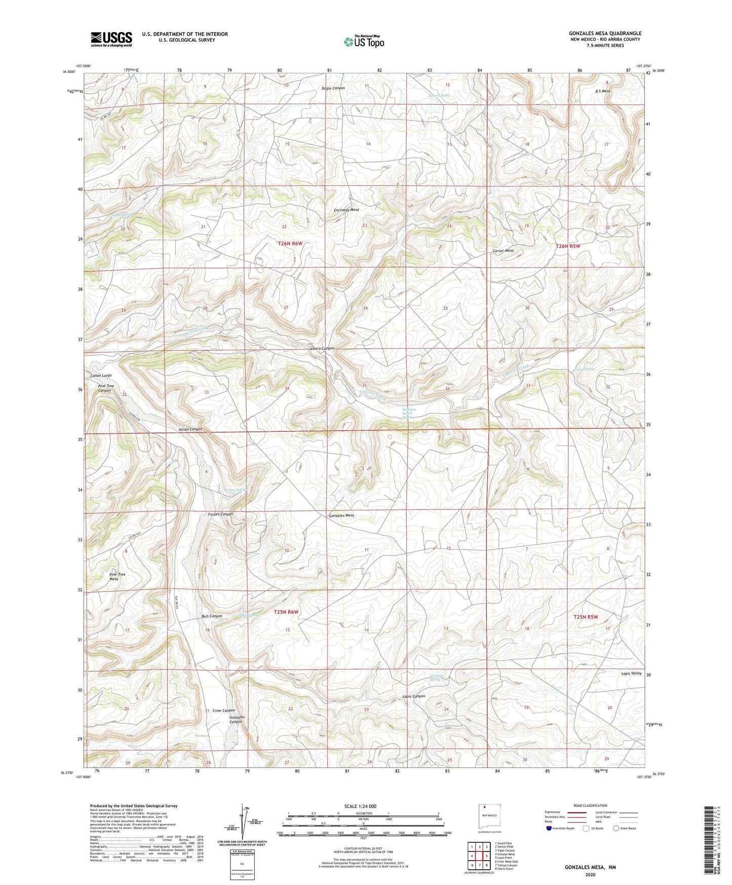
2023 topographic map quadrangle Gonzales Mesa in the state of New Mexico. Scale: 1:24000. Based on the newly updated USGS 7.5' US Topo map series, this map is in the following counties: Rio Arriba. The map contains contour data, water features, and other items you are used to seeing on USGS maps, but also has updated roads and other features. This is the next generation of topographic maps. Printed on high-quality waterproof paper with UV fade-resistant inks.
Quads adjacent to this one:
West: Smouse Mesa
Northwest: Gould Pass
North: Santos Peak
Northeast: Vigas Canyon
East: Lapis Point
Southeast: Otero Store
South: Tafoya Canyon
Southwest: Crow Mesa East
This map covers the same area as the classic USGS quad with code o36107d4.
Contains the following named places: Albert Canyon, Albert Lake, Bull Canyon, Bull Springs, Carter Mesa, Crow Canyon, Dogie Canyon Pumping Station, Dogie Spring, Encinada Mesa, Forbes Canyon, Forbes Spring, Gonzales Canyon, Gonzales Mesa, Gonzales Spring, Julian Canyon, Kaime Ranch, Lapis Canyon, Pine Tree Canyon, Pine Tree Mesa, Tapicito Creek, Tawa Spring, Williams Ranch Spring