MyTopo
Santos Peak New Mexico US Topo Map
Couldn't load pickup availability
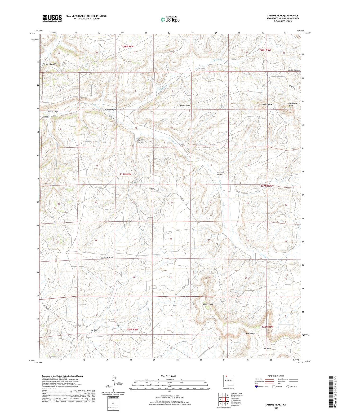
2023 topographic map quadrangle Santos Peak in the state of New Mexico. Scale: 1:24000. Based on the newly updated USGS 7.5' US Topo map series, this map is in the following counties: Rio Arriba. The map contains contour data, water features, and other items you are used to seeing on USGS maps, but also has updated roads and other features. This is the next generation of topographic maps. Printed on high-quality waterproof paper with UV fade-resistant inks.
Quads adjacent to this one:
West: Gould Pass
Northwest: Delgadita Mesa
North: Fourmile Canyon
Northeast: Gobernador
East: Vigas Canyon
Southeast: Lapis Point
South: Gonzales Mesa
Southwest: Smouse Mesa
This map covers the same area as the classic USGS quad with code o36107e4.
Contains the following named places: Albert Mesa, Camp Ercan, Canon de Camino, Lowry 3 Water Well, Lowry 4 Water Well, Lowry 5 Water Well, Lowry Camp, Magdalena Butte, Martinez Canyon, Munoz Canyon, Munoz Creek, Rincon Largo, Santos Mesa, Santos Peak