MyTopo
Granjean Well New Mexico US Topo Map
Couldn't load pickup availability
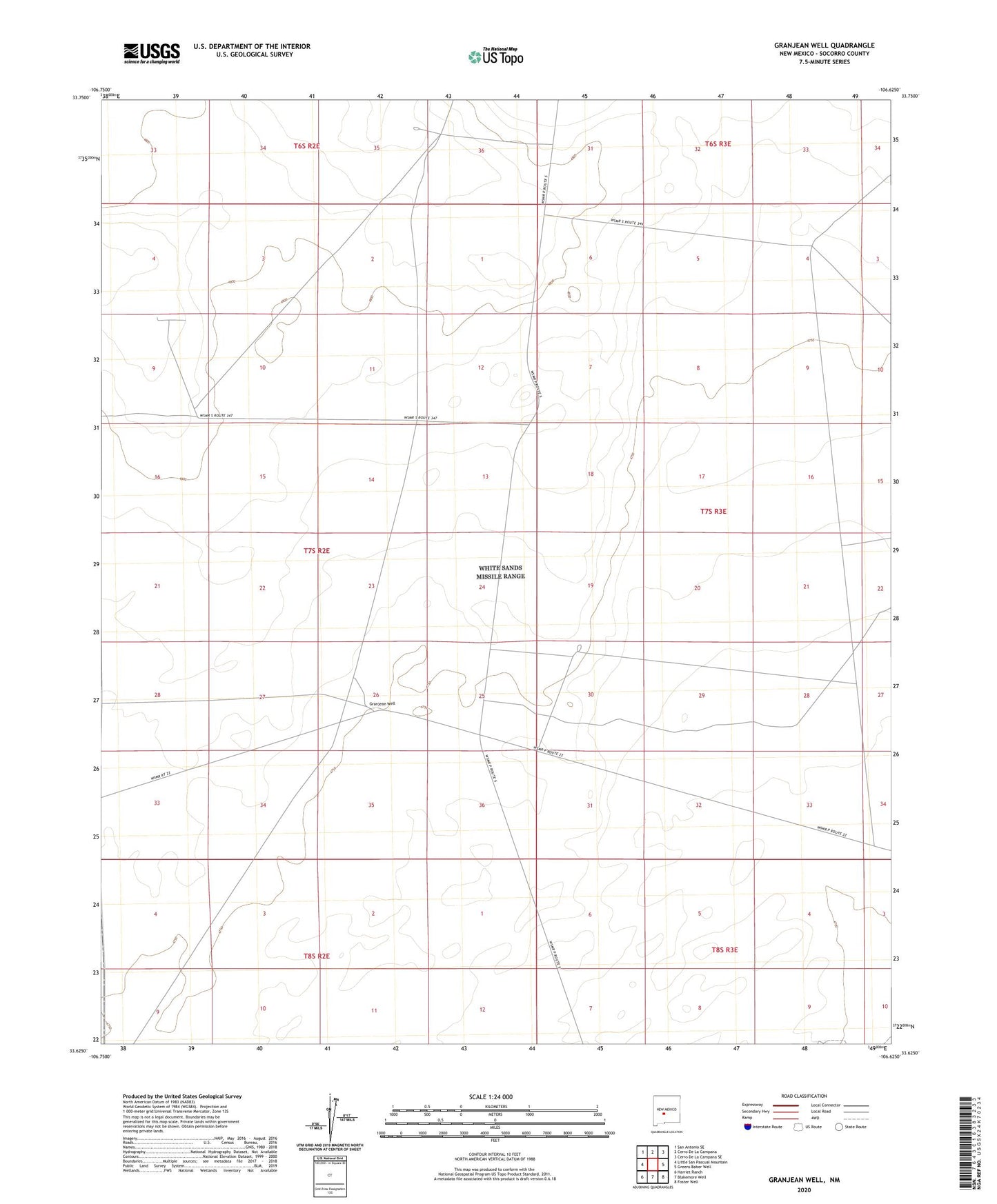
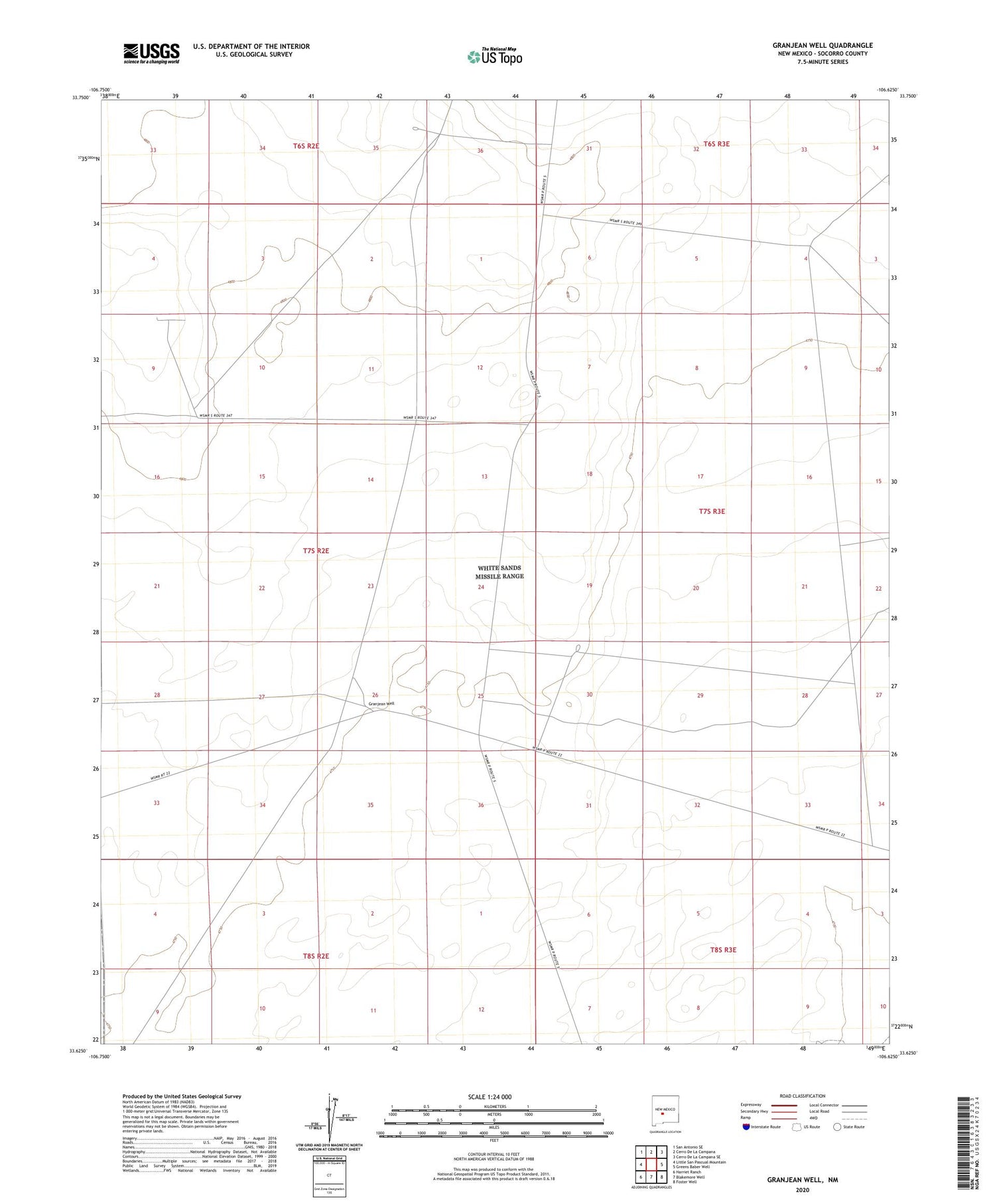
2023 topographic map quadrangle Granjean Well in the state of New Mexico. Scale: 1:24000. Based on the newly updated USGS 7.5' US Topo map series, this map is in the following counties: Socorro. The map contains contour data, water features, and other items you are used to seeing on USGS maps, but also has updated roads and other features. This is the next generation of topographic maps. Printed on high-quality waterproof paper with UV fade-resistant inks.
Quads adjacent to this one:
West: Little San Pascual Mountain
Northwest: San Antonio SE
North: Cerro De La Campana
Northeast: Cerro De La Campana SE
East: Greens Baber Well
Southeast: Foster Well
South: Blakemore Well
Southwest: Harriet Ranch
This map covers the same area as the classic USGS quad with code o33106f6.
Contains the following named places: Bruton Tank, Bruton Well, Buntn Water Well, Granjean Well, Green Ranch