MyTopo
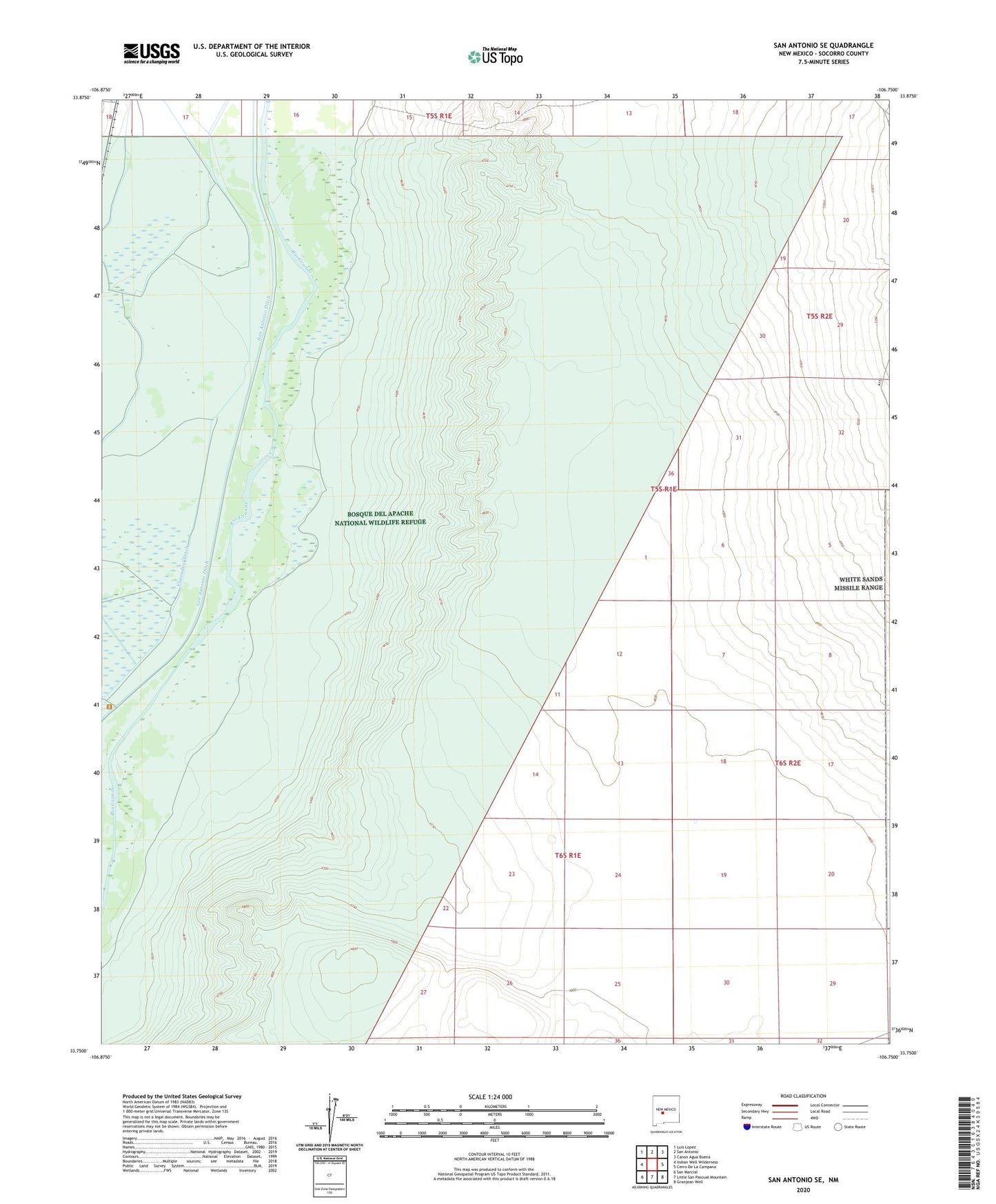
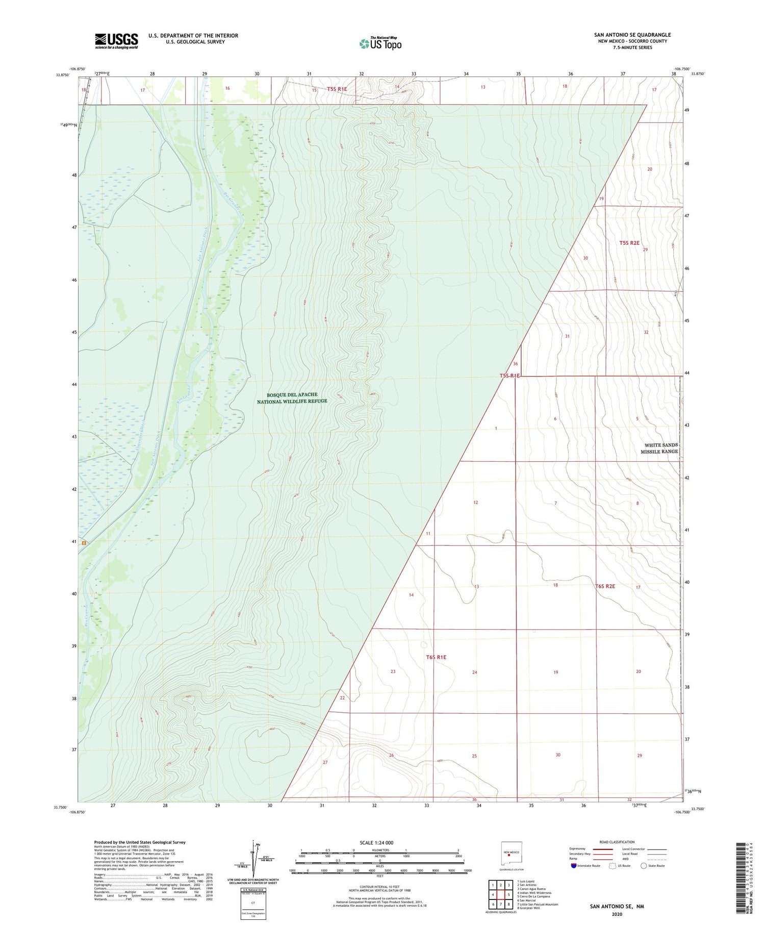
San Antonio SE New Mexico US Topo Map
Couldn't load pickup availability
2023 topographic map quadrangle San Antonio SE in the state of New Mexico. Scale: 1:24000. Based on the newly updated USGS 7.5' US Topo map series, this map is in the following counties: Socorro. The map contains contour data, water features, and other items you are used to seeing on USGS maps, but also has updated roads and other features. This is the next generation of topographic maps. Printed on high-quality waterproof paper with UV fade-resistant inks.
Quads adjacent to this one:
West: Indian Well Wilderness
Northwest: Luis Lopez
North: San Antonio
Northeast: Canon Agua Buena
East: Cerro De La Campana
Southeast: Granjean Well
South: Little San Pascual Mountain
Southwest: San Marcial
This map covers the same area as the classic USGS quad with code o33106g7.
Contains the following named places: 10 Water Well, 87832, Antelope Wilderness Study Area, Bosque Del Apache Grant, Bosque Del Apache National Wildlife Refuge, Bosque del Apache Weather Station, Bosque del Apache Wilderness (Little San Pascual Unit), Elmendorf Ditch, Fite Tank, Kinney Wells, Little San Pascual Wilderness, Table Mountain Tank, Water Well 2