MyTopo
Hackberry Hill New Mexico US Topo Map
Couldn't load pickup availability
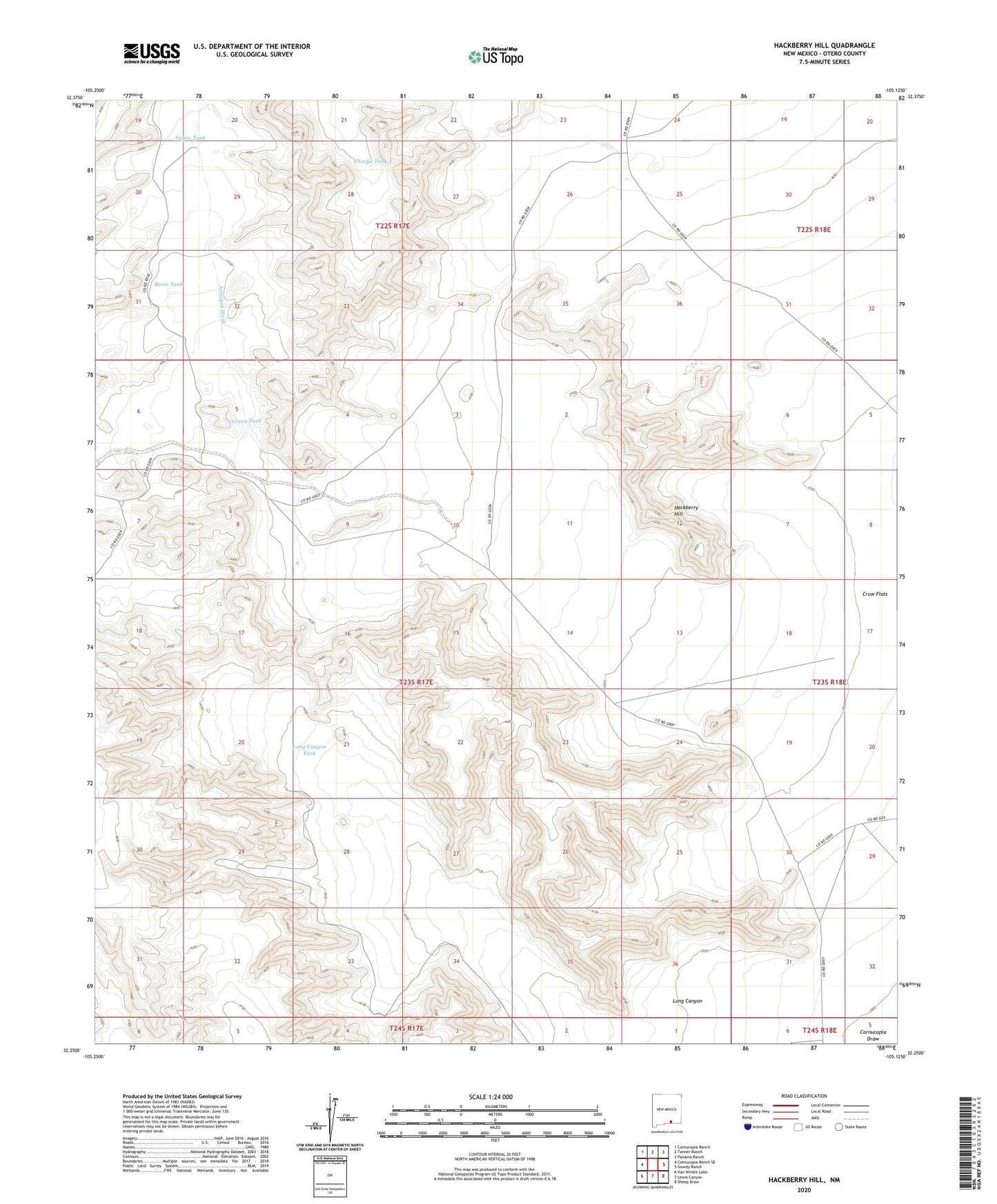
2023 topographic map quadrangle Hackberry Hill in the state of New Mexico. Scale: 1:24000. Based on the newly updated USGS 7.5' US Topo map series, this map is in the following counties: Otero. The map contains contour data, water features, and other items you are used to seeing on USGS maps, but also has updated roads and other features. This is the next generation of topographic maps. Printed on high-quality waterproof paper with UV fade-resistant inks.
Quads adjacent to this one:
West: Cornucopia Ranch SE
Northwest: Cornucopia Ranch
North: Tanner Ranch
Northeast: Panama Ranch
East: Gowdy Ranch
Southeast: Sheep Draw
South: Lewis Canyon
Southwest: Van Winkle Lake
This map covers the same area as the classic USGS quad with code o32105c2.
Contains the following named places: 10269 Water Well, Air Force Well, Boots Tank, Charlie Tank, Green Tank, Hackberry Hill, Hackberry Well, Jernigan Wash, Lewis Ranch, Long Canyon, Long Canyon Tank, Negro Tank, Perry Well, Templeton Ranch