MyTopo
Sheep Draw New Mexico US Topo Map
Couldn't load pickup availability
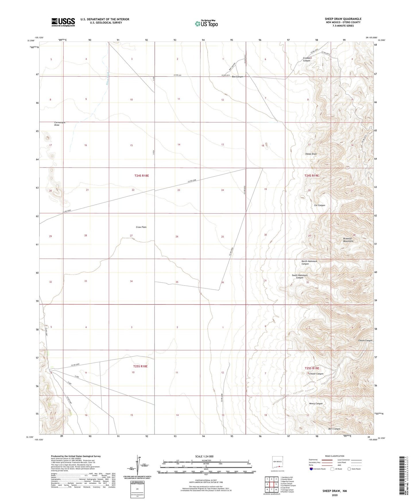
2023 topographic map quadrangle Sheep Draw in the state of New Mexico. Scale: 1:24000. Based on the newly updated USGS 7.5' US Topo map series, this map is in the following counties: Otero. The map contains contour data, water features, and other items you are used to seeing on USGS maps, but also has updated roads and other features. This is the next generation of topographic maps. Printed on high-quality waterproof paper with UV fade-resistant inks.
Quads adjacent to this one:
West: Lewis Canyon
Northwest: Hackberry Hill
North: Gowdy Ranch
Northeast: Algerita Canyon
East: La Paloma Canyon
Southeast: Panther Canyon
South: Cienega School
Southwest: Culp Draw
This map covers the same area as the classic USGS quad with code o32105b1.
Contains the following named places: Bert Canyon, Box Canyon, Cal Canyon, Chosie Canyon, Cornucopia Draw, Crooked Canyon, Crow Flats, Hammock Well, Henry Canyon, John A Well, Kitchen Well, Lewis Ranch, New Well, North Hammock Canyon, Perry Windmill, Pinon Wash, Sheep Draw, South Hammock Canyon