MyTopo
Hard Ground Flats New Mexico US Topo Map
Couldn't load pickup availability
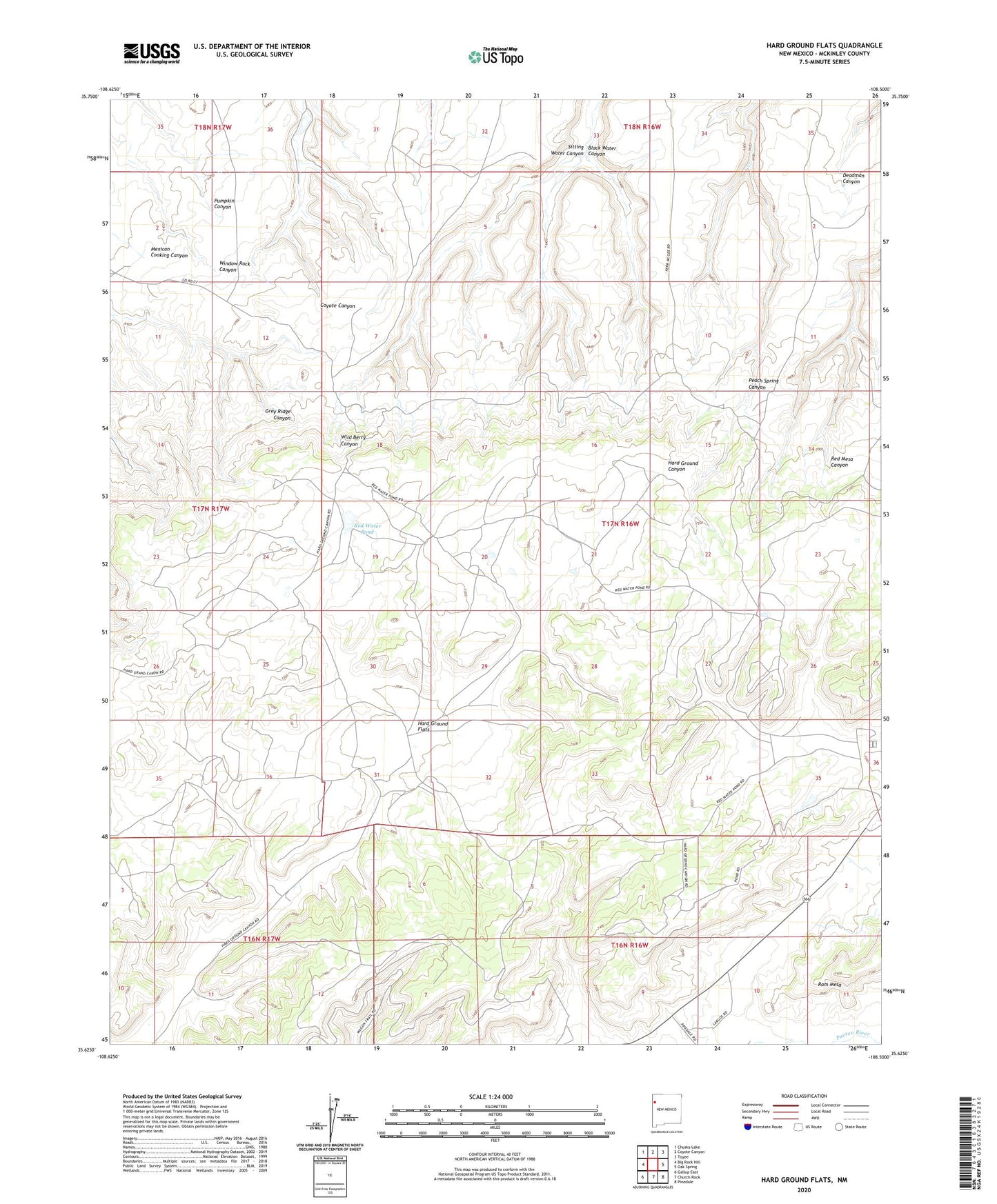
2023 topographic map quadrangle Hard Ground Flats in the state of New Mexico. Scale: 1:24000. Based on the newly updated USGS 7.5' US Topo map series, this map is in the following counties: McKinley. The map contains contour data, water features, and other items you are used to seeing on USGS maps, but also has updated roads and other features. This is the next generation of topographic maps. Printed on high-quality waterproof paper with UV fade-resistant inks.
Quads adjacent to this one:
West: Big Rock Hill
Northwest: Chuska Lake
North: Coyote Canyon
Northeast: Toyee
East: Oak Spring
Southeast: Pinedale
South: Church Rock
Southwest: Gallup East
This map covers the same area as the classic USGS quad with code o35108f5.
Contains the following named places: Black Water Canyon, G-3 Water Well, Hard Ground Flats, Kent Nowlin Pit, Northeast Church Rock, Ram Mesa, Red Water Pond, Sitting Water Canyon