MyTopo
Church Rock New Mexico US Topo Map
Couldn't load pickup availability
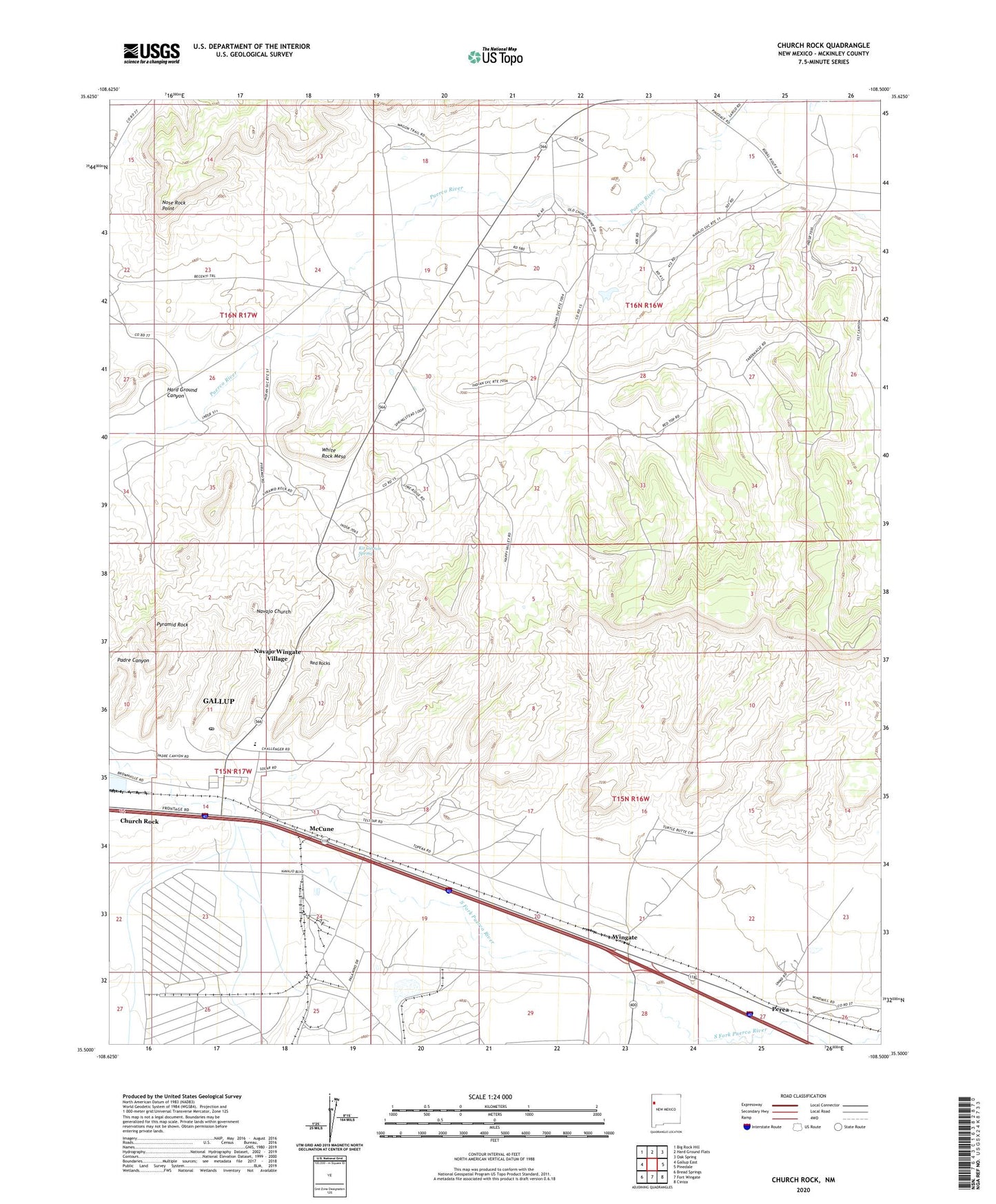
2023 topographic map quadrangle Church Rock in the state of New Mexico. Scale: 1:24000. Based on the newly updated USGS 7.5' US Topo map series, this map is in the following counties: McKinley. The map contains contour data, water features, and other items you are used to seeing on USGS maps, but also has updated roads and other features. This is the next generation of topographic maps. Printed on high-quality waterproof paper with UV fade-resistant inks.
Quads adjacent to this one:
West: Gallup East
Northwest: Big Rock Hill
North: Hard Ground Flats
Northeast: Oak Spring
East: Pinedale
Southeast: Ciniza
South: Fort Wingate
Southwest: Bread Springs
This map covers the same area as the classic USGS quad with code o35108e5.
Contains the following named places: 10022 Water Well, 16T-510 Water Well, 16T-513 Water Well, 87311, Church Rock, Church Rock Census Designated Place, Church Rock Chapter, Church Rock Mine, Church Rock Post Office, Fort Wingate 68 Water Well, Foutz Number 1 Mine, Foutz Number 2, Foutz Number Three Mine, Hard Ground Canyon, Kit Carson Spring, McCune, Navajo Church, Navajo Wingate Village, Nose Rock Point, Nose Rock Well, Perea, Pyramid Rock, Red Rock Musuem, Red Rock State Park, Red Rocks, Red Rocks Historical Marker, Saint Phillips Mission Indian Village, SJOBS Water Well, Springstead Trading Post, U Mine, White Cliffs, White Rock Mesa, Williams and Reynolds Mine, Wingate