MyTopo
Eightmile Draw New Mexico US Topo Map
Couldn't load pickup availability
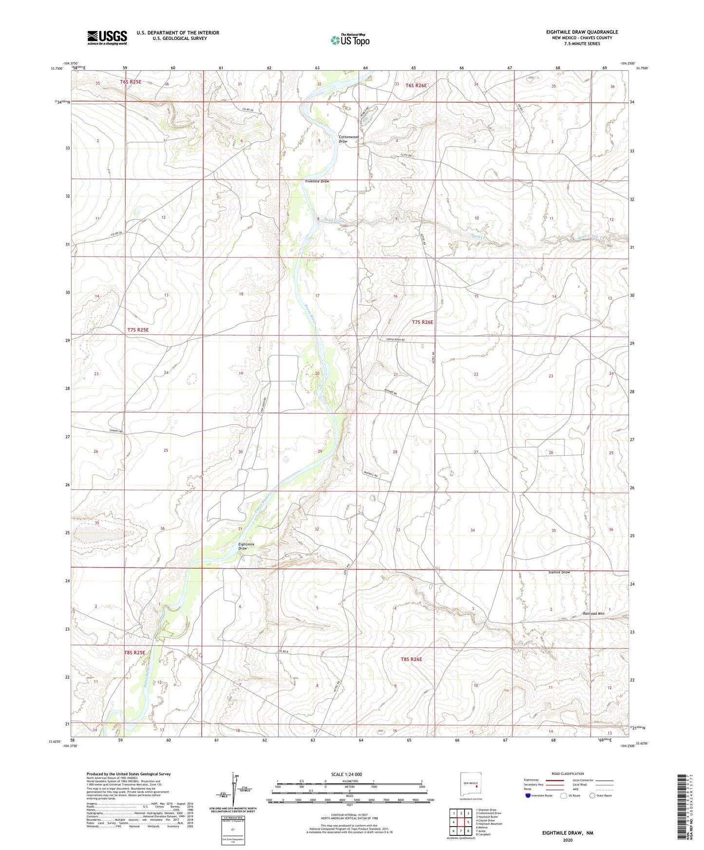
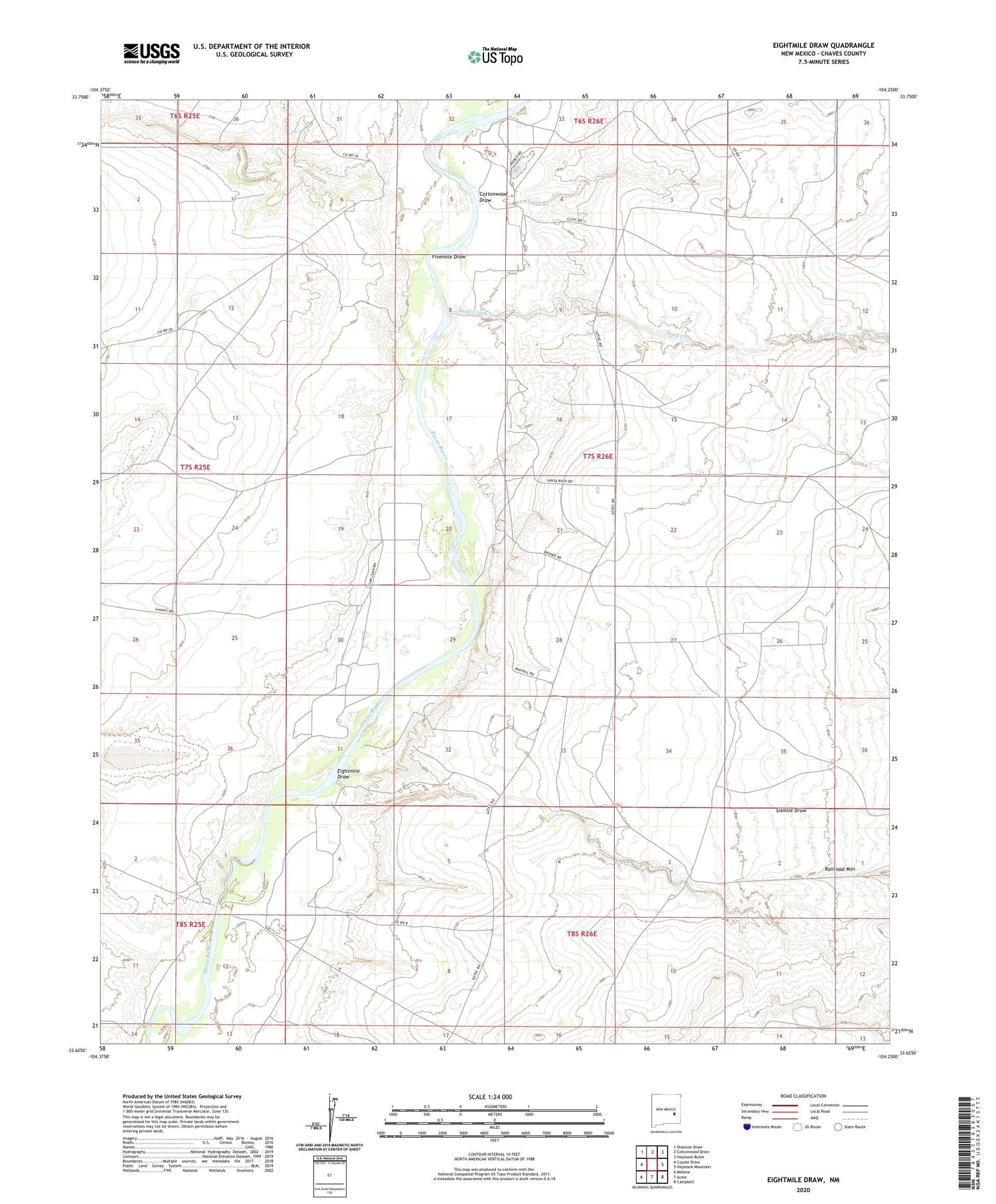
2023 topographic map quadrangle Eightmile Draw in the state of New Mexico. Scale: 1:24000. Based on the newly updated USGS 7.5' US Topo map series, this map is in the following counties: Chaves. The map contains contour data, water features, and other items you are used to seeing on USGS maps, but also has updated roads and other features. This is the next generation of topographic maps. Printed on high-quality waterproof paper with UV fade-resistant inks.
Quads adjacent to this one:
West: Coyote Draw
Northwest: Shannon Draw
North: Cottonwood Draw
Northeast: Haystack Butte
East: Haystack Mountain
Southeast: Campbell
South: Acme
Southwest: Melena
This map covers the same area as the classic USGS quad with code o33104f3.
Contains the following named places: Adair Well, Amarillo Well, C L White Ranch, Circle Three E Ranch, Cottonwood Draw, Crawford Ranch, Durham Ranch, Eightmile Draw, Faircloth Well, Fivemile Draw, John White Ranch, Milner Lake, Neal Ranch, Potter Well, Rattlesnake Well, Sand Creek, Sixmile Draw, Sturgeon Ranch