MyTopo
Hospah New Mexico US Topo Map
Couldn't load pickup availability
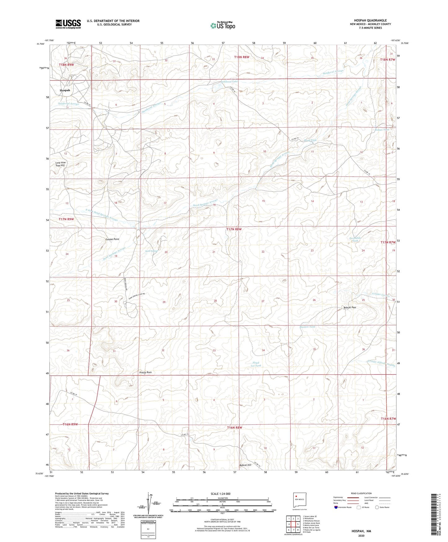
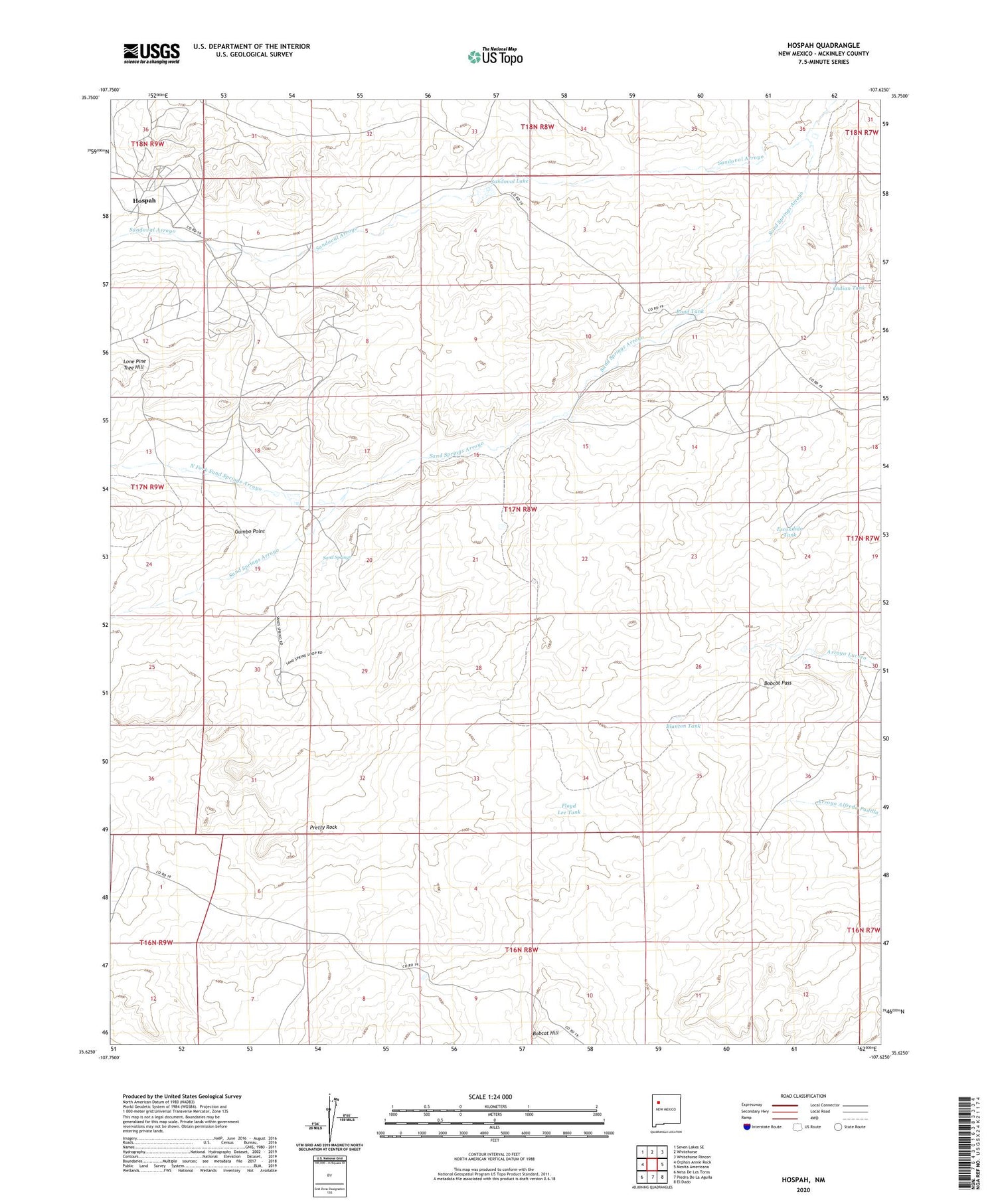
2020 topographic map quadrangle Hospah in the state of New Mexico. Scale: 1:24000. Based on the newly updated USGS 7.5' US Topo map series, this map is in the following counties: McKinley. The map contains contour data, water features, and other items you are used to seeing on USGS maps, but also has updated roads and other features. This is the next generation of topographic maps. Printed on high-quality waterproof paper with UV fade-resistant inks.
Quads adjacent to this one:
West: Orphan Annie Rock
Northwest: Seven Lakes SE
North: Whitehorse
Northeast: Whitehorse Rincon
East: Mesita Americana
Southeast: El Dado
South: Piedra De La Aguila
Southwest: Mesa De Los Toros
Contains the following named places: 15R-321 Water Well, 15R-321A Water Well, 15R-321B Water Well, Blanton Tank, Bobcat Hill, Bobcat Pass, Bull Camp Windmill, Crownpoint Division, Doodlebug Well, Escondido Tank, Floyd Lee Tank, Gumbo Point, Hospah, Hospah Oil Field, Indian Tank, Jake Chee Windmill, Lone Pine Tree Hill, North Fork Sand Springs Arroyo, Pretty Rock, Road Tank, Sand Springs, Sandoval Arroyo, Sandoval Lake, Steel Windmill