MyTopo
Piedra De La Aguila New Mexico US Topo Map
Couldn't load pickup availability
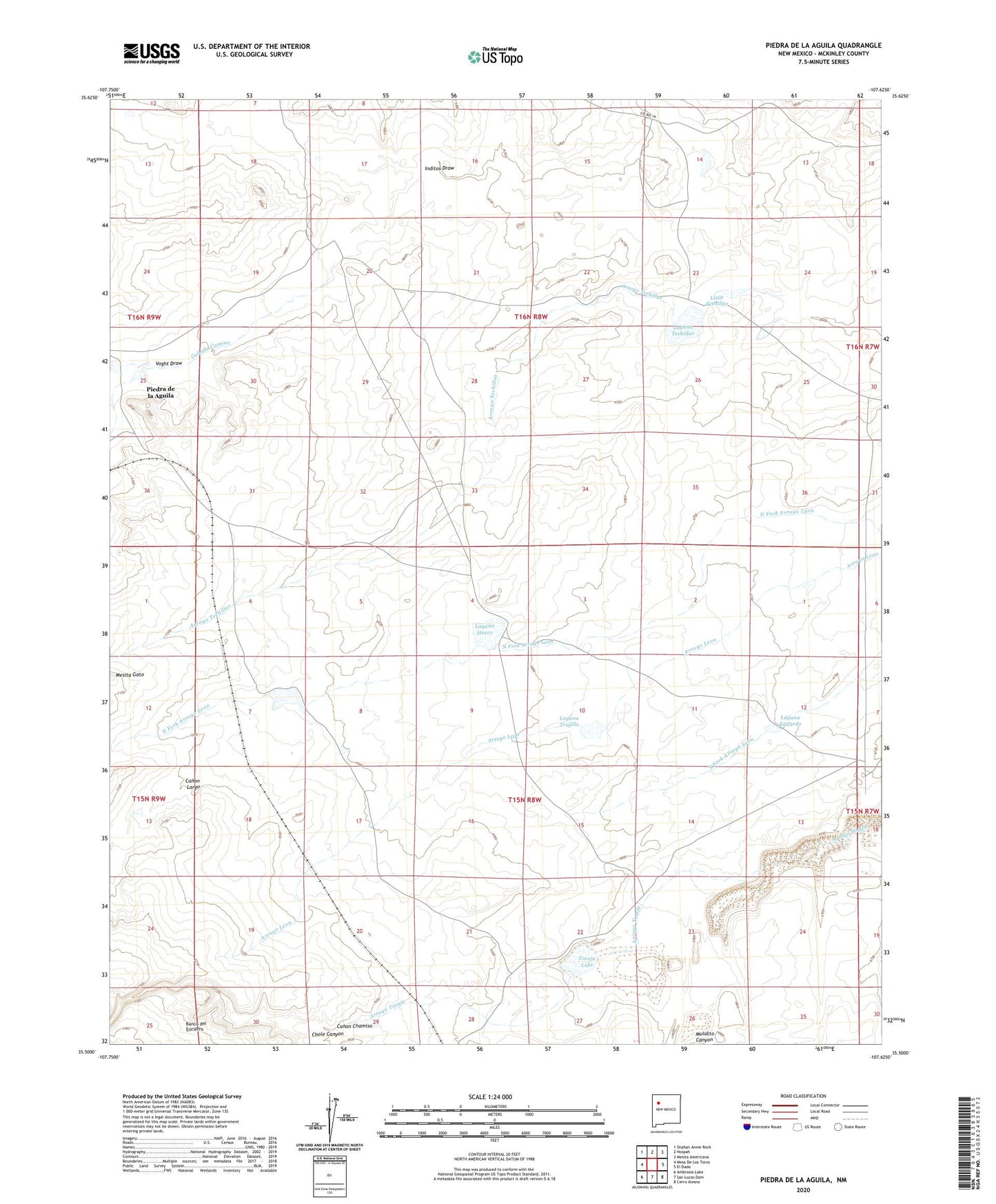
2023 topographic map quadrangle Piedra De La Aguila in the state of New Mexico. Scale: 1:24000. Based on the newly updated USGS 7.5' US Topo map series, this map is in the following counties: McKinley. The map contains contour data, water features, and other items you are used to seeing on USGS maps, but also has updated roads and other features. This is the next generation of topographic maps. Printed on high-quality waterproof paper with UV fade-resistant inks.
Quads adjacent to this one:
West: Mesa De Los Toros
Northwest: Orphan Annie Rock
North: Hospah
Northeast: Mesita Americana
East: El Dado
Southeast: Cerro Alesna
South: San Lucas Dam
Southwest: Ambrosia Lake
This map covers the same area as the classic USGS quad with code o35107e6.
Contains the following named places: Arroyo Techillas, Canada del Camino, Canada Marcelina, Canon Chamiso, Canon Largo, Chole Canyon, Four Corners Cow Camp, Huero Well, Inditos Draw, Laguna Eduardo, Laguna Huero, Laguna Techillas, Laguna Trujillo, Little Techillas, Mesita Gato, New Well, Pena, Piedra de la Aguila, Railroad Dike, Rancho Eufelia, Rancho Feliz, Tinaja Lake, Voght Place