MyTopo
Iron Mountain New Mexico US Topo Map
Couldn't load pickup availability
Also explore the Iron Mountain Forest Service Topo of this same quad for updated USFS data
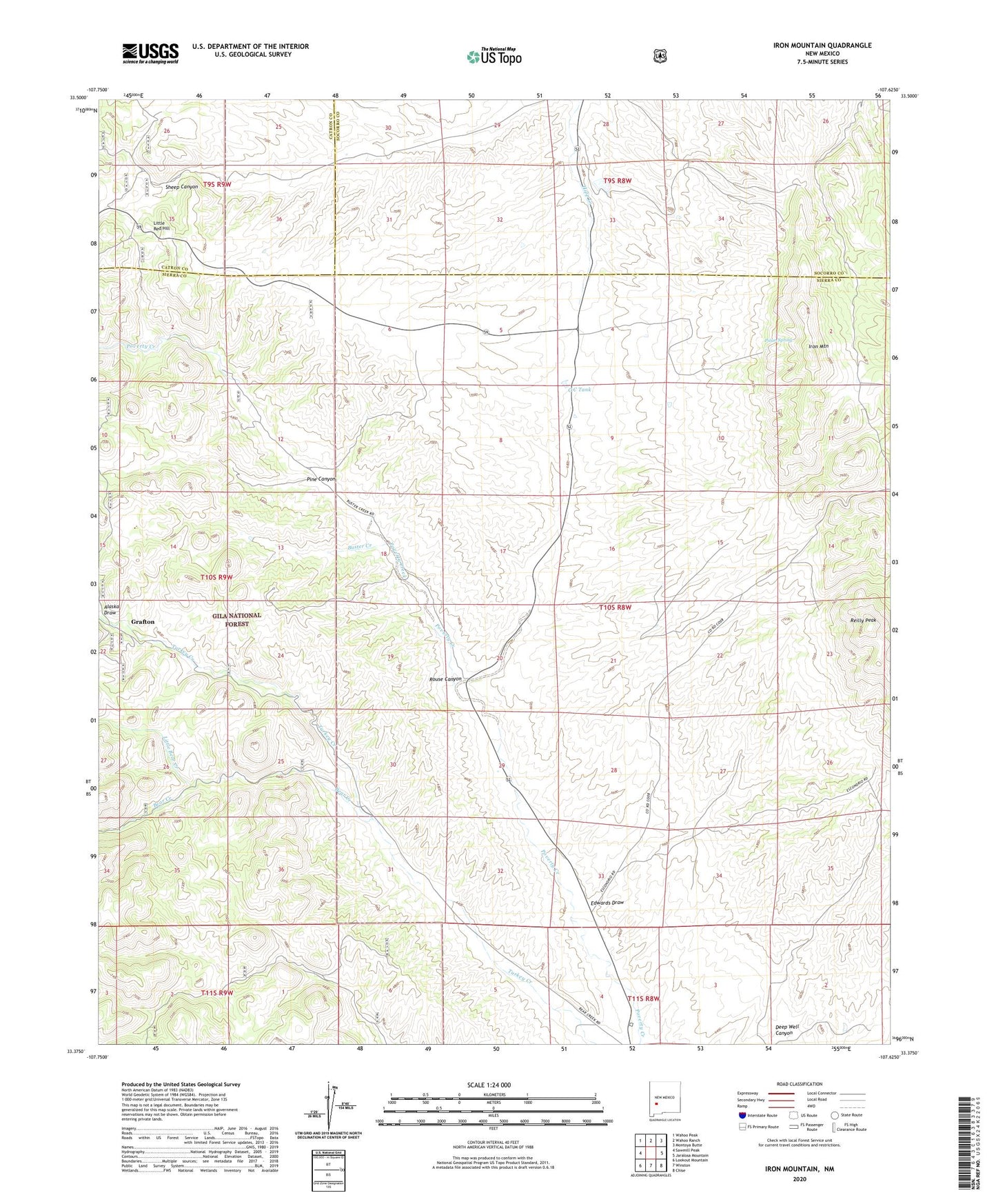
2023 topographic map quadrangle Iron Mountain in the state of New Mexico. Scale: 1:24000. Based on the newly updated USGS 7.5' US Topo map series, this map is in the following counties: Sierra, Socorro, Catron. The map contains contour data, water features, and other items you are used to seeing on USGS maps, but also has updated roads and other features. This is the next generation of topographic maps. Printed on high-quality waterproof paper with UV fade-resistant inks.
Quads adjacent to this one:
West: Sawmill Peak
Northwest: Wahoo Peak
North: Wahoo Ranch
Northeast: Montoya Butte
East: Jaralosa Mountain
Southeast: Chise
South: Winston
Southwest: Lookout Mountain
This map covers the same area as the classic USGS quad with code o33107d6.
Contains the following named places: Alaska Draw, Alaska Group, Backslope, Bear Creek, Bellboy Mine, Black Mountain, Blackhawk Mine, Blue Water Well, Buster Creek, Buster Water Well, C C Tank, Edwards Draw, Emporia Mine, Escondrijo Windmill, Gold Coin, Grafton, Grafton Post Office, Great Republic, Horses Head, Invincible Mine, Iron Mountain, Iron Mountain Deposit, Iron Mountain Detention Dam, Iron Mountain Mine, Ivanhoe Mine, Keystone, Little Bear Creek, Little Red Hill, Lucky Strike, Midway Water Well, Minnehaha Mine, Minnehoha Mine, Moore Ranch, North Dry Creek, Parker Strike, Paymaster Mine, Peewee Water Well, Pine Canyon, Pinon Spring, Reilly Peak, Republic Mine, Rouse Canyon, Sage Ranch, Scheelemite, Scheelemite Gem Mine, Sheep Canyon, Sky Band, Tungsten Reef