
MyTopo
Jaralosa Mountain New Mexico US Topo Map
Couldn't load pickup availability
Also explore the Jaralosa Mountain Forest Service Topo of this same quad for updated USFS data
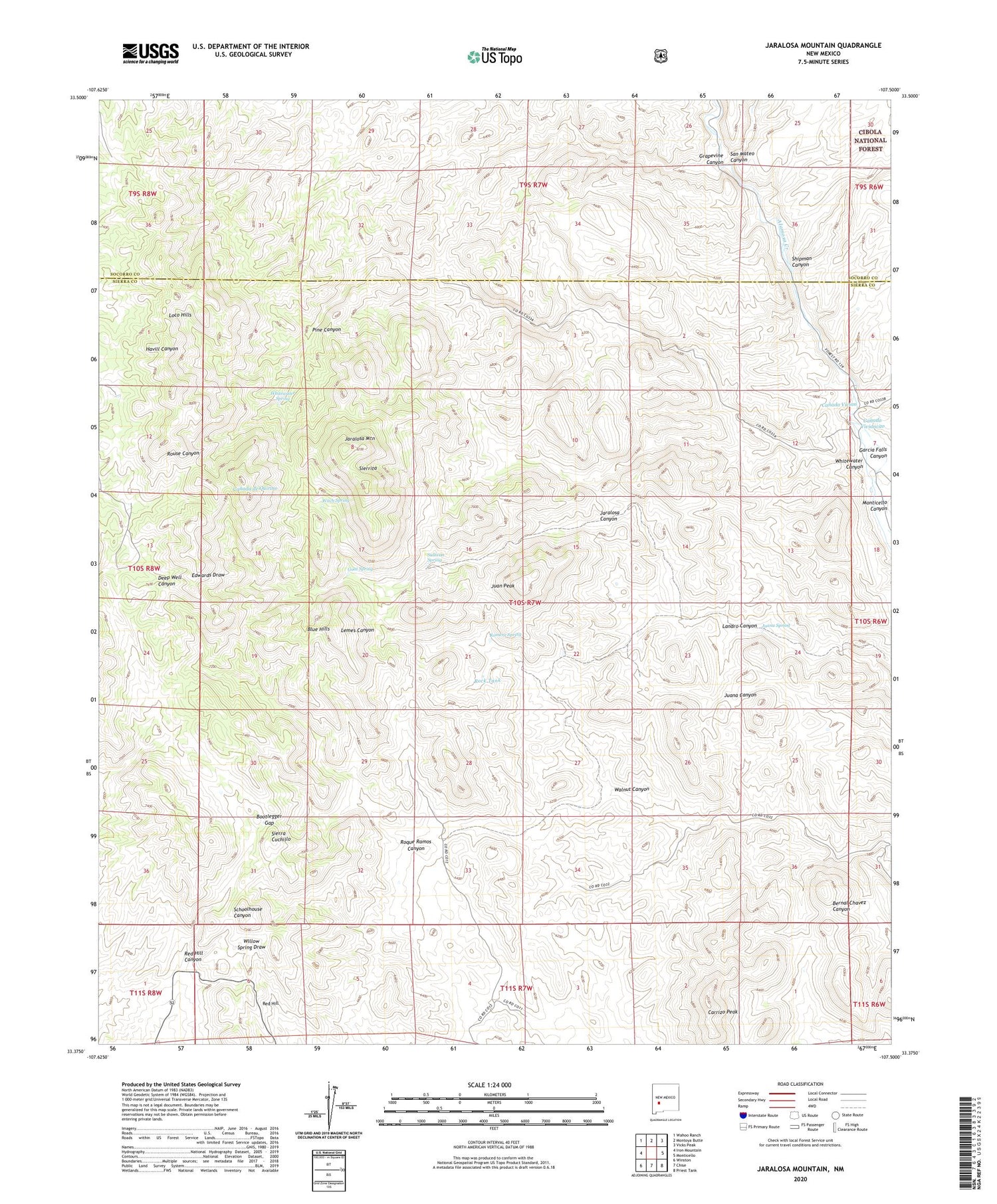
2023 topographic map quadrangle Jaralosa Mountain in the state of New Mexico. Scale: 1:24000. Based on the newly updated USGS 7.5' US Topo map series, this map is in the following counties: Sierra, Socorro. The map contains contour data, water features, and other items you are used to seeing on USGS maps, but also has updated roads and other features. This is the next generation of topographic maps. Printed on high-quality waterproof paper with UV fade-resistant inks.
Quads adjacent to this one:
West: Iron Mountain
Northwest: Wahoo Ranch
North: Montoya Butte
Northeast: Vicks Peak
East: Monticello
Southeast: Priest Tank
South: Chise
Southwest: Winston
This map covers the same area as the classic USGS quad with code o33107d5.
Contains the following named places: Apadoca Well, Blue Hills, Bootlegger Gap, Canada Vivian, Canada Viviancito, Carrizo Peak, Chaves Place, Fairview, Fairview Prospect, Fenceline Tank, Garcia Falls Canyon, Goat Spring, Grapevine Canyon, H V L Ranch, Jaralosa Canyon, Jaralosa Mountain, Jewkes Place, Juan Peak, Juana Spring, Juana Well, Landro Canyon, Loco Hills, Montoya Well, Payne Well, Pine Canyon, Ramos Hills, Red Hill, Red Hill Canyon, Red Well, RG 26393 Water Well, RG 26394 Water Well, RG 32700 Water Well, Rock Tank, Romero Spring, Rouse Place, Rouse Place Water Well, San Mateo Canyon, Sedillo Well, Serna Mine, Shipman Canyon, Sierrita, Sophio Well, Sophio Windmill, Sullivan Spring, Walnut Canyon, Whitewater Canyon, Whitewater Spring, Witch Spring


