MyTopo
Winston New Mexico US Topo Map
Couldn't load pickup availability
Also explore the Winston Forest Service Topo of this same quad for updated USFS data
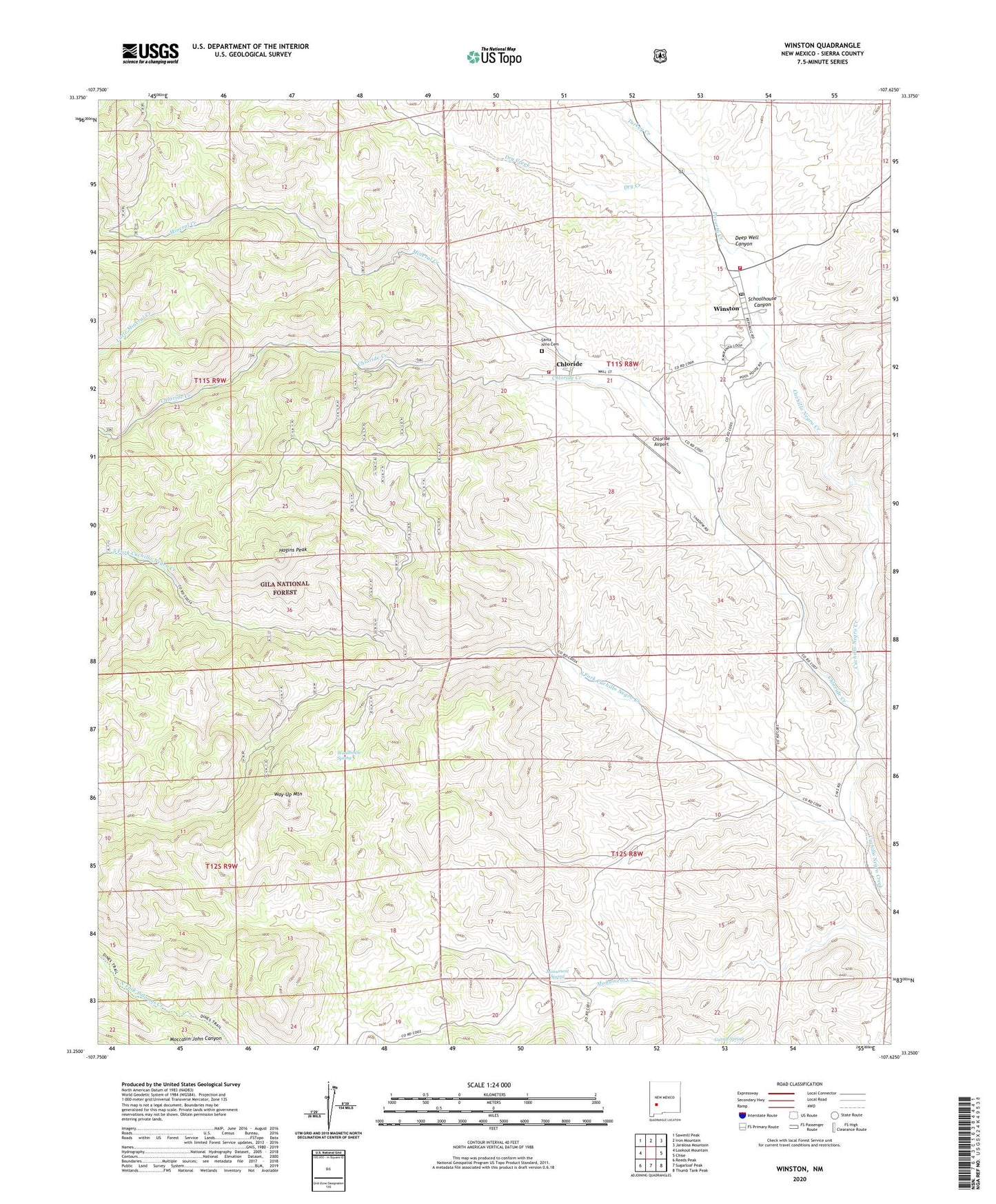
2023 topographic map quadrangle Winston in the state of New Mexico. Scale: 1:24000. Based on the newly updated USGS 7.5' US Topo map series, this map is in the following counties: Sierra. The map contains contour data, water features, and other items you are used to seeing on USGS maps, but also has updated roads and other features. This is the next generation of topographic maps. Printed on high-quality waterproof paper with UV fade-resistant inks.
Quads adjacent to this one:
West: Lookout Mountain
Northwest: Sawmill Peak
North: Iron Mountain
Northeast: Jaralosa Mountain
East: Chise
Southeast: Thumb Tank Peak
South: Sugarloaf Peak
Southwest: Reeds Peak
This map covers the same area as the classic USGS quad with code o33107c6.
Contains the following named places: Bald Eagle Mines, Bald Eagle Windmill, Byers Run, Chloride, Chloride Airport, Chloride Cemetery, Chloride Creek, Chloride Post Office, Colossal and Midnight Mines, Colossal Mine, Deep Well Canyon, Dreadnaught, Dreadnaught Mine, Dry Creek, Garcia Well, Gold Hill, Gold Hill Mine, Green Fly Mine, Hagins Peak, Hoosier Mine, Little Joe Mine, Little Mineral Creek, Lucky Well, Midnight Cabin, Midnight Mine, Midnight Well, Mineral Creek, Monte Christo Saloon Historic Site, Monument Spring, Nana, Nana Mine, Northern Light Mine, Pinatosa Canyon, Pioneer Store, Poverty Creek, Poverty Creek Volunteer Fire Department Mobile Unit, Pye Lode, Saint Cloud Mines, Santa Nino Cemetery, Schoolhouse Canyon, Silver Well, South Fork Cuchillo Negro Creek, Square Tank Well, Stone Ranch Well, Treasury Windmill, Turkey Creek, U.S. Treasury, United States Treasury Mine, Wall Street Mine, Way-Up Mountain, West Well, White Mountain Group, Winston, Winston - Chloride Fire Department Station 1, Winston - Chloride Fire Department Station 2, Winston Census Designated Place, Winston Post Office, Winston Weather Station, Woodhouse Spring