MyTopo
Jacob Spring New Mexico US Topo Map
Couldn't load pickup availability
Also explore the Jacob Spring Forest Service Topo of this same quad for updated USFS data
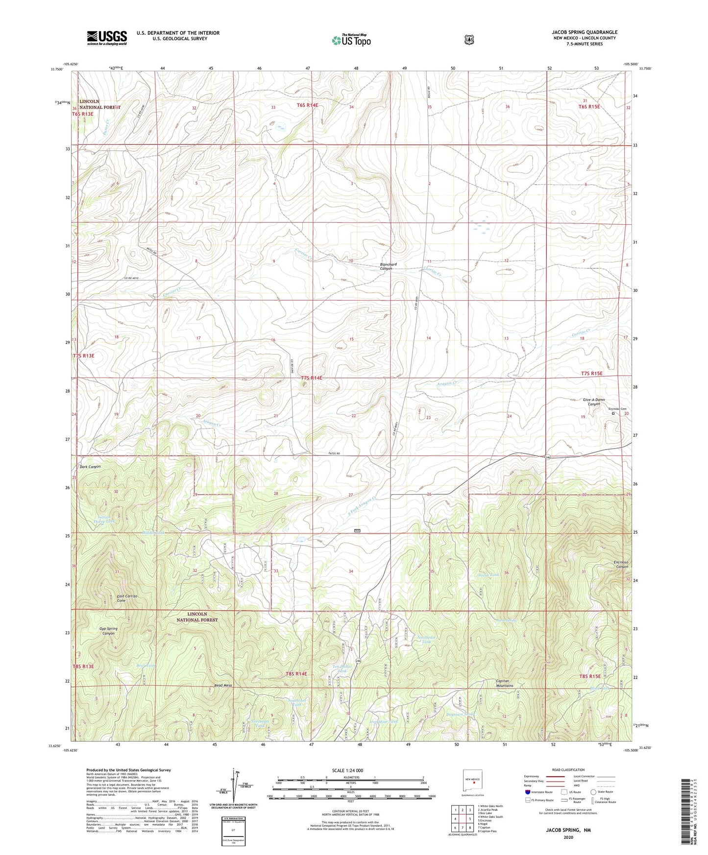
2023 topographic map quadrangle Jacob Spring in the state of New Mexico. Scale: 1:24000. Based on the newly updated USGS 7.5' US Topo map series, this map is in the following counties: Lincoln. The map contains contour data, water features, and other items you are used to seeing on USGS maps, but also has updated roads and other features. This is the next generation of topographic maps. Printed on high-quality waterproof paper with UV fade-resistant inks.
Quads adjacent to this one:
West: White Oaks South
Northwest: White Oaks North
North: Jicarilla Peak
Northeast: Box Lake
East: Encinoso
Southeast: Capitan Pass
South: Capitan
Southwest: Nogal
This map covers the same area as the classic USGS quad with code o33105f5.
Contains the following named places: Aragon Creek, Bear Tank, Big Ben, Blanchard Canyon, Blind Tank, Broken Toe, Dark Canyon, Dogtown Tank, East Carrizo Cone, Encinoso Cemetery, Give-A-Damn Canyon, Give-A-Damn Well, Iron Mine Tank, Jacob Spring, Jacob Tank, Lacey Ranch, Leslie, Leslie Ranch, McCrory Prospect Sec 31, McCrory Prospect Sec 36, Middle Tank, Northeast Tank, Read Mesa, Section Thirty Tank, South Fork Aragon Creek, Southeast Tank, Ten Dollar Tank, Texas Park, Weddige Ranch, Whettige