MyTopo
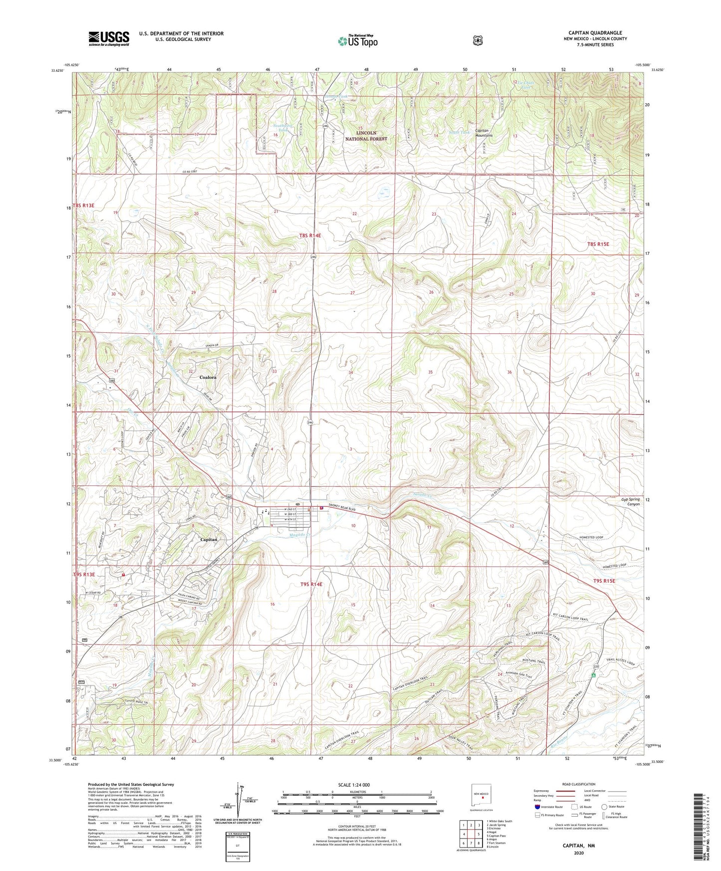
Capitan New Mexico US Topo Map
Couldn't load pickup availability
Also explore the Capitan Forest Service Topo of this same quad for updated USFS data
2023 topographic map quadrangle Capitan in the state of New Mexico. Scale: 1:24000. Based on the newly updated USGS 7.5' US Topo map series, this map is in the following counties: Lincoln. The map contains contour data, water features, and other items you are used to seeing on USGS maps, but also has updated roads and other features. This is the next generation of topographic maps. Printed on high-quality waterproof paper with UV fade-resistant inks.
Quads adjacent to this one:
West: Nogal
Northwest: White Oaks South
North: Jacob Spring
Northeast: Encinoso
East: Capitan Pass
Southeast: Lincoln
South: Fort Stanton
Southwest: Angus
This map covers the same area as the classic USGS quad with code o33105e5.
Contains the following named places: 10010 Water Well, Capitan, Capitan Cemetery, Capitan Elementary School, Capitan Forest Service Facility, Capitan Four Square Church, Capitan High School, Capitan Historical Marker, Capitan Mine, Capitan Number One, Capitan Number Two, Capitan Police Department, Capitan Post Office, Capitan Volunteer Fire Department Station 1 Headquarters, Capitan Volunteer Fire Department Station 2, Capitan Weather Station, Capitian Depot Historic Site, Christ Community Fellowship Church, Church of Christ, Coalora, Coalora Post Office, Flatley Ranch, Fort Stanton, Golder Ranch, Gray, Hondo Tank, Lincoln County Emergency Medical Services Capitan Station, Linderman, Los Patos Ruins, Magado Creek, Marfield Well, North Fork Salado Creek, Oso Creek, Robinson Ranch, Sacred Heart Catholic Church, Smokey Bear State Park Point of Interest, Smokey Mine, South Fork Salado Creek, South Tank, Southwest Tank, Tie Chute Tank, Trinity Southern Baptist Church, United Methodist Church Parish, Village of Capitan