MyTopo
Dale Mountain New Mexico US Topo Map
Couldn't load pickup availability
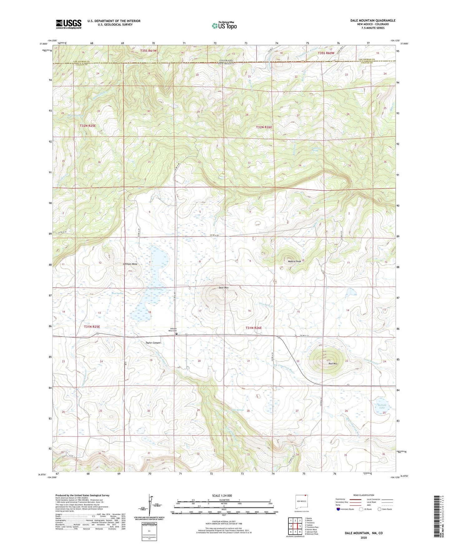
2023 topographic map quadrangle Dale Mountain in the state of New Mexico. Scale: 1:24000. Based on the newly updated USGS 7.5' US Topo map series, this map is in the following counties: Colfax, Las Animas. The map contains contour data, water features, and other items you are used to seeing on USGS maps, but also has updated roads and other features. This is the next generation of topographic maps. Printed on high-quality waterproof paper with UV fade-resistant inks.
Quads adjacent to this one:
West: Yankee
Northwest: Barela
North: Abeyta
Northeast: Trinchera
East: Trinchera Pass
Southeast: Robinson Peak
South: Johnson Park
Southwest: Hunter Mesa
This map covers the same area as the classic USGS quad with code o36104h2.
Contains the following named places: Bear Canyon, Bellisle Lake, Berry, Berry Lake, Dale Mountain, Dale Mountain Mine, Dale Springs, Demcheck, Doherty, Gutierrez Spring, Johnson Mesa Cemetery, Madrid Peak, Mestas Ditch, Red Mountain, Red Mountain Post Office, Ross Spring, Saint Johns Church