MyTopo
Los Montoyas New Mexico US Topo Map
Couldn't load pickup availability
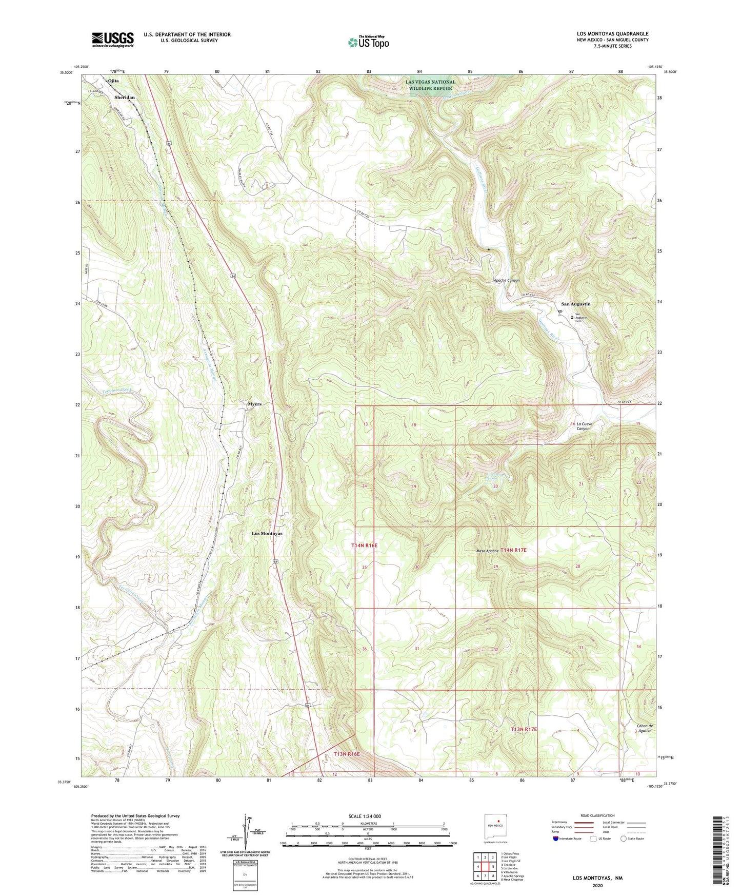
2023 topographic map quadrangle Los Montoyas in the state of New Mexico. Scale: 1:24000. Based on the newly updated USGS 7.5' US Topo map series, this map is in the following counties: San Miguel. The map contains contour data, water features, and other items you are used to seeing on USGS maps, but also has updated roads and other features. This is the next generation of topographic maps. Printed on high-quality waterproof paper with UV fade-resistant inks.
Quads adjacent to this one:
West: Tecolote
Northwest: Ojitos Frios
North: Las Vegas
Northeast: Las Vegas SE
East: La Liendre
Southeast: Mesa Chupinas
South: Apache Springs
Southwest: Villanueva
This map covers the same area as the classic USGS quad with code o35105d2.
Contains the following named places: Ancon del Gato Ditch, Apache Canyon, Arroyo la Manga, Arroyo Vegoso, Concepcion Dam, La Cueva Canyon, La Cueva Spring, Los Fuertes, Los Montoyas, Lourdes Post Office, Lourdes School, Myers, Ojita, Rito Vegoso, San Augustin, San Augustin Cemetery, San Augustin Dam, Sheridan, Sundance