MyTopo
Leyba New Mexico US Topo Map
Couldn't load pickup availability
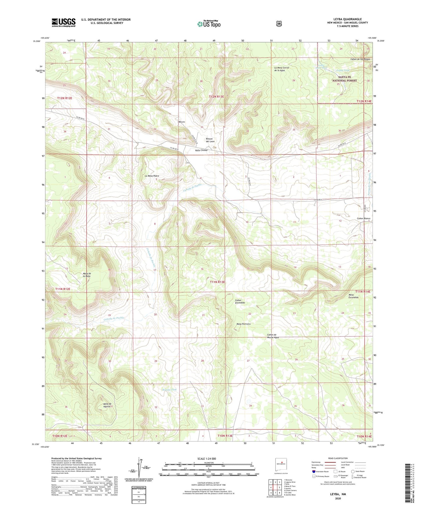
2020 topographic map quadrangle Leyba in the state of New Mexico. Scale: 1:24000. Based on the newly updated USGS 7.5' US Topo map series, this map is in the following counties: San Miguel. The map contains contour data, water features, and other items you are used to seeing on USGS maps, but also has updated roads and other features. This is the next generation of topographic maps. Printed on high-quality waterproof paper with UV fade-resistant inks.
Quads adjacent to this one:
West: Mesa El Toro
Northwest: Rencona
North: Laguna Ortiz
Northeast: Sena
East: Aurora
Southeast: Jacinto Mesa
South: El Cabo
Southwest: Clines Corners
Contains the following named places: Benada Tank, Blind Well, Canada de Pueblo, Corner Tank, El Pablito Indian Ruins, La Mesa Corral de la Agua, La Mesa Pobre, Leyba, Leyba Post Office, Leyba Tank, Lower Agua Tank, Mesa de Aguilar, Mesa de la Mula, Mesa Escondida, Mesa Portrero, North Tank, Ojo Indian Ruins, Rincon Bajito, Rincon Bonito, Rincon Colorado, Rincon del Leon, Rincon Vigil, Rock Tank, San Francisco Church, Shelly, Shelly Hayes Camp, Shelly Windmill, Valle Chimal, Villanueva Division, ZIP Code: 87560