MyTopo
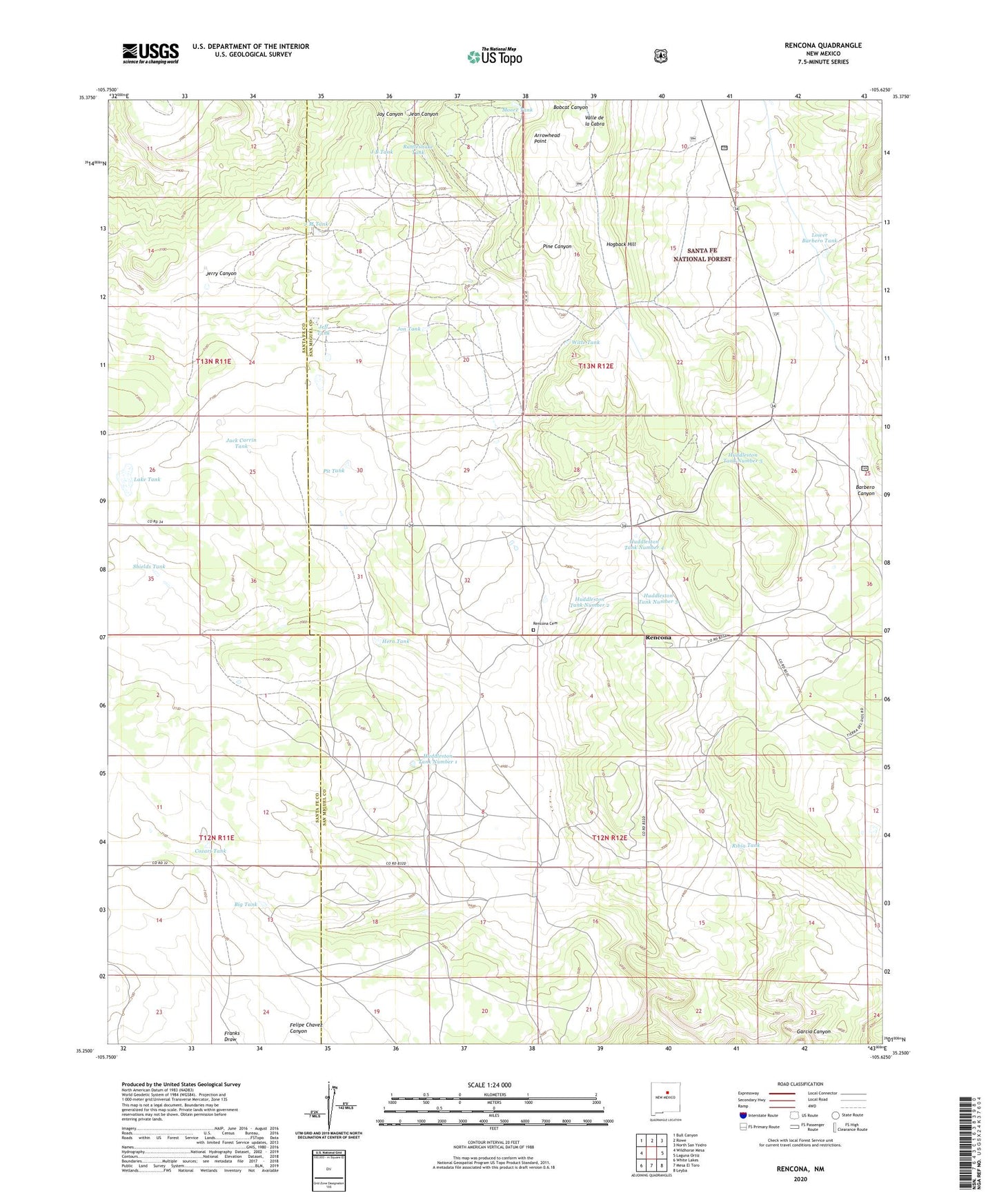
Rencona New Mexico US Topo Map
Couldn't load pickup availability
Also explore the Rencona Forest Service Topo of this same quad for updated USFS data
2023 topographic map quadrangle Rencona in the state of New Mexico. Scale: 1:24000. Based on the newly updated USGS 7.5' US Topo map series, this map is in the following counties: San Miguel, Santa Fe. The map contains contour data, water features, and other items you are used to seeing on USGS maps, but also has updated roads and other features. This is the next generation of topographic maps. Printed on high-quality waterproof paper with UV fade-resistant inks.
Quads adjacent to this one:
West: Wildhorse Mesa
Northwest: Bull Canyon
North: Rowe
Northeast: North San Ysidro
East: Laguna Ortiz
Southeast: Leyba
South: Mesa El Toro
Southwest: White Lakes
This map covers the same area as the classic USGS quad with code o35105c6.
Contains the following named places: Arrowhead Point, Big Tank, Childres Place, Cozart Tank, Douthit Place, East Well, Flat Well, Foster Tank, Garcia Canyon, Garcia Tank, Hard West Well, Henley Tank, Hern Tank, Hogback Hill, Huddleston Ranch, Huddleston Tank Number 1, Huddleston Tank Number 2, Huddleston Tank Number 3, Huddleston Tank Number 4, Huddleston Tank Number 5, Huddleston Well Number 1, Huddleston Well Number 3, J B Tank, J M Tank, Jack Canon Place, Jack Carrin Tank, Jackson Tank, Jay Canyon, Jean Canyon, Jeff Tank, Jerry Canyon, Jon Tank, Lake Tank, Lower Barbero Tank, Martinez Ranch, Martinez Tank, Massey Tank, Moore Tank, Neville Ranch, O D Well, Padilla Ranch, Pit Tank, Quintana Tank, Rattlesnake Tank, Rencona, Rencona Cemetery, Rencona Post Office, Rencona Weather Station, Ribia Tank, School Section Tank, Shields Tank, Tapia Tank, Turney Well, Upper Barbero Tank, Witte Ranch, Witte Tank