MyTopo
Lilley Mountain New Mexico US Topo Map
Couldn't load pickup availability
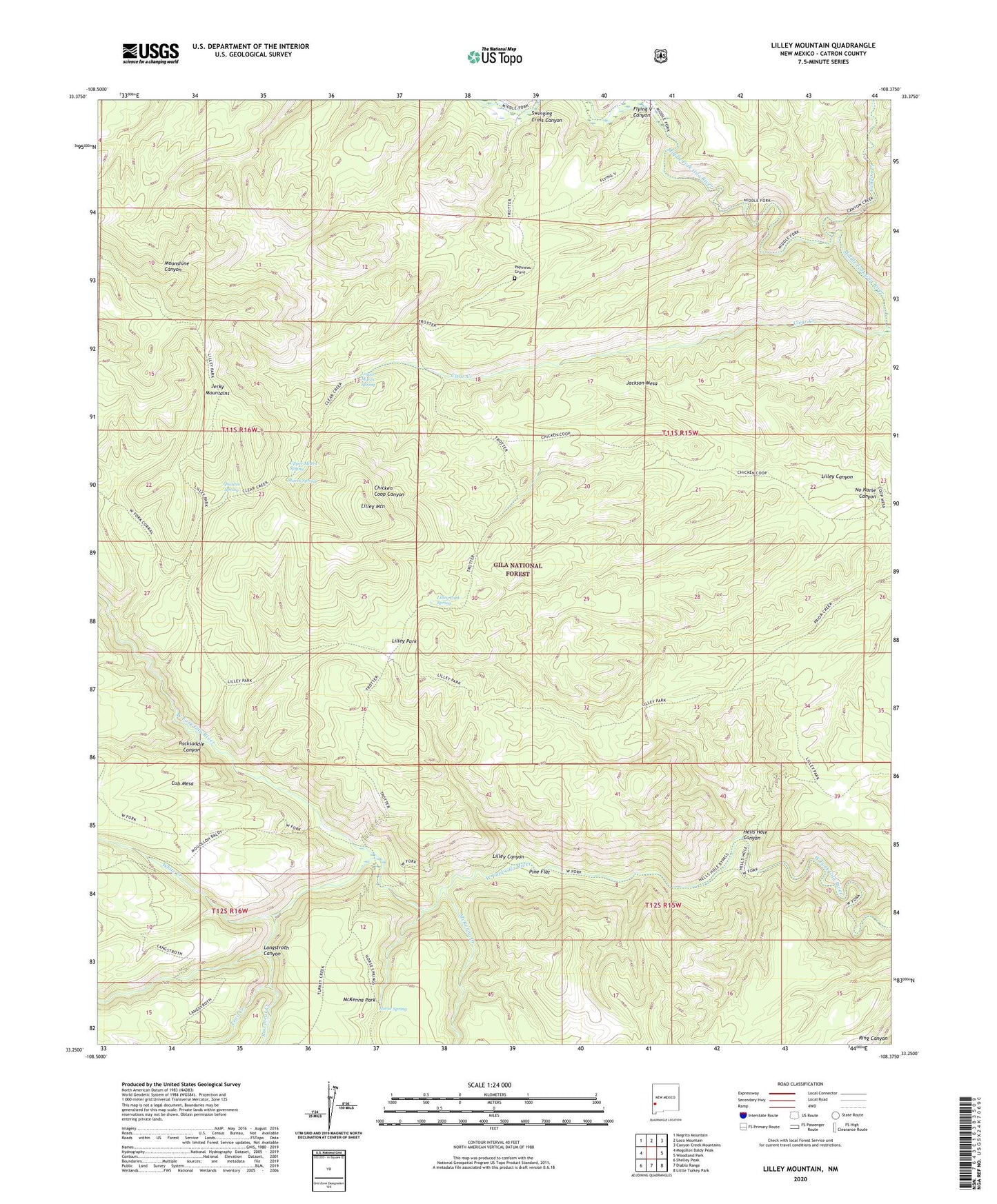
2020 topographic map quadrangle Lilley Mountain in the state of New Mexico. Scale: 1:24000. Based on the newly updated USGS 7.5' US Topo map series, this map is in the following counties: Catron. The map contains contour data, water features, and other items you are used to seeing on USGS maps, but also has updated roads and other features. This is the next generation of topographic maps. Printed on high-quality waterproof paper with UV fade-resistant inks.
Quads adjacent to this one:
West: Mogollon Baldy Peak
Northwest: Negrito Mountain
North: Loco Mountain
Northeast: Canyon Creek Mountains
East: Woodland Park
Southeast: Little Turkey Park
South: Diablo Range
Southwest: Shelley Peak
Contains the following named places: Canyon Creek, Clear Creek, Flying V Canyon, Hells Hole, Hells Hole Canyon, Horse Spring, Jackson Mesa, Jerky Mountains, Langstroth Canyon, Lilley Canyon, Lilley Mountain, Lilley Park, Lilley Park Spring, Lower Marrs Spring, Marrs Spring, McKenna Creek, No Name Canyon, Packsaddle Canyon, Papineau Grave, Pine Flat, Quentin Spring, Rawmeat Creek, Swinging Cross Canyon, Trail Creek, Trotter Cabin, Trotter Trail, Upper Marrs Spring, White Creek, White Creek Cabin