MyTopo
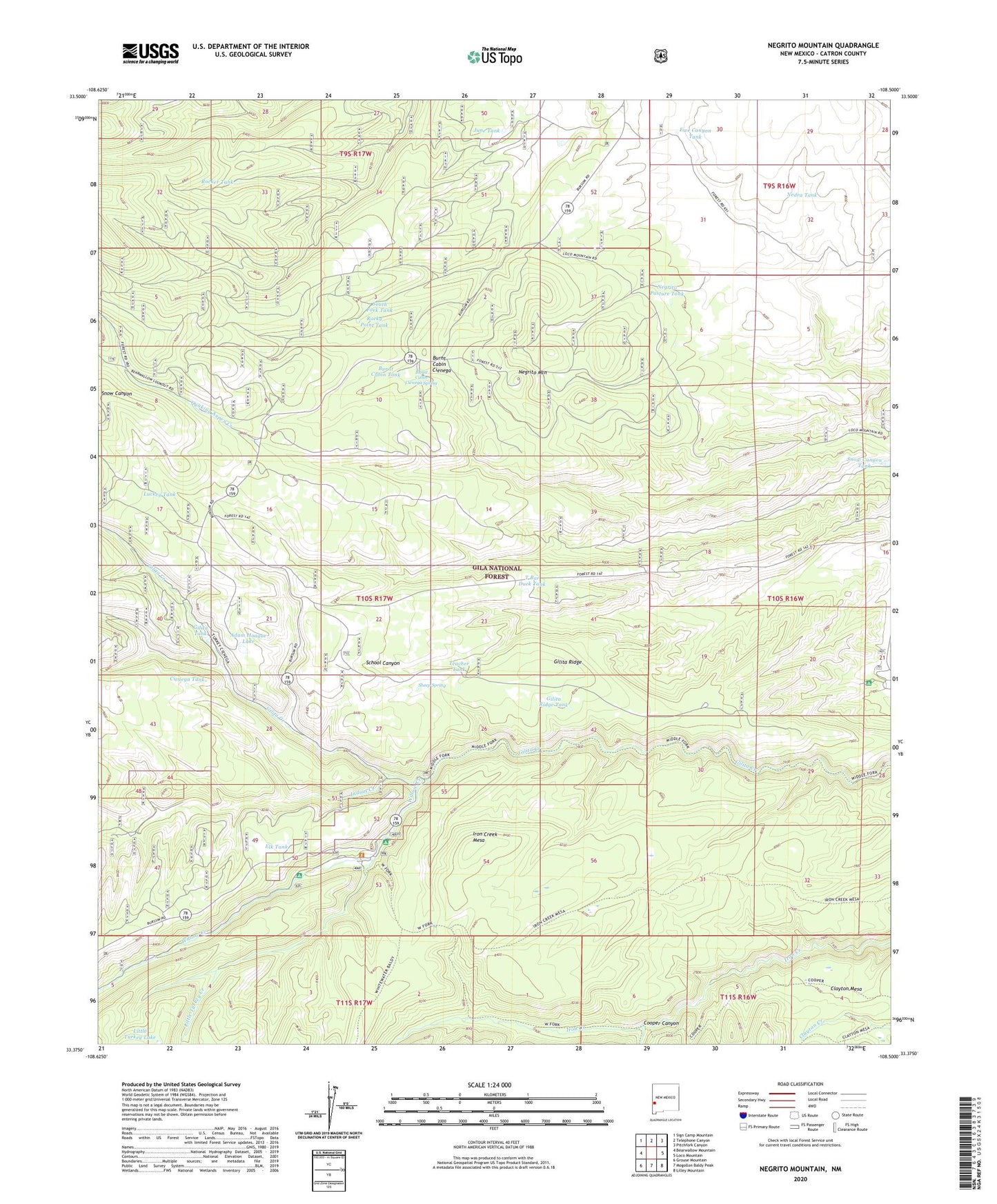
Negrito Mountain New Mexico US Topo Map
Couldn't load pickup availability
Also explore the Negrito Mountain Forest Service Topo of this same quad for updated USFS data
2023 topographic map quadrangle Negrito Mountain in the state of New Mexico. Scale: 1:24000. Based on the newly updated USGS 7.5' US Topo map series, this map is in the following counties: Catron. The map contains contour data, water features, and other items you are used to seeing on USGS maps, but also has updated roads and other features. This is the next generation of topographic maps. Printed on high-quality waterproof paper with UV fade-resistant inks.
Quads adjacent to this one:
West: Bearwallow Mountain
Northwest: Sign Camp Mountain
North: Telephone Canyon
Northeast: Pitchfork Canyon
East: Loco Mountain
Southeast: Lilley Mountain
South: Mogollon Baldy Peak
Southwest: Grouse Mountain
This map covers the same area as the classic USGS quad with code o33108d5.
Contains the following named places: Adam Hoague Lake, Ben Lilly Campground, Burnt Cabin Cienega, Burnt Cabin Cienega Spring, Burnt Cabin Tank, Cienega Tank, Clayton Mesa Trail, Cooper Canyon, Dark Canyon Tank, Dipping Vat Campground, Elk Tank, Ewe Canyon Tank, Gilita Ridge, Gilita Ridge Tank, Gilita Tank, Indian Creek, Iron Creek Lake, Iron Creek Mesa, Iron Creek Mesa Trail, June Tank, Little Turkey Creek, Little Turkey Lake, Luckey Tank, Middle Fork Trail, N Bar Lake, N Bar Park, N Bar Ranch, Nedra Tank, Negrito Mountain, Negrito Mountain Lookout, Negrito Pasture Tank, Rocker Tank, Rocky Point Tank, Sheep Spring, Snow Canyon Tank, Snowlake Recreation Site, South Fork Tank, T Bar Duck Tank, Teacher Tank, Turkey Creek, Turkey Tank, Willow Creek, Willow Creek Campground, Willow Creek Guard Station, Willow Creek Lodge