MyTopo
Canyon Creek Mountains New Mexico US Topo Map
Couldn't load pickup availability
Also explore the Canyon Creek Mountains Forest Service Topo of this same quad for updated USFS data
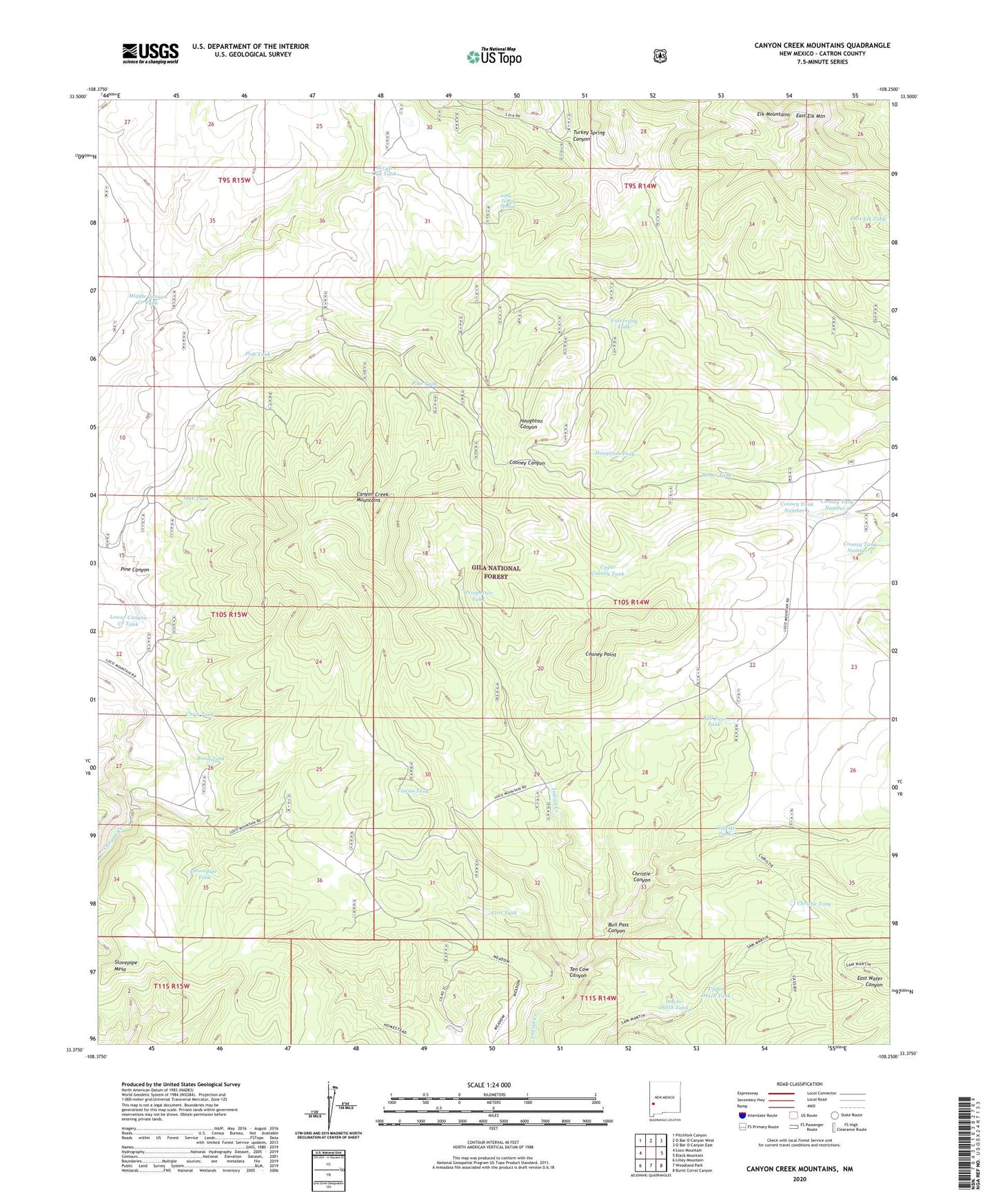
2023 topographic map quadrangle Canyon Creek Mountains in the state of New Mexico. Scale: 1:24000. Based on the newly updated USGS 7.5' US Topo map series, this map is in the following counties: Catron. The map contains contour data, water features, and other items you are used to seeing on USGS maps, but also has updated roads and other features. This is the next generation of topographic maps. Printed on high-quality waterproof paper with UV fade-resistant inks.
Quads adjacent to this one:
West: Loco Mountain
Northwest: Pitchfork Canyon
North: O Bar O Canyon West
Northeast: O Bar O Canyon East
East: Black Mountain
Southeast: Burnt Corral Canyon
South: Woodland Park
Southwest: Lilley Mountain
This map covers the same area as the classic USGS quad with code o33108d3.
Contains the following named places: Bonus Tank, Bull Pass Canyon, Bull Pass Tank, Canyon Creek Mountains, Chris Tank, Christie Canyon, Christie Tank, Cooney Point, Cooney Prairie, Cooney Tank Number 1, Cooney Tank Number 2, Cooney Tank Number 3, Double Springs Ranch, East Elk Mountain, East Elk Tank, Elk Mountains, Gillette Tanks, Houghton Tank, Hulse Ranch, Indian Creek Water Well, Indian Creek Well, Little Turkey Spring, Lost Tank, Lower Canyon Creek Tank, Lower Dutch Tank, Middle Canyon Creek Tank, Oak Tank, Pine Canyon, Pine Tank, Prospector Tank, Road Tank, Scrub Oak Tank, Stovepipe Mesa, Stovepipe Tank, Ten Cow Canyon, Tincan Tank, Turkey Spring Canyon, University Tank, Upper Cooney Tank, Upper Dutch Tank