MyTopo
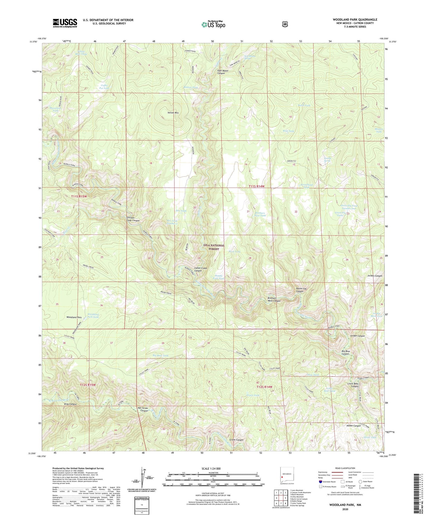
Woodland Park New Mexico US Topo Map
Couldn't load pickup availability
Also explore the Woodland Park Forest Service Topo of this same quad for updated USFS data
2023 topographic map quadrangle Woodland Park in the state of New Mexico. Scale: 1:24000. Based on the newly updated USGS 7.5' US Topo map series, this map is in the following counties: Catron. The map contains contour data, water features, and other items you are used to seeing on USGS maps, but also has updated roads and other features. This is the next generation of topographic maps. Printed on high-quality waterproof paper with UV fade-resistant inks.
Quads adjacent to this one:
West: Lilley Mountain
Northwest: Loco Mountain
North: Canyon Creek Mountains
Northeast: Black Mountain
East: Burnt Corral Canyon
Southeast: Gila Hot Springs
South: Little Turkey Park
Southwest: Diablo Range
This map covers the same area as the classic USGS quad with code o33108c3.
Contains the following named places: Adobe Tank, Arrowhead Tank, Basin Tank, Big Bear Canyon, Big Bear Tank, Brothers West Canyon, Brothers West Tank, Cassidy Spring, Chicken Coop Canyon, Coffee Pot Tank, Deep Tank, Dirt Tank, Dirt Tank Number 2, East Water Canyon, Gila National Forest, Grave Canyon, Grave Tank, Green Fly Tank Number 2, Green Fly Tank Number One, Green Fly Tanks, Green Fly Trail, House Log Canyon, Indian Creek, Indian Creek Canyon, Jordan Canyon, Jordan Mesa Tank, Little Bear Canyon, Little Bear Tank, Marceleno Tank, Middle Fork Tank, Nat Straw Canyon, Pino Tank, Prior Cabin, Prior Creek, Ramon Tank, Ring Canyon, Rock Tank, Sam Martin Spring, The Meadows, Wild Tank, Woodland Park, Woodland Park Tank, Woodland Park Trail, Yellow Bear Tank, Yellow Mountain