MyTopo
Lucero New Mexico US Topo Map
Couldn't load pickup availability
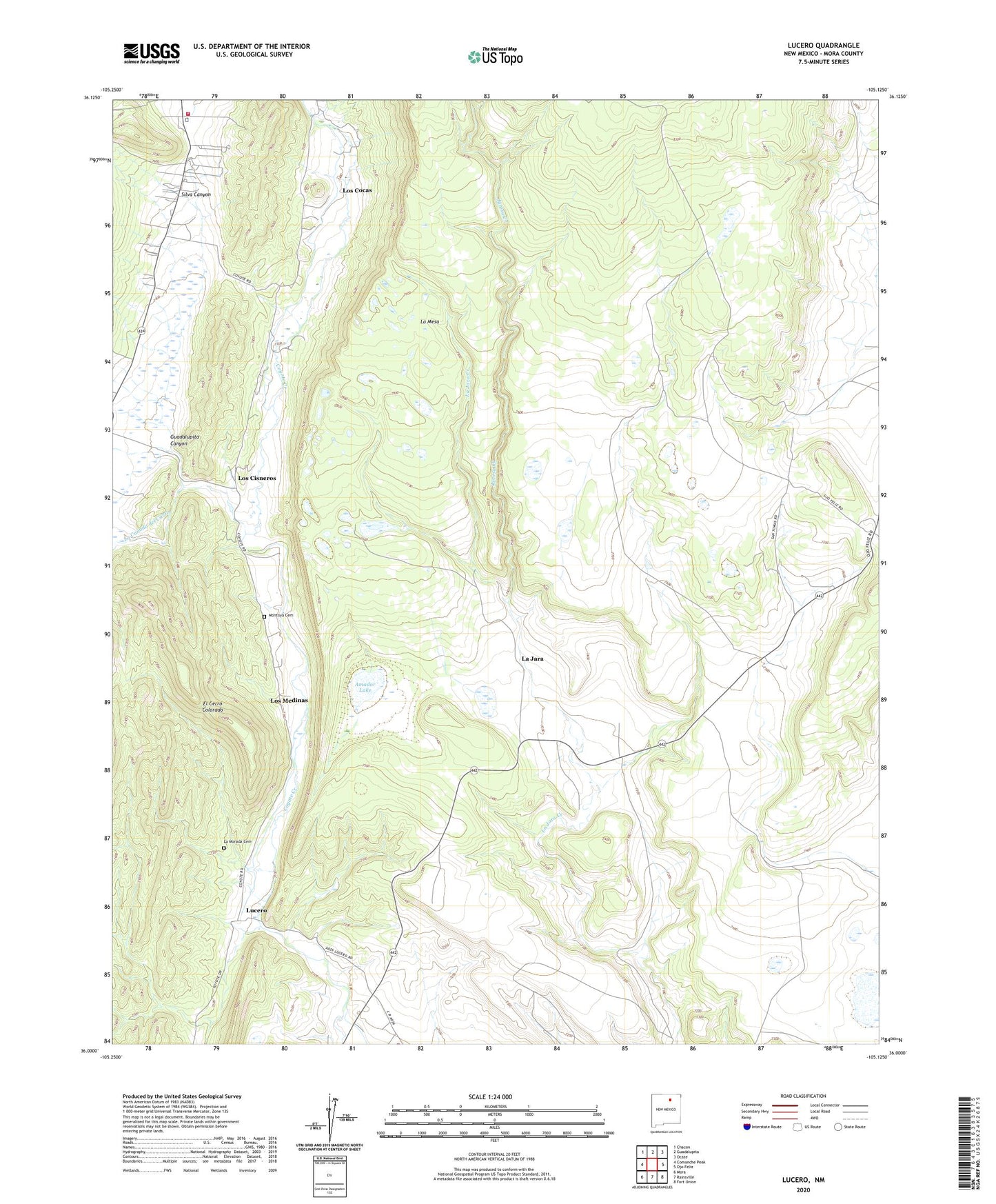
2020 topographic map quadrangle Lucero in the state of New Mexico. Scale: 1:24000. Based on the newly updated USGS 7.5' US Topo map series, this map is in the following counties: Mora. The map contains contour data, water features, and other items you are used to seeing on USGS maps, but also has updated roads and other features. This is the next generation of topographic maps. Printed on high-quality waterproof paper with UV fade-resistant inks.
Quads adjacent to this one:
West: Comanche Peak
Northwest: Chacon
North: Guadalupita
Northeast: Ocate
East: Ojo Feliz
Southeast: Fort Union
South: Rainsville
Southwest: Mora
Contains the following named places: Amador Lake, El Cerro Colorado, El Convento, Guadalupita Canyon, Guadalupita Volunteer Fire Department, Jarosa Creek, La Canada del Carro, La Jara, La Morada Cemetery, Los Cisneros, Los Cocas, Los Medinas, Lucero, Lucero Post Office, Montoya, Montoya Cemetery, Silva Canyon, ZIP Code: 87735