MyTopo
Ojo Feliz New Mexico US Topo Map
Couldn't load pickup availability
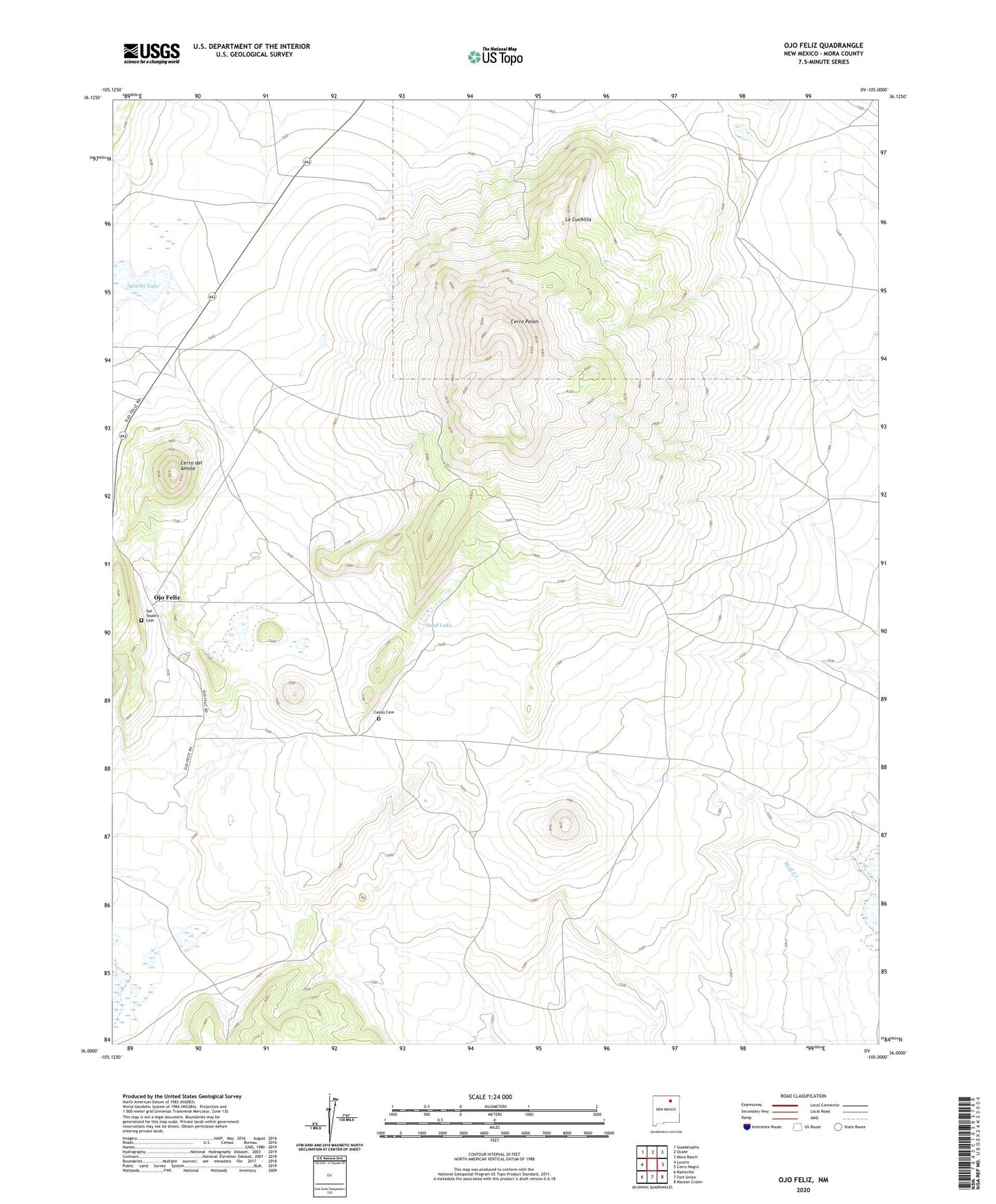
2023 topographic map quadrangle Ojo Feliz in the state of New Mexico. Scale: 1:24000. Based on the newly updated USGS 7.5' US Topo map series, this map is in the following counties: Mora. The map contains contour data, water features, and other items you are used to seeing on USGS maps, but also has updated roads and other features. This is the next generation of topographic maps. Printed on high-quality waterproof paper with UV fade-resistant inks.
Quads adjacent to this one:
West: Lucero
Northwest: Guadalupita
North: Ocate
Northeast: Mora Ranch
East: Cerro Negro
Southeast: Maxson Crater
South: Fort Union
Southwest: Rainsville
This map covers the same area as the classic USGS quad with code o36105a1.
Contains the following named places: Apache Lake, Casias Cemetery, Cerro del Amole, Cerro Pelon, La Cuchilla, Lois Claim, Mora Grant, North Baldy Ridge Group Mine, Ojo Feliz, Ojo Feliz Post Office, Pelon Windmill, Ponil Mine, San Yasdiro Cemetery, San Yasidro Church, Sand Lake