MyTopo
Mora New Mexico US Topo Map
Couldn't load pickup availability
Also explore the Mora Forest Service Topo of this same quad for updated USFS data
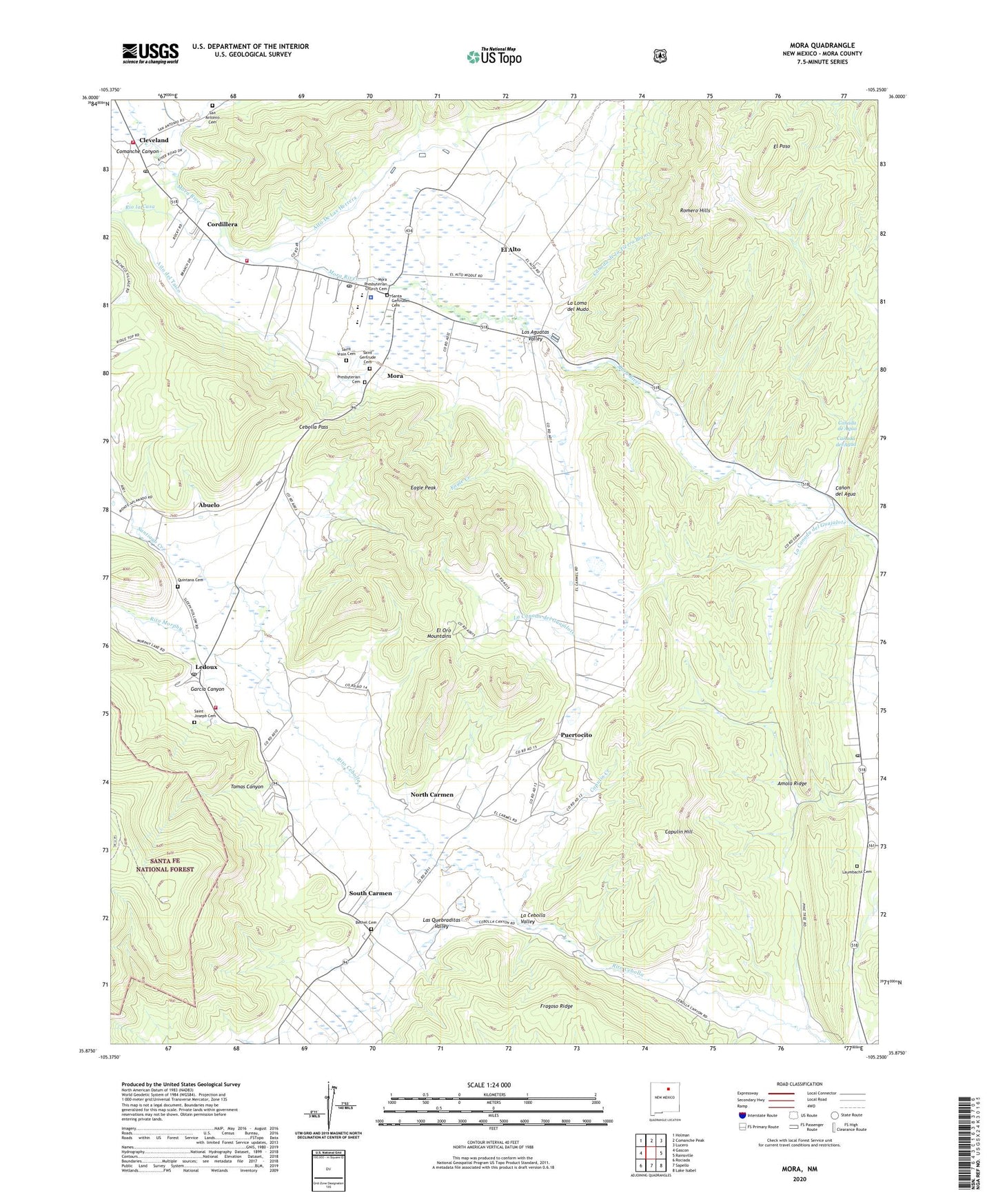
2023 topographic map quadrangle Mora in the state of New Mexico. Scale: 1:24000. Based on the newly updated USGS 7.5' US Topo map series, this map is in the following counties: Mora. The map contains contour data, water features, and other items you are used to seeing on USGS maps, but also has updated roads and other features. This is the next generation of topographic maps. Printed on high-quality waterproof paper with UV fade-resistant inks.
Quads adjacent to this one:
West: Gascon
Northwest: Holman
North: Comanche Peak
Northeast: Lucero
East: Rainsville
Southeast: Lake Isabel
South: Sapello
Southwest: Rociada
This map covers the same area as the classic USGS quad with code o35105h3.
Contains the following named places: Abuelo, Aito del Taico, Alto De Las Herrera, Amola Ridge, Bethel Cemetery, Brother of Jesus Mission, Buena Vista Post Office, Canada de Agua, Canada de la Tierra Blanco, Canada del Agua, Canon, Canon del Agua, Canoncito, Capulin Creek, Capulin Hill, Cassidy Mill Historic Site, Cebolla, Cebolla Pass, Chappell - Holman - Encinial - Ledoux Volunteer Fire Station, Cleveland, Cleveland Post Office, Cleveland Roller Mill Museum, Comanche Canyon, Cordillera, D Cassidy and Sons General Merchandise, Daniel Cassidy House Historic Site, David Cargo Public Library, Desiderio Valdez House Historic Site, Eagle Creek, Eagle Peak, El Alto, El Oro, El Oro Mountains, El Poso, Garcia Canyon, Garcia House Historic Site, Gordon-Sanchez Mill Historic Site, Holman Elementary School, John Doherty House Historic Site, Jose Olguin Barn and Corral Complex, La Canada del Guajalote, La Cebolla Valley, La Loma del Mudo, Las Quebraditas Valley, Laumbachs Cemetery, Ledoux, Ledoux Post Office, Ledoux Rural Historic District, Ledoux Volunteer Fire Department, Los Aguatas Valley, Mica Mine, Mora, Mora Beryl Prospect, Mora Census Designated Place, Mora County Sheriff's Office, Mora High School, Mora Historic District, Mora National Fish Hatchery, Mora Post Office, Mora Presbyterian Church Cemetery, Mora Valley, Mora Valley Community Baptist, Mora Valley Community Health Services Ambulance, Mora Volunteer Fire Department, North Carmen, North Carmen Historic District, Our Lady of Mount Carmel Church, Presbyterian Cemetery, Puertocito, Quintana Cemetery, Rio la Casa, Rito Morphy, Romero Hills, Sacred Heart Chapel, Saint Gertrude Cemetery, Saint James Chapel, Saint Joseph Cemetery, Saint Joseph Church, Saint Vrain Cemetery, Saint Vrains Mill, San Antonio Cemetery, Sanchez Canyon, Santa Gertrudes Cemetery, Santa Gertrudis, Santiago Creek, South Carmen, Tomas Canyon, ZIP Code: 87732