MyTopo
Massacre Peak New Mexico US Topo Map
Couldn't load pickup availability
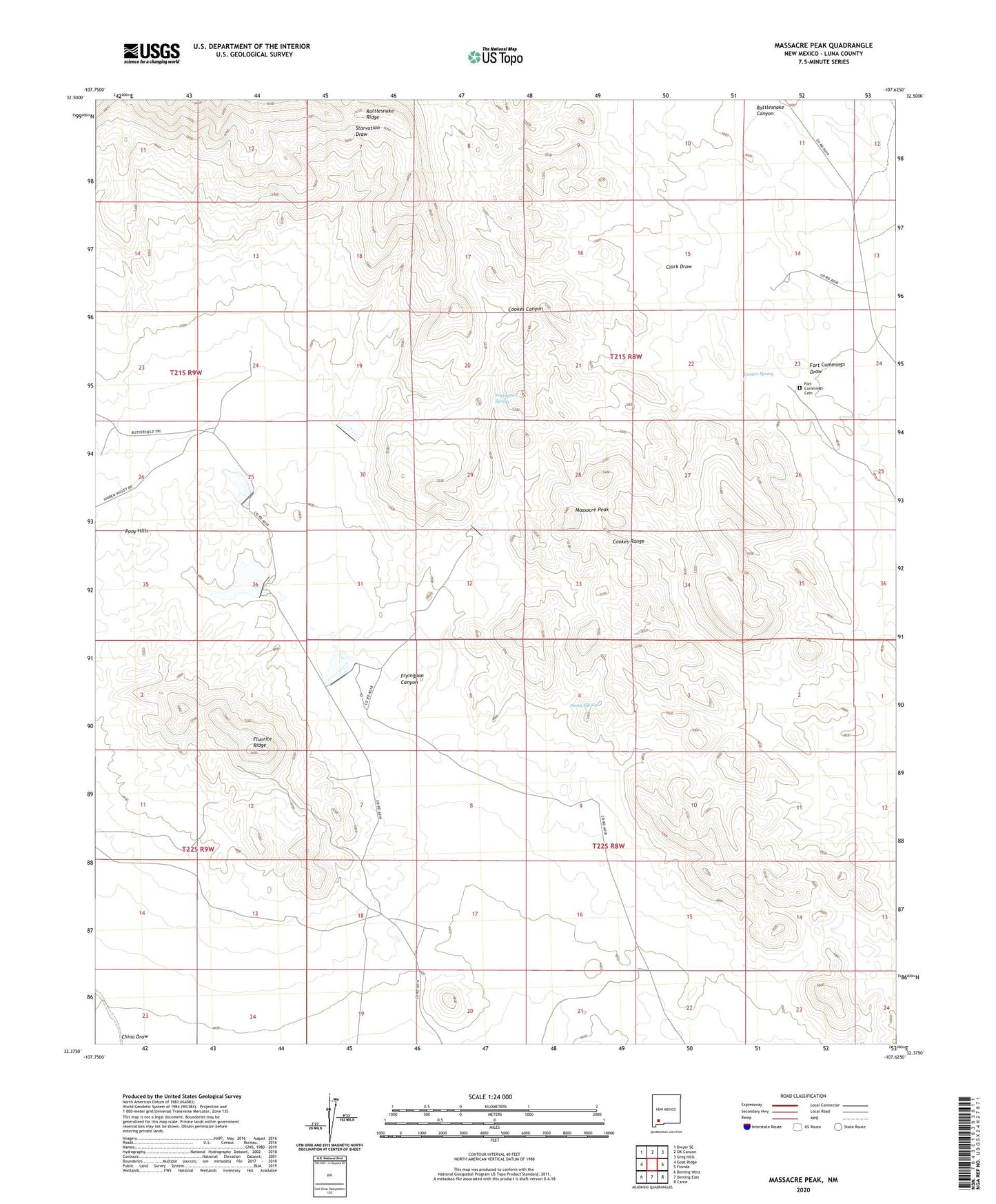
2020 topographic map quadrangle Massacre Peak in the state of New Mexico. Scale: 1:24000. Based on the newly updated USGS 7.5' US Topo map series, this map is in the following counties: Luna. The map contains contour data, water features, and other items you are used to seeing on USGS maps, but also has updated roads and other features. This is the next generation of topographic maps. Printed on high-quality waterproof paper with UV fade-resistant inks.
Quads adjacent to this one:
West: Goat Ridge
Northwest: Dwyer SE
North: OK Canyon
Northeast: Greg Hills
East: Florida
Southeast: Carne
South: Deming East
Southwest: Deming West
Contains the following named places: 01216 Water Well, 01226 Water Well, 01277 Water Well, 01278 Water Well, 01282 Water Well, 01579 Water Well, 01580 Water Well, Clark Draw, Cookes Spring, Cookes Spring Station, Deming North Division, Detention Dam Number 1, Detention Dam Number 2, Detention Dam Number 5, Doubtful Group, Fluorite Ridge, Fort Cummings, Fort Cummings 1836-1886 Historical Marker, Fort Cummings Cemetery, Fort Cummings Post Office, Fryingpan Canyon, Fryingpan Spring, Grattan Mine, Gratten Mine, Green Spar Mine, Greenleaf Mine, Hill Top Mine, Hilltop Prospect, Hyatt Ranch, Lucky Mine, Massacre Peak, Millard Windmill, Number 1228 Water Well, Oil Well Windmill, Pony Hills, Puma Spring, Rattlesnake Canyon, Rattlesnake Ridge, Sadler Mine, San Juan Mine, Sidey Windmill, Starvation Draw Detention Dam Number 1, Starvation Draw Detention Dam Number 2, Starvation Draw Detention Dam Number 3, Starvation Draw Detention Dam Number 4, Starvation Draw Detention Dam Number 5, Tip Top Prospect, Valley Mine, White Bluff, Whitehill Prospect, Wilson Ranch