MyTopo
OK Canyon New Mexico US Topo Map
Couldn't load pickup availability
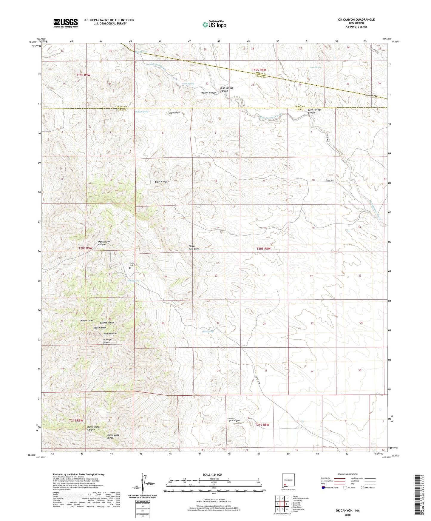
2023 topographic map quadrangle OK Canyon in the state of New Mexico. Scale: 1:24000. Based on the newly updated USGS 7.5' US Topo map series, this map is in the following counties: Luna, Grant, Sierra. The map contains contour data, water features, and other items you are used to seeing on USGS maps, but also has updated roads and other features. This is the next generation of topographic maps. Printed on high-quality waterproof paper with UV fade-resistant inks.
Quads adjacent to this one:
West: Dwyer SE
Northwest: Dwyer
North: Whiterock Mountain
Northeast: Lake Valley
East: Greg Hills
Southeast: Florida
South: Massacre Peak
Southwest: Goat Ridge
This map covers the same area as the classic USGS quad with code o32107e6.
Contains the following named places: 01507 Water Well, 01508 Water Well, 01509 Water Well, 01510 Water Well, 01511 Water Well, 01512 Water Well, 01514 Water Well, 01522 Water Well, Alkali Canyon, Bear Springs Canyon, Burro Spring, Cathy Ranch, Clark Draw, Cookes Peak, Cookes Range, Cookes Range Wilderness Study Area, Cooks Peak, Cooks Peak Cemetery, Dove Spring, Dove Springs Canyon, Flying Y Ranch, Gladys Mine, Graphic Mine, Greenleaf 3 Mine, Greenleaf 4 Mine, Greenleaf 5 Mine, Hope Mine, Inez Mine, L McKinney Ranch, Little Mary Mine, Lookout Deposit, Mickey Mine, Mule Springs, Ok Canyon, Old Commodore Mine, Poe Group Mine, Raithel Mine, Riley Spring, Shale Spring, Silver Cave Number 2, Summit Group Mine, Surprise and Mahonney Number 1 Shaft, Walnut Canyon, Walnut Spring, Webster Mine, West Side Mine, White Oaks Mine