MyTopo
Maxwell New Mexico US Topo Map
Couldn't load pickup availability
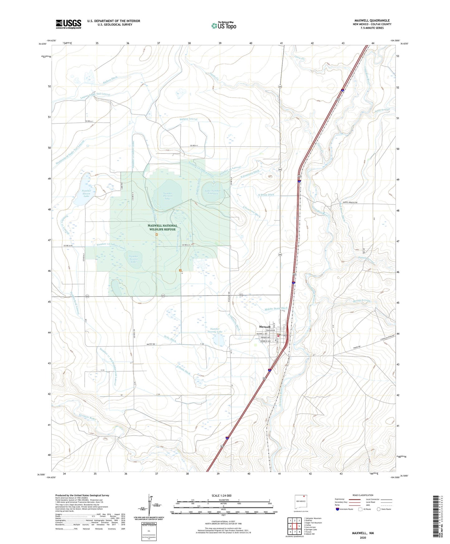
2023 topographic map quadrangle Maxwell in the state of New Mexico. Scale: 1:24000. Based on the newly updated USGS 7.5' US Topo map series, this map is in the following counties: Colfax. The map contains contour data, water features, and other items you are used to seeing on USGS maps, but also has updated roads and other features. This is the next generation of topographic maps. Printed on high-quality waterproof paper with UV fade-resistant inks.
Quads adjacent to this one:
West: Colfax
Northwest: Saltpeter Mountain
North: Koehler
Northeast: Eagle Tail Mountain
East: Loco Arroyo
Southeast: Abbott NW
South: French
Southwest: Springer Lake
This map covers the same area as the classic USGS quad with code o36104e5.
Contains the following named places: Crow Creek, Curtis Creek, Dam Number 13, Dam Number Two, Dyke Ditch, East Thirteen Ditch, East Twelve Ditch, Highline Ditch, Kappis Arroyo, Laguna Eagle Tail Lateral, Lake Number Fourteen, Loco Arroyo, Maxwell, Maxwell Cemetery, Maxwell Elementary School, Maxwell Fire Department, Maxwell First Baptist, Maxwell High School, Maxwell National Wildlife Refuge, Maxwell Number 11 Dam, Maxwell Number 12 Dam, Maxwell Number 14 Dam, Maxwell Post Office, Maxwell Weather Station, Middle Drain Ditch, North Drain Ditch, North Fourteen Ditch, Number 11 and Stubblefield Lateral, Number 11 Inflow Canal, Number 11 Lateral, Number 12 Inflow Canal, Number 14 Inflow Canal, Number 14 Lateral, Number Eleven Lake, Number Thirteen Lake, Number Twelve Lake, Number Twenty Lake, Red River Ditch, Red River School, Reservoir Number 13, Reservoir Number Two, Ridge Ditch, Siphon Ditch, Siphon Lateral, South Drain Ditch, South Fourteen Ditch, Spring Arroyo, Stubblefield Eagle Tail Lateral, Village of Maxwell, West Thirteen Ditch, ZIP Code: 87728