MyTopo
Thompson Ranch New Mexico US Topo Map
Couldn't load pickup availability
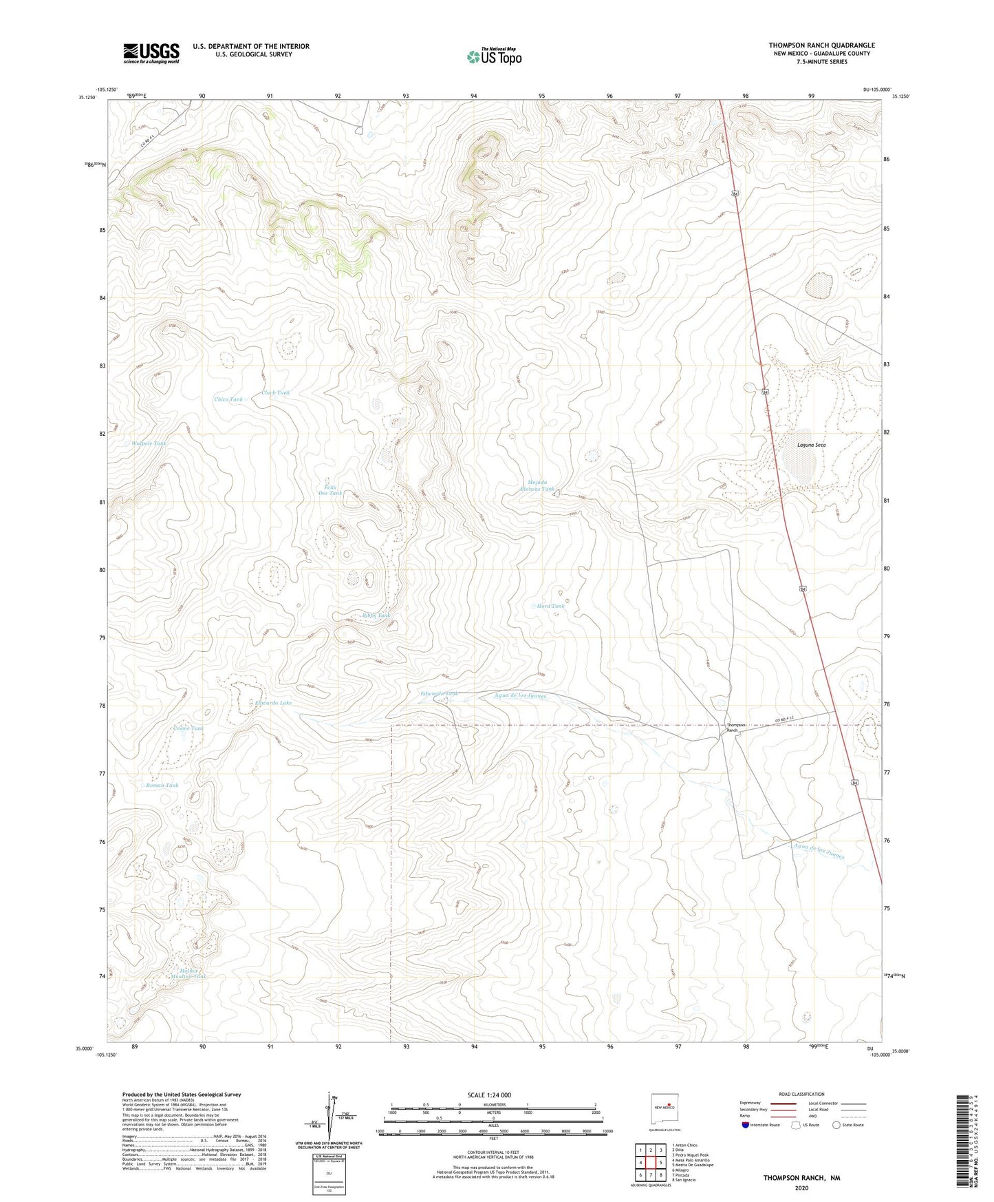
2023 topographic map quadrangle Thompson Ranch in the state of New Mexico. Scale: 1:24000. Based on the newly updated USGS 7.5' US Topo map series, this map is in the following counties: Guadalupe. The map contains contour data, water features, and other items you are used to seeing on USGS maps, but also has updated roads and other features. This is the next generation of topographic maps. Printed on high-quality waterproof paper with UV fade-resistant inks.
Quads adjacent to this one:
West: Mesa Palo Amarillo
Northwest: Anton Chico
North: Dilia
Northeast: Pedro Miguel Peak
East: Mesita De Guadalupe
Southeast: San Ignacio
South: Pintada
Southwest: Milagro
This map covers the same area as the classic USGS quad with code o35105a1.
Contains the following named places: Alegre Windmill, Anton Chico, Baker Lake, Bibbs Tank, Chico Tank, Cluck Tank, Cosme Tank, Dilia Division, Edwardo Lake, Edwardo Tank, Felix Dee Tank, Gibson Tank, Hord Tank, Laguna Seca, Miser Windmill, Mojada Blancas Tank, Molma Moulton Tank, North Windmill, Roman Tank, Thompson Ranch, Walpole Tank