MyTopo
Milnesand New Mexico US Topo Map
Couldn't load pickup availability
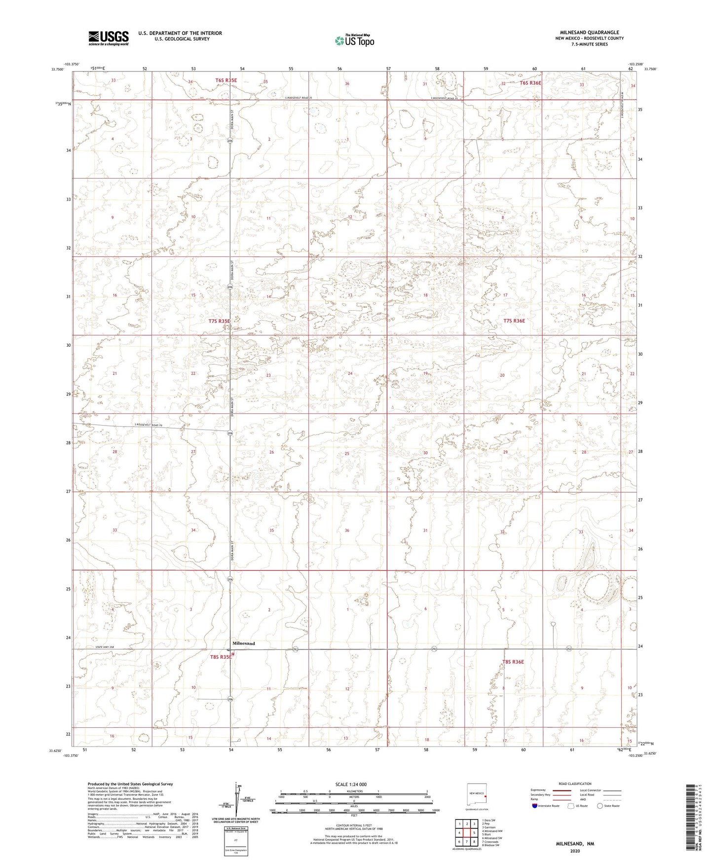
2023 topographic map quadrangle Milnesand in the state of New Mexico. Scale: 1:24000. Based on the newly updated USGS 7.5' US Topo map series, this map is in the following counties: Roosevelt. The map contains contour data, water features, and other items you are used to seeing on USGS maps, but also has updated roads and other features. This is the next generation of topographic maps. Printed on high-quality waterproof paper with UV fade-resistant inks.
Quads adjacent to this one:
West: Milnesand NW
Northwest: Dora SW
North: Pep
Northeast: Garrison
East: Bluit
Southeast: Bledsoe SW
South: Crossroads
Southwest: Milnesand SW
This map covers the same area as the classic USGS quad with code o33103f3.
Contains the following named places: 06223 Water Well, 06224 Water Well, 10138 Water Well, 11402 Water Well, 11403 Water Well, 11426 Water Well, 11427 Water Well, 11512 Water Well, 11513 Water Well, 11514 Water Well, 11515 Water Well, 11516 Water Well, 11517 Water Well, 11518 Water Well, 11520 Water Well, 11521 Water Well, 11522 Water Well, 12556 Water Well, 12557 Water Well, 12560 Water Well, 12588 Water Well, 12590 Water Well, 12591 Water Well, 12592 Water Well, 12603 Water Well, 12604 Water Well, Milnesand, Milnesand Baptist Church, Milnesand Fire and Rescue Station 1, Milnesand Natural Gas Mast, Milnesand Post Office, Todd Oil Field