MyTopo
Milnesand SW New Mexico US Topo Map
Couldn't load pickup availability
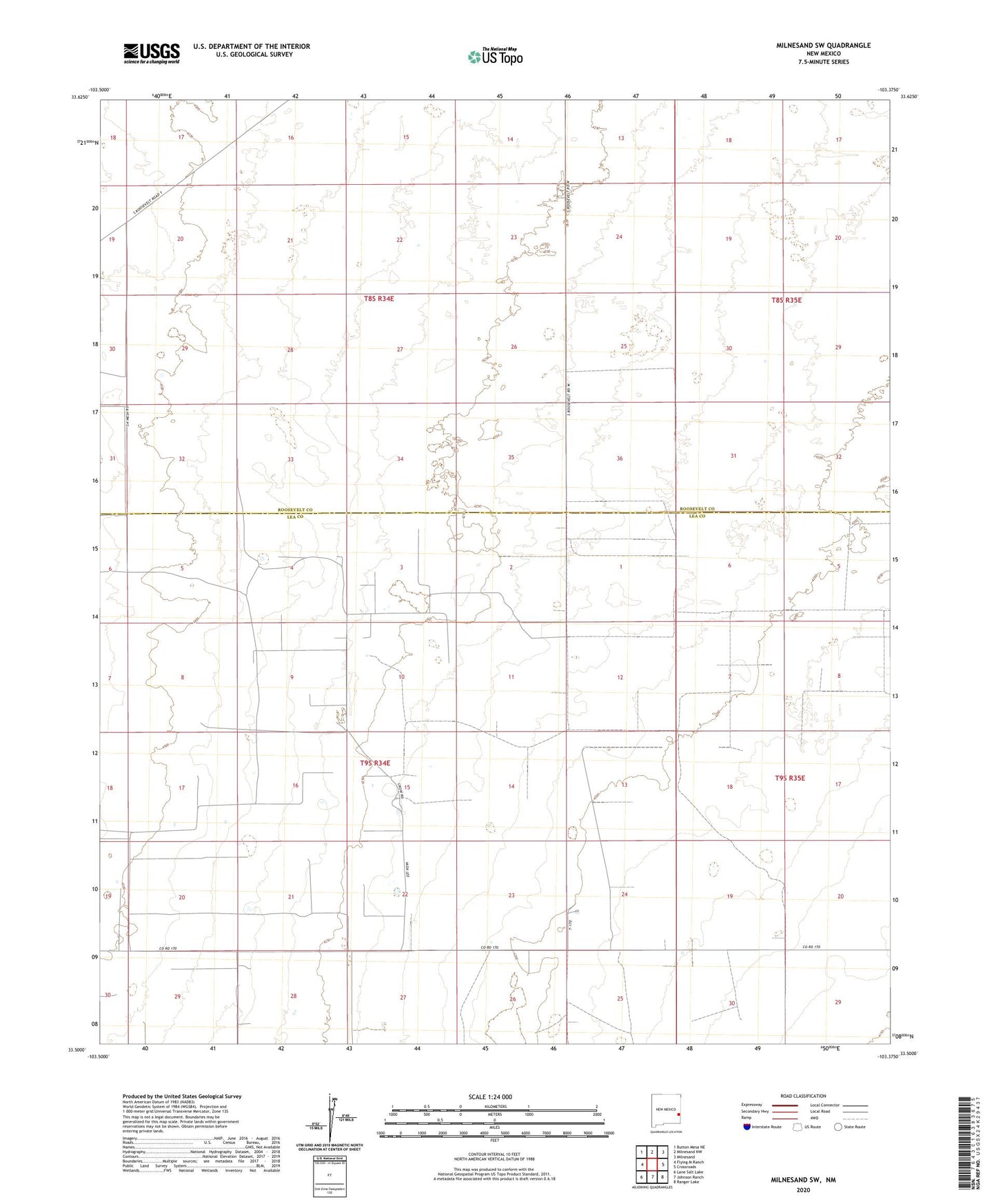
2023 topographic map quadrangle Milnesand SW in the state of New Mexico. Scale: 1:24000. Based on the newly updated USGS 7.5' US Topo map series, this map is in the following counties: Lea, Roosevelt. The map contains contour data, water features, and other items you are used to seeing on USGS maps, but also has updated roads and other features. This is the next generation of topographic maps. Printed on high-quality waterproof paper with UV fade-resistant inks.
Quads adjacent to this one:
West: Flying M Ranch
Northwest: Button Mesa NE
North: Milnesand NW
Northeast: Milnesand
East: Crossroads
Southeast: Ranger Lake
South: Johnson Ranch
Southwest: Lane Salt Lake
This map covers the same area as the classic USGS quad with code o33103e4.
Contains the following named places: 06226 Water Well, 12530 Water Well, 12531 Water Well, 12532 Water Well, 12533 Water Well, 12534 Water Well, 12535 Water Well, 12536 Water Well, 12538 Water Well, 12539 Water Well, 12541 Water Well, 12542 Water Well, 12543 Water Well, 12544 Water Well, 12578 Water Well, 12579 Water Well, 12584 Water Well, 12585 Water Well, 12586 Water Well, 12587 Water Well, 12595 Water Well, 12600 Water Well, 12601 Water Well, 13372 Water Well, 13373 Water Well, 13374 Water Well, Milnesand Oil Field, Vada Oil Field