MyTopo
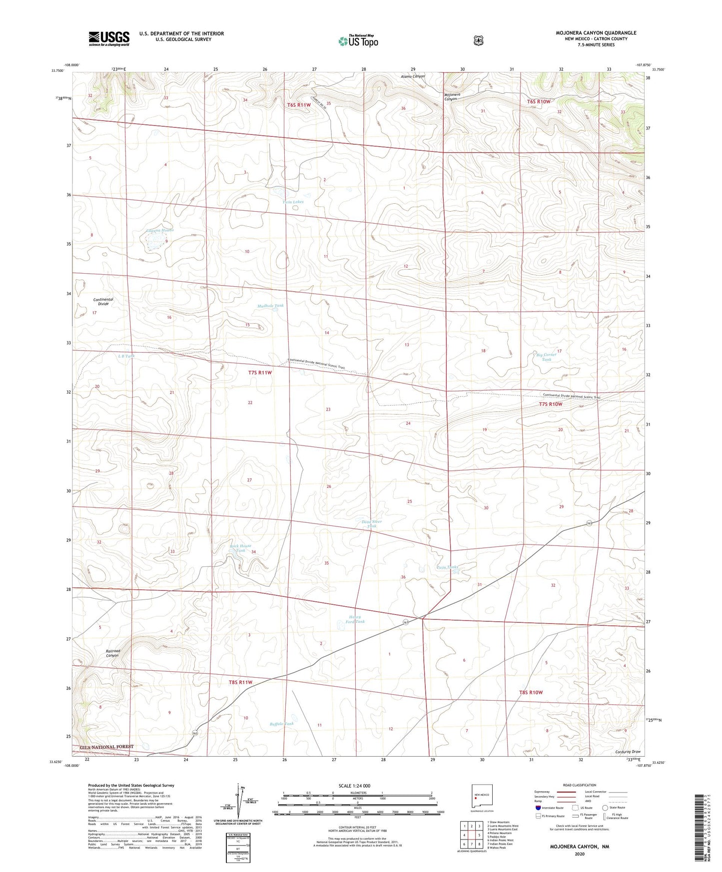
Mojonera Canyon New Mexico US Topo Map
Couldn't load pickup availability
Also explore the Mojonera Canyon Forest Service Topo of this same quad for updated USFS data
2023 topographic map quadrangle Mojonera Canyon in the state of New Mexico. Scale: 1:24000. Based on the newly updated USGS 7.5' US Topo map series, this map is in the following counties: Catron. The map contains contour data, water features, and other items you are used to seeing on USGS maps, but also has updated roads and other features. This is the next generation of topographic maps. Printed on high-quality waterproof paper with UV fade-resistant inks.
Quads adjacent to this one:
West: Pelona Mountain
Northwest: Shaw Mountain
North: Luera Mountains West
Northeast: Luera Mountains East
East: Paddys Hole
Southeast: Wahoo Peak
South: Indian Peaks East
Southwest: Indian Peaks West
This map covers the same area as the classic USGS quad with code o33107f8.
Contains the following named places: Big Corner Tank, Buffalo Tank, Dead Steer Tank, Divide Windmill, Dry Lake Windmill, Henry Ford Tank, L B Tank, Laguna Hondo, Mojonera Canyon, Mudhole Tank, North Garcia Windmill, Rock House Tank, Twin Lakes, Twin Tanks