MyTopo
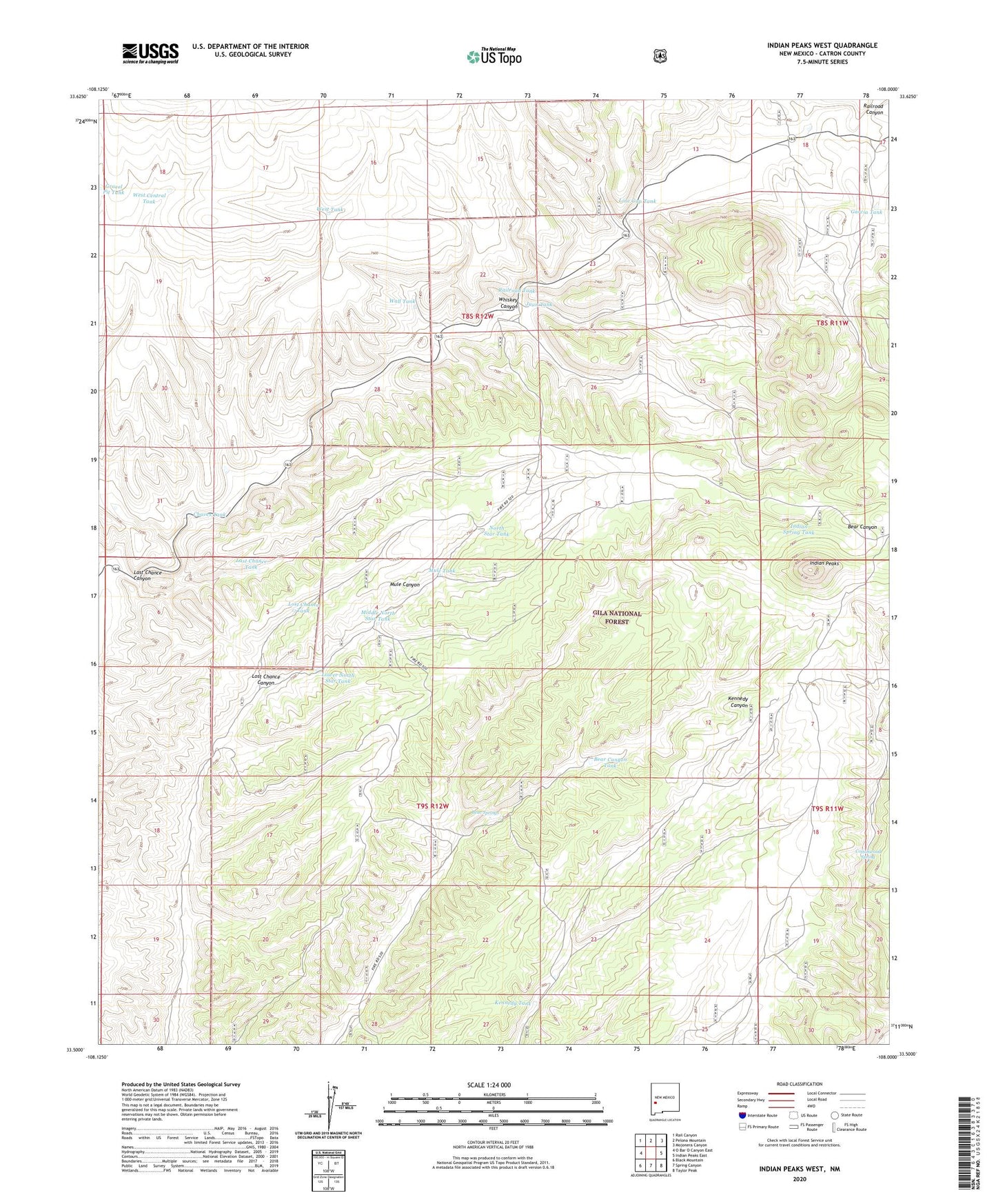
Indian Peaks West New Mexico US Topo Map
Couldn't load pickup availability
Also explore the Indian Peaks West Forest Service Topo of this same quad for updated USFS data
2023 topographic map quadrangle Indian Peaks West in the state of New Mexico. Scale: 1:24000. Based on the newly updated USGS 7.5' US Topo map series, this map is in the following counties: Catron. The map contains contour data, water features, and other items you are used to seeing on USGS maps, but also has updated roads and other features. This is the next generation of topographic maps. Printed on high-quality waterproof paper with UV fade-resistant inks.
Quads adjacent to this one:
West: O Bar O Canyon East
Northwest: Rail Canyon
North: Pelona Mountain
Northeast: Mojonera Canyon
East: Indian Peaks East
Southeast: Taylor Peak
South: Spring Canyon
Southwest: Black Mountain
This map covers the same area as the classic USGS quad with code o33108e1.
Contains the following named places: Bear Canyon Tank, Bear Springs, Chaves Tank, Cottonwood Spring, Garcia Tank, Garcia Trick Tank, Garcia Windmill, Gravel Pit Tank, Indian Spring Tank, Juan Tank, Kennedy Tank, Last Chance Canyon, Last Chance Tank, Line Gap Tank, Long Day Tank, Lost Chance Canyon, Lost Chance Tank, Lower North Star Tank, Mesa Tank, Middle North Star Tank, Mule Canyon Well, Mule Tank, North Star Tank, Railroad Canyon Windmill, Railroad Tank, Upper Spring Tank, Valley Tank, Wall Tank, West Central Tank, West Tank, Whiskey Canyon