MyTopo
Monument Point New Mexico US Topo Map
Couldn't load pickup availability
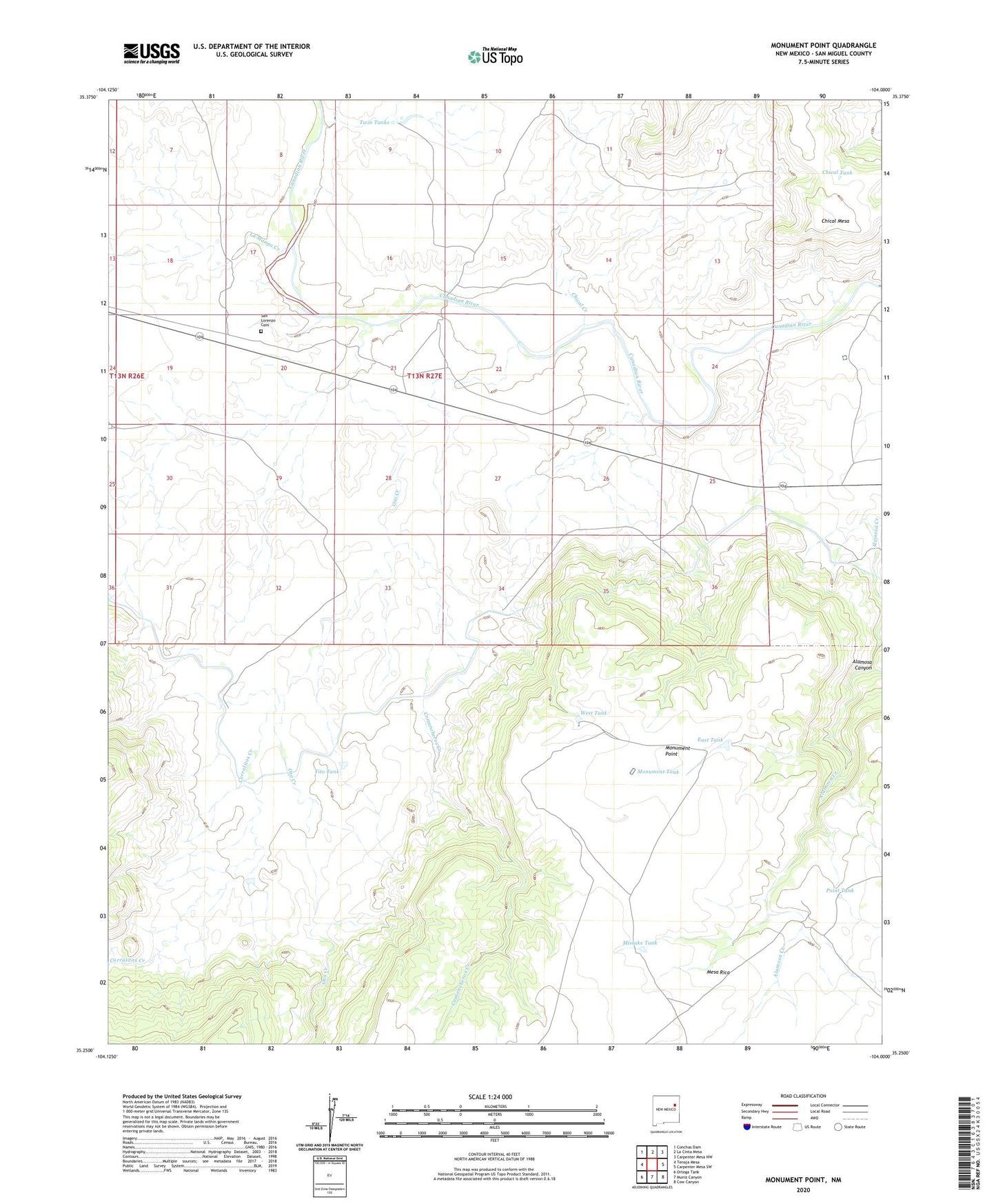
2020 topographic map quadrangle Monument Point in the state of New Mexico. Scale: 1:24000. Based on the newly updated USGS 7.5' US Topo map series, this map is in the following counties: San Miguel. The map contains contour data, water features, and other items you are used to seeing on USGS maps, but also has updated roads and other features. This is the next generation of topographic maps. Printed on high-quality waterproof paper with UV fade-resistant inks.
Quads adjacent to this one:
West: Tenaja Mesa
Northwest: Conchas Dam
North: La Cinta Mesa
Northeast: Carpenter Mesa NW
East: Carpenter Mesa SW
Southeast: Cow Canyon
South: Muniz Canyon
Southwest: Ortega Tank
Contains the following named places: Alamosa Windmill, Chical Creek, Chical Tank, Comancheros Creek, Corralitos Creek, East Tank, La Manga Creek, Lower La Manga Windmill, Lower Oso Windmill, Lower Windmill, Mistake Tank, Monument Point, Monument Tank, Monument Windmill, Oso Creek, Point Tank, Point Windmill, San Lorenzo Cemetery, Tito Tank, Tunnel Number 2, Twin Tanks, West Tank