MyTopo
Moriarty South New Mexico US Topo Map
Couldn't load pickup availability
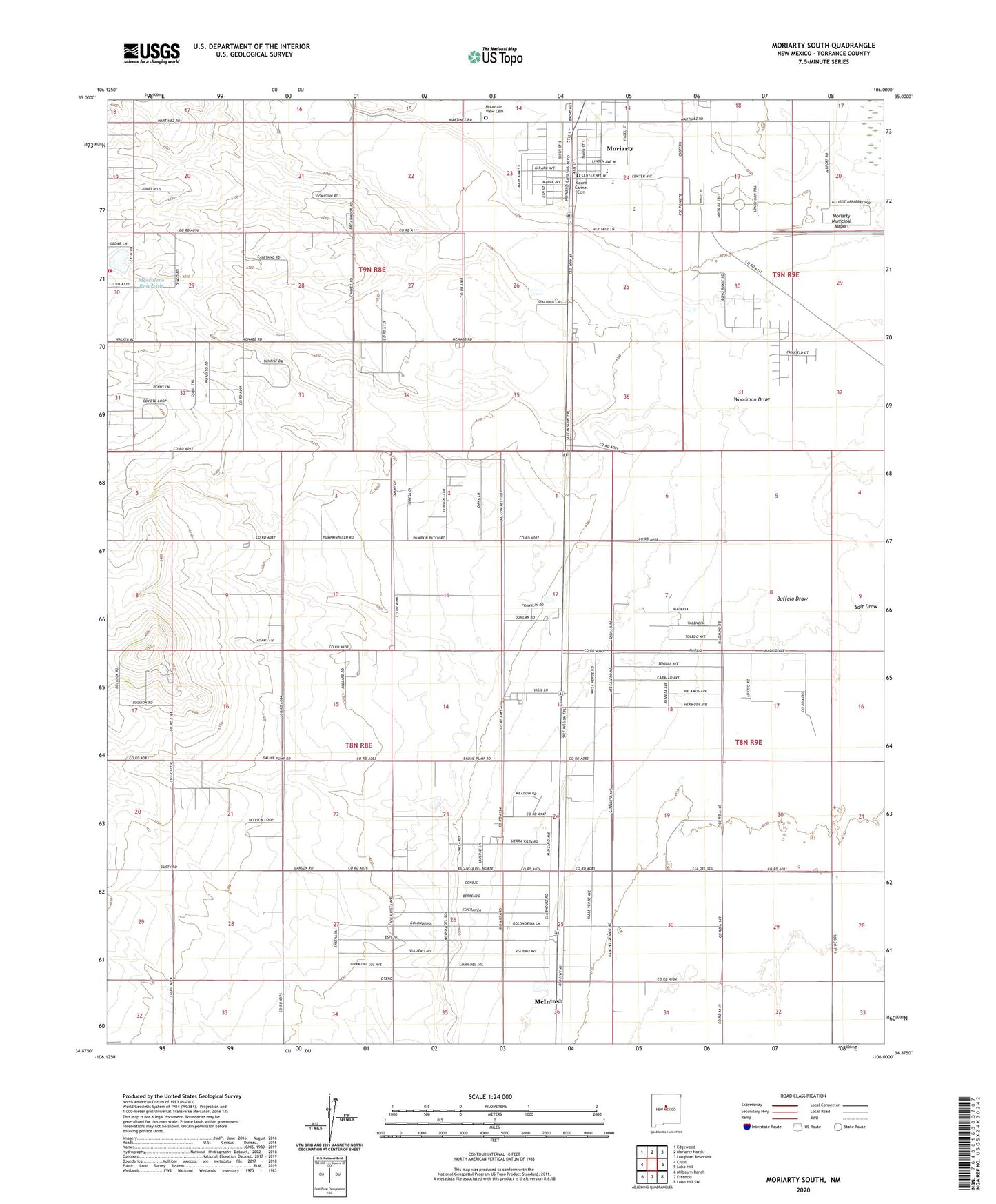
2020 topographic map quadrangle Moriarty South in the state of New Mexico. Scale: 1:24000. Based on the newly updated USGS 7.5' US Topo map series, this map is in the following counties: Torrance. The map contains contour data, water features, and other items you are used to seeing on USGS maps, but also has updated roads and other features. This is the next generation of topographic maps. Printed on high-quality waterproof paper with UV fade-resistant inks.
Quads adjacent to this one:
West: Chilili
Northwest: Edgewood
North: Moriarty North
Northeast: Longhorn Reservoir
East: Lobo Hill
Southeast: Lobo Hill SW
South: Estancia
Southwest: Milbourn Ranch
Contains the following named places: 10176 Water Well, 10189 Water Well, 10196 Water Well, Bethel United Methodist Church, Buffalo Draw, C Davis Place, Central New Mexico Medical Center, E Davis Place, E-3859-S-Enlarged Well, East Mountain Assembly of God Church, Eclipse Windmill Historic Site, First Baptist Church of Moriarty, First United Methodist Church, Flowers Ranch, Frontier Church, Hornsby Ranch, Indian Ranchettes, McIntosh Census Designated Place, Mendonca Ranch, Mescalero Lake Dam, Mescalero Reservoir, Moriarty, Moriarty Community Library, Moriarty Historical Society Museum, Moriarty Municipal Airport, Mount Carmel Cemetery, Mountain View Cemetery, Torrance County District 2 Volunteer Fire Department, Woodman Draw