
MyTopo
Mount Baldy New Mexico US Topo Map
Couldn't load pickup availability
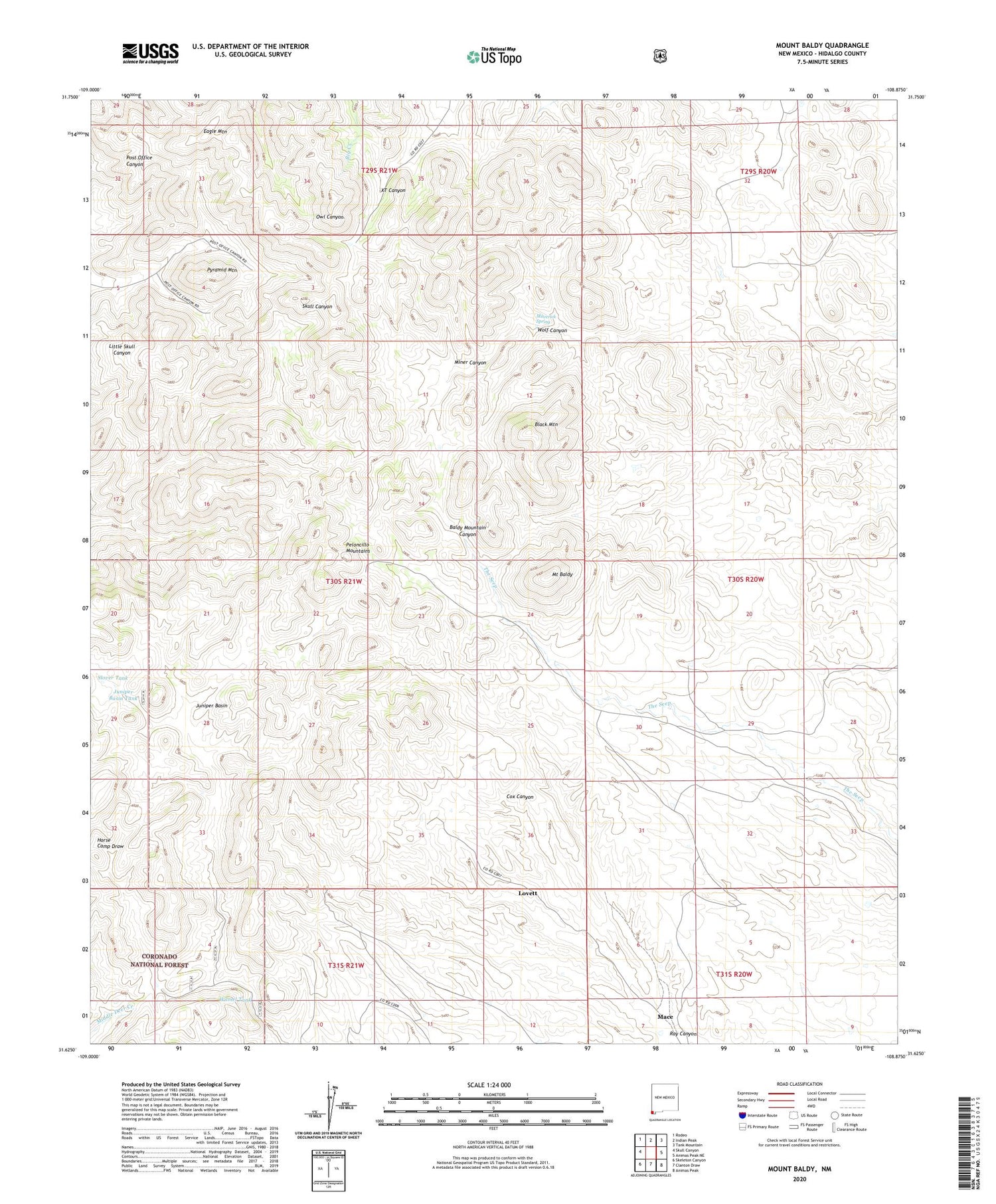
2020 topographic map quadrangle Mount Baldy in the state of New Mexico. Scale: 1:24000. Based on the newly updated USGS 7.5' US Topo map series, this map is in the following counties: Hidalgo. The map contains contour data, water features, and other items you are used to seeing on USGS maps, but also has updated roads and other features. This is the next generation of topographic maps. Printed on high-quality waterproof paper with UV fade-resistant inks.
Quads adjacent to this one:
West: Skull Canyon
Northwest: Rodeo
North: Indian Peak
Northeast: Tank Mountain
East: Animas Peak NE
Southeast: Animas Peak
South: Clanton Draw
Southwest: Skeleton Canyon
Contains the following named places: Black Mountain, Eagle Mountain, Eaton Place, Juniper Basin, Juniper Basin Tank, Lovett, Lower Lovett Place, Mace, Maverick Spring, Miller Tank, Mills Goat Ranch, Mount Baldy, Old Isaacs Place, Pyramid Mountain, Ray Canyon, Shorty Miller, Shorty Millers Lower Ranch, Slover Tank, Upper Lovett Place, Wamel Tank, Wolf Canyon


