MyTopo
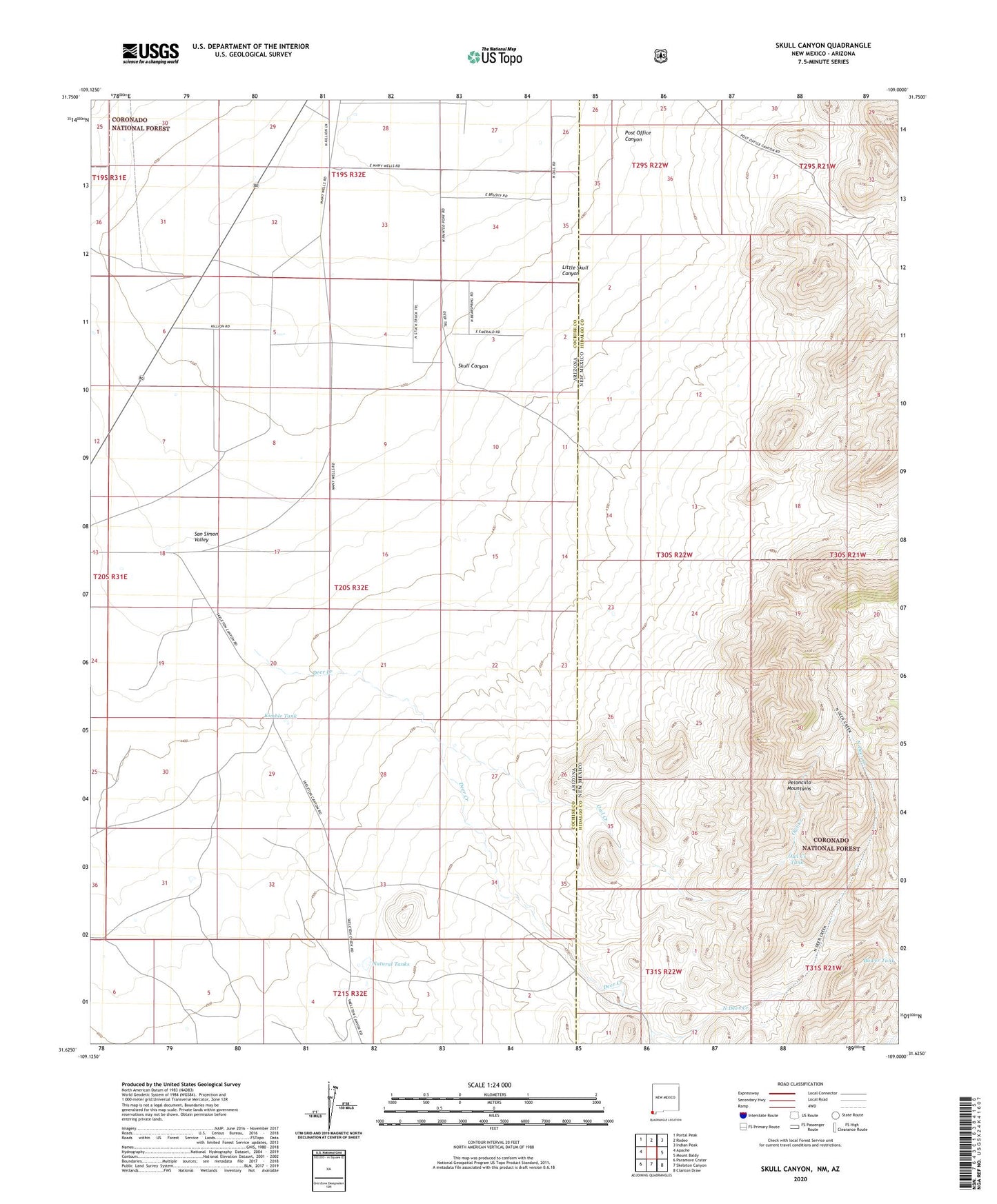
Skull Canyon New Mexico US Topo Map
Couldn't load pickup availability
Also explore the Skull Canyon Forest Service Topo of this same quad for updated USFS data
2023 topographic map quadrangle Skull Canyon in the states of Arizona, New Mexico. Scale: 1:24000. Based on the newly updated USGS 7.5' US Topo map series, this map is in the following counties: Hidalgo, Cochise. The map contains contour data, water features, and other items you are used to seeing on USGS maps, but also has updated roads and other features. This is the next generation of topographic maps. Printed on high-quality waterproof paper with UV fade-resistant inks.
Quads adjacent to this one:
West: Apache
Northwest: Portal Peak
North: Rodeo
Northeast: Indian Peak
East: Mount Baldy
Southeast: Clanton Draw
South: Skeleton Canyon
Southwest: Paramore Crater
This map covers the same area as the classic USGS quad with code o31109f1.
Contains the following named places: Allen Tank, Bower Tank, Deer Creek, Kimble Ranch, Kimble Tank, Little Skull Canyon, Natural Tanks, North Deer Creek, Owl Creek, Owl Creek Tank, Post Office Canyon, Skull Canyon