MyTopo
Rodeo New Mexico US Topo Map
Couldn't load pickup availability
Also explore the Rodeo Forest Service Topo of this same quad for updated USFS data
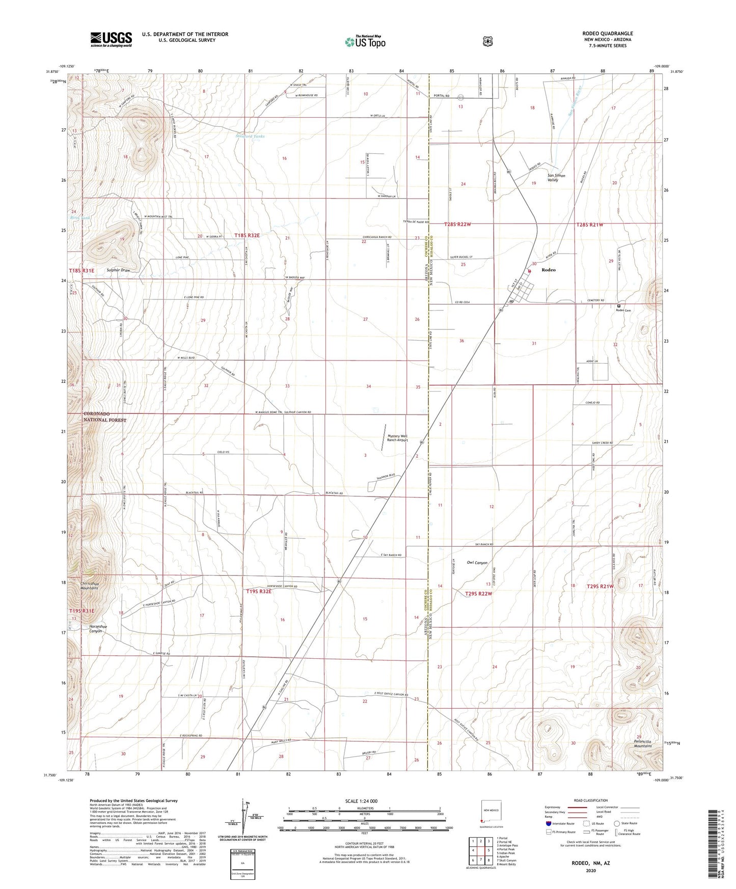
2023 topographic map quadrangle Rodeo in the states of Arizona, New Mexico. Scale: 1:24000. Based on the newly updated USGS 7.5' US Topo map series, this map is in the following counties: Hidalgo, Cochise. The map contains contour data, water features, and other items you are used to seeing on USGS maps, but also has updated roads and other features. This is the next generation of topographic maps. Printed on high-quality waterproof paper with UV fade-resistant inks.
Quads adjacent to this one:
West: Portal Peak
Northwest: Portal
North: Portal NE
Northeast: Antelope Pass
East: Indian Peak
Southeast: Mount Baldy
South: Skull Canyon
Southwest: Apache
This map covers the same area as the classic USGS quad with code o31109g1.
Contains the following named places: 09002 Water Well, 09003 Water Well, 09004 Water Well, Birts Tank, Damell Ranch, Horseshoe Canyon, Main Well South Water Well, Miller Ranch, Mystery Well Ranch Airport, Rodeo, Rodeo Cemetery, Rodeo Census Designated Place, Rodeo Post Office, Rodeo Volunteer Fire Department, Rodeo Weather Station, Saint Simon Episcopal Mission, San Felipe Catholic Church, Stanford Ranch, Stanford Tanks, Sulphur Draw