
MyTopo
Muir Ranch New Mexico US Topo Map
Couldn't load pickup availability
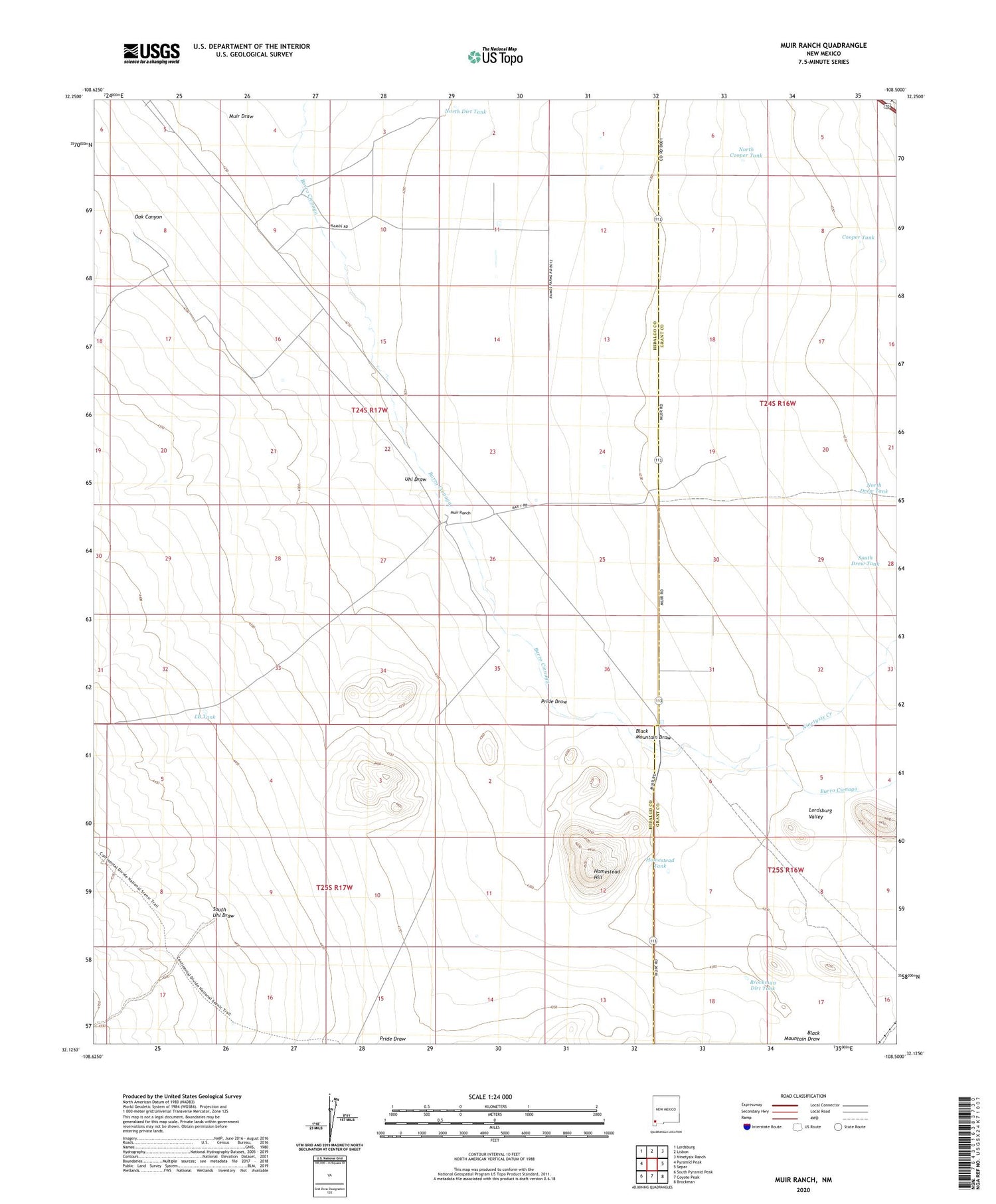
2020 topographic map quadrangle Muir Ranch in the state of New Mexico. Scale: 1:24000. Based on the newly updated USGS 7.5' US Topo map series, this map is in the following counties: Hidalgo, Grant. The map contains contour data, water features, and other items you are used to seeing on USGS maps, but also has updated roads and other features. This is the next generation of topographic maps. Printed on high-quality waterproof paper with UV fade-resistant inks.
Quads adjacent to this one:
West: Pyramid Peak
Northwest: Lordsburg
North: Lisbon
Northeast: Ninetysix Ranch
East: Separ
Southeast: Brockman
South: Coyote Peak
Southwest: South Pyramid Peak
Contains the following named places: 10020 Water Well, 10023 Water Well, 10025 Water Well, 10026 Water Well, 10333 Water Well, Black Mountain Draw, Brockman Dirt Tank, Cooper Tank, Cooper Water Well, Cooper Well, Homestead Hill, Homestead Tank, Homestead Well, Lawrence Well, LB Tank, LB Wells, Mitchell Place, Muir Draw, Muir Ranch, Ninetysix Creek, North Cooper Tank, North Dirt Tank, North Drew Tank, North Well, Oak Canyon, Pride Draw, South Drew Tank, South Uhl Draw, Uhl Draw, West Water Well, West Well


