
MyTopo
Ninetysix Ranch New Mexico US Topo Map
Couldn't load pickup availability
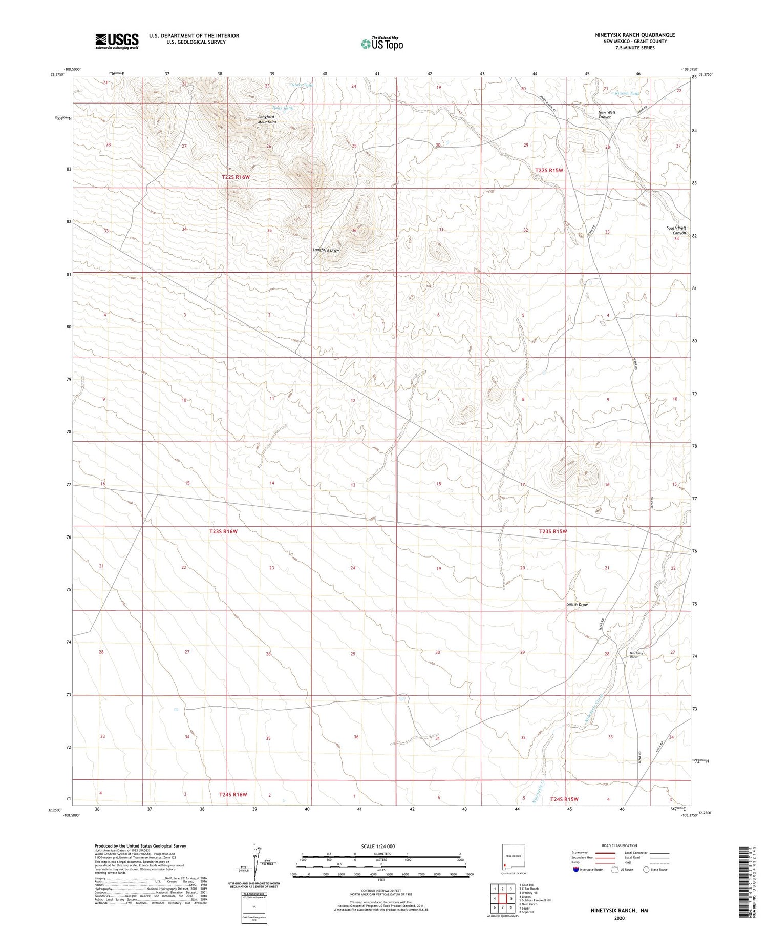
2023 topographic map quadrangle Ninetysix Ranch in the state of New Mexico. Scale: 1:24000. Based on the newly updated USGS 7.5' US Topo map series, this map is in the following counties: Grant. The map contains contour data, water features, and other items you are used to seeing on USGS maps, but also has updated roads and other features. This is the next generation of topographic maps. Printed on high-quality waterproof paper with UV fade-resistant inks.
Quads adjacent to this one:
West: Lisbon
Northwest: Gold Hill
North: C Bar Ranch
Northeast: Werney Hill
East: Soldiers Farewell Hill
Southeast: Separ NE
South: Separ
Southwest: Muir Ranch
This map covers the same area as the classic USGS quad with code o32108c4.
Contains the following named places: 10180 Water Well, 10181 Water Well, 10182 Water Well, Buena Vista Windmill, Bull Windmill, Dons Tank, Glaze Tank, Glaze Windmill, Hideout Windmill, Langford Draw, Langford Mountains, Little Tank, Lucky Windmill, New Well Canyon, Ninetysix Ranch, Pendleton Windmill, Rincon Tank, Smith Draw, Smith Windmill, Snaky Windmill, South Windmill


