MyTopo
Nicoll Lake New Mexico US Topo Map
Couldn't load pickup availability
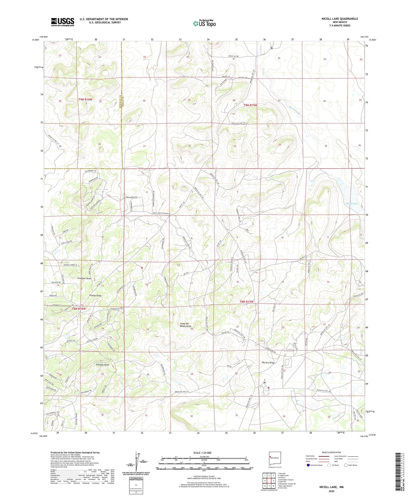
2023 topographic map quadrangle Nicoll Lake in the state of New Mexico. Scale: 1:24000. Based on the newly updated USGS 7.5' US Topo map series, this map is in the following counties: Cibola, McKinley. The map contains contour data, water features, and other items you are used to seeing on USGS maps, but also has updated roads and other features. This is the next generation of topographic maps. Printed on high-quality waterproof paper with UV fade-resistant inks.
Quads adjacent to this one:
West: Shoemaker Canyon
Northwest: Pescado
North: Togeye Lake
Northeast: El Morro
East: Goat Hill
Southeast: Cerro Alto
South: Red Lake Mission
Southwest: Shoemaker Canyon SE
This map covers the same area as the classic USGS quad with code o34108h4.
Contains the following named places: Ashcroft Reservoir Dam, Candy Kitchen, Candy Kitchen Census Designated Place, Candy Kitchen Volunteer Fire Department / Emergency Medical Services, KTDB-FM (Ramah), Nicoll Lake, Pinehill, Pinehill Census Designated Place, Pinehill Emergency Medical Services, Pinehill Post Office, Pinehill Volunteer Fire Department, Ramah Navajo Community, Ramah Navajo Community Center, Ramah Navajo Police Department, Ramah Number 4 Water Well, Zuni - Ramah Service Unit Indian Health Service Pinehill Health Center